 |
|
|
|
|
|
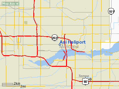
Location
& QuickFacts
|
FAA Information Effective: |
2005-10-27 |
| Airport Identifier: |
AZ42 |
| Longitude/Latitude: |
111-59-30.5240W/33-26-51.1590N
-111.991812/33.447544 (Estimated) |
| Elevation: |
1140
ft / 347.47 m (Estimated) |
| Land: |
0
acres |
| From nearest city: |
3
nautical miles E of Phoenix, AZ |
| Location: |
Maricopa
County, AZ |
| Magnetic Variation: |
13E
(1985) |
Owner
& Manager
|
Ownership: |
Privately
owned |
| Owner: |
S.
Bonifasi |
| Address: |
7725
E Redfield Number 101
Scottsdale, AZ 85260 |
| Phone number: |
602-998-7222 |
| Manager: |
Charles
Bonifasi |
| Address: |
7725
E Redfield Number 101
Scottsdale, AZ 85260 |
| Phone number: |
602-998-7222 |
Airport
Operations and Facilities
|
Airport Use: |
Private |
| Wind indicator: |
No |
| Segmented Circle: |
No |
| Control Tower: |
No |
| Attendance Schedule: |
UNATNDD |
| Landing fee charge: |
No |
| Sectional chart: |
Phoenix |
| Region: |
AWP
- Western-Pacific |
| Boundary ARTCC: |
ZAB
- Albuquerque |
| Tie-in FSS: |
PRC
- Prescott |
| FSS on Airport: |
No |
| FSS Phone: |
928-778-7810 |
| FSS Toll Free: |
1-800-WX-BRIEF |
Runway
Information
Helipad H1
|
Dimension: |
100
x 100 ft / 30.5 x 30.5 m |
| Surface: |
ASPH,
|
| |
Runway
H1 |
Runway
|
| Traffic Pattern: |
Left |
Left |
|
Radio
Navigation Aids
| ID |
Type |
Name |
Ch |
Freq |
Var |
Dist |
| SDL |
NDB |
Scottsdale |
|
224.00 |
12E |
11.7
nm |
| FFZ |
NDB |
Falcon
Field |
|
281.00 |
12E |
13.0
nm |
| CHD |
NDB |
Chandler |
|
407.00 |
12E |
14.3
nm |
| LUF |
TACAN |
Luke |
077X |
|
13E |
20.2
nm |
| PXR |
VORTAC |
Phoenix |
103X |
115.60 |
12E |
1.4
nm |
| IWA |
VORTAC |
Willie |
080X |
113.30 |
13E |
19.2
nm |
| TFD |
VORTAC |
Stanfield |
095X |
114.80 |
12E |
34.0
nm |
| BXK |
VORTAC |
Buckeye |
043X |
110.60 |
14E |
41.8
nm |
| GBN |
VORTAC |
Gila
Bend |
113X |
116.60 |
14E |
45.3
nm |
| PHX |
VOT |
Phoenix
Sky Harbor |
|
109.00 |
|
1.1
nm |
Remarks
- VFR;
PVT USE; PROVIDED PILOTS USING FACILITY ESTABLISH AND REMAIN
WITHIN TWR-WAY RADIO COMMUNICATIONS WITH PHOENIX TOWER WHILE
OPERATING WITHIN THE PHOENIX CONTROL ZONE.
Address: Maricopa
County, AZ
Phone: 602-998-7222
Images and information placed above are from
http://www.airport-data.com/airport/AZ42/
We thank them for the data!
| General Info
|
| Country |
United States
|
| State |
ARIZONA
|
| FAA ID |
AZ42
|
| Latitude |
33-26-51.159N
|
| Longitude |
111-59-30.524W
|
| Elevation |
1140 feet
|
| Near City |
PHOENIX
|
We don't guarantee the information is fresh and accurate. The data may be wrong or outdated.
For more up-to-date information please refer to other sources.
|
|


