 |
|
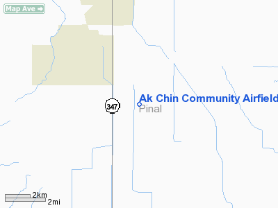
Ak Chin Community Airfield |
|
|
Location
& QuickFacts
| FAA Information Effective: |
2005-10-27 |
| Airport Identifier: |
41AZ |
| Longitude/Latitude: |
112-01-32.5060W/32-59-10.1850N
-112.025696/32.986162 (Estimated) |
| Elevation: |
1210
ft / 368.81 m (Estimated) |
| Land: |
0
acres |
| From nearest city: |
4
nautical miles SE of Maricopa, AZ |
| Location: |
Pinal
County, AZ |
| Magnetic Variation: |
12E
(1985) |
Owner
& Manager
| Ownership: |
Publicly
owned |
| Owner: |
Ak
Chin Indian Community |
| Address: |
42507
Peters & Nall Road
Maricopa, AZ 85239 |
| Phone number: |
602-568-2227 |
| Manager: |
Don
England |
| Address: |
42507
Peters & Nall Road
Maricopa, AZ 85239 |
| Phone number: |
602-568-2227 |
Airport
Operations and Facilities
| Airport Use: |
Open
to public |
| Wind indicator: |
Yes |
| Segmented Circle: |
No |
| Control Tower: |
No |
| Attendance Schedule: |
UNATNDD |
| Landing fee charge: |
No |
| Sectional chart: |
Phoenix |
| Region: |
AWP
- Western-Pacific |
| Boundary ARTCC: |
ZAB
- Albuquerque |
| Tie-in FSS: |
PRC
- Prescott |
| FSS on Airport: |
No |
| FSS Phone: |
928-778-7810 |
| FSS Toll Free: |
1-800-WX-BRIEF |
Runway
Information Runway
17/35
| Dimension: |
2950
x 35 ft / 899.2 x 10.7 m |
| Surface: |
ASPH,
Fair Condition |
| |
Runway
17 |
Runway
35 |
| Traffic Pattern: |
Right |
Right |
| Obstruction: |
10
ft road, 200.0 ft from runway
+5' TANK 40' RIGHT. |
15
ft trees, 200.0 ft from runway, 80 ft left of centerline
15' TREES 80' LEFT. |
|
Radio
Navigation Aids
| ID |
Type |
Name |
Ch |
Freq |
Var |
Dist |
| CHD |
NDB |
Chandler |
|
407.00 |
12E |
20.1
nm |
| FFZ |
NDB |
Falcon
Field |
|
281.00 |
12E |
32.1
nm |
| SDL |
NDB |
Scottsdale |
|
224.00 |
12E |
39.1
nm |
| LUF |
TACAN |
Luke |
077X |
|
13E |
37.6
nm |
| TFD |
VORTAC |
Stanfield |
095X |
114.80 |
12E |
8.4
nm |
| IWA |
VORTAC |
Willie |
080X |
113.30 |
13E |
26.8
nm |
| PXR |
VORTAC |
Phoenix |
103X |
115.60 |
12E |
27.0
nm |
| GBN |
VORTAC |
Gila
Bend |
113X |
116.60 |
14E |
32.8
nm |
| BXK |
VORTAC |
Buckeye |
043X |
110.60 |
14E |
49.0
nm |
| PHX |
VOT |
Phoenix
Sky Harbor |
|
109.00 |
|
27.0
nm |
Remarks
- +3'
EMBANKMENT AND DRAINAGE DITCH EAST SIDE OF RWY, 35' FM CNTRLN.
- ROAD
AND 3' EMBANKMENT WEST SIDE OF RWY, 35' FM CNTRLN.
- E111:
VFR; PUBLIC USE. PRVDD ALL PILOTS USING OR PROPOSE TO USE ARPT ARE
THOROUGHLY BRIEFED ON PROXIMITY OF VFR LOW ALTITUDE TRAINING ROUTE.
Address: Pinal County, AZ
Phone: 602-568-2227
Images and information placed above are from
http://www.airport-data.com/airport/41AZ/
We thank them for the data!
| General Info
|
| Country |
United States
|
| State |
ARIZONA
|
| FAA ID |
41AZ
|
| Latitude |
32-59-10.185N
|
| Longitude |
112-01-32.506W
|
| Elevation |
1210 feet
|
| Near City |
MARICOPA
|
We don't guarantee the information is fresh and accurate. The data may be wrong or outdated.
For more up-to-date information please refer to other sources.
|
|


