|
 |
|
||||
|
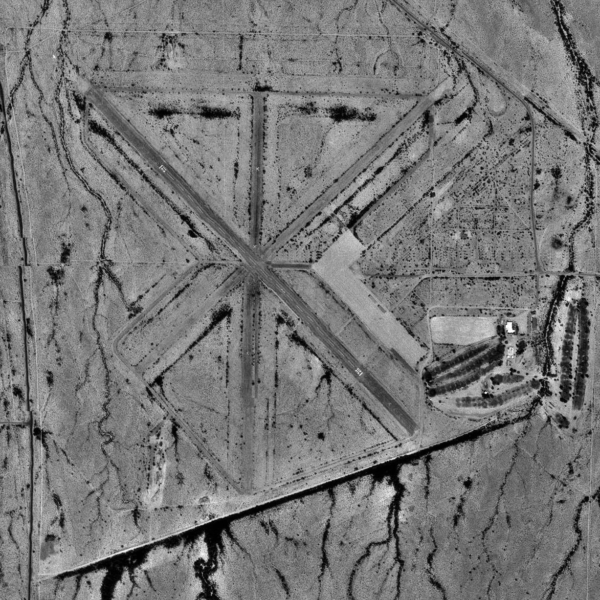
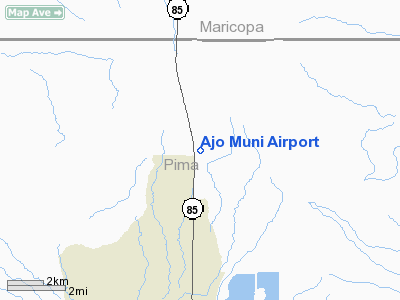
Eric Marcus Municipal Airport (FAA LID: P01) is a county-owned, public-use airport in Pima County, Arizona, United States. It is located five nautical miles (9 km) north of the central business district of Ajo and is about 82 miles (132 km) southwest of Phoenix. The airport was renamed on February 11, 2006; it was formerly known as Ajo Municipal Airport. The airport is included in the FAA's National Plan of Integrated Airport Systems for 2009–2013, which categorizes it as a general aviation facility. HistoryThe airport was opened about 1943 as Ajo Army Airfield and was used by the United States Army Air Forces as a training base and gunnery range during World War II. It was under the command of the 472d (Reduced) Army Air Force Base Unit, AAF West Coast Training Center as a sub-post of Luke Field. Ajo AAF also had three auxiliary landing fields, located out on the (now) Barry Goldwater bombing range, #1 at 32°31′41″N 112°55′58″W / 32.52806°N 112.93278°W; #2 at 32°36′19″N 112°52′41″W / 32.60528°N 112.87806°W, and #3 at 32°39′38″N 112°52′14″W / 32.66056°N 112.87056°W. Although abandoned since the war, all of these fields are easily visible from the air. At the end of the war the airfield was determined to be excess by the military and turned over to the local government for civil use. Of the three original runways, only one is serviceable and still in use. Most of the buildings on the airfield were sold off, removed or broken up. Abandoned streets and taxiways are being eroded away by sands, tumbleweeds and time. Facilities and aircraftEric Marcus Municipal Airport covers an area of 1,375 acres (556 ha) and has one runway designated 12/30 with a 3,800 x 60 ft (1,158 x 18 m) asphalt surface. For the 12-month period ending March 31, 2006, the airport had 300 general aviation aircraft operations, an average of 25 per month. The Ajo Country Club is on the southeast part of the former Army Airfield containment area. The above content comes from Wikipedia and is published under free licenses – click here to read more.
Location & QuickFacts
Owner & Manager
Airport Operations and Facilities
Airport Services
Remarks
Address: Phone:
Images and information placed above are from http://www.airport-data.com/airport/P01/ We thank them for the data!
Runway 12/303800 x 60 feet
|
||||||||||||||||||||||||||||||||||||||||||||||||||||||||||||||||||||||||||||||||||||||||||||||||||||||||||||||||||||||||||||||||||||||||||||||||||||||||||||||||||||||||||||||||||||||||||||||||||||||||||||||||||||||||||||||||||||||||||||||||||||||||||||||||||||||||||||||||||||||||||||||||||||||||||||||
| Runway 12 | |
|---|---|
| Surface | ASPHALT |
| True Heading | 138.0 |
| Latitude | 32.453889 32° 27' 14.00" N |
| Longitude | -112.871669 112° 52' 18.01" W |
| Landing Distance | 3800 feet 1158 meters |
| Takeoff Distance | 4865 feet 1483 meters |
| Overrun Length | 1065 feet 325 meters |
| Overrun Surface | ASPHALT |
| Lighting System | PCL
LIRL PAPI |
| Runway 30 | |
|---|---|
| Surface | ASPHALT |
| True Heading | 318.0 |
| Latitude | 32.446111 32° 26' 46.00" N |
| Longitude | -112.863331 112° 51' 47.99" W |
| Elevation | 1458.0 feet 444 meters |
| Landing Distance | 3800 feet 1158 meters |
| Takeoff Distance | 5200 feet 1585 meters |
| Overrun Length | 1400 feet 427 meters |
| Overrun Surface | ASPHALT |
| Lighting System | PCL
LIRL PAPI |
| GILA BEND | |||||
|---|---|---|---|---|---|
| Type | ID | Channel | Freq | Country | State |
| VORTAC | GBN | 113X | 116.6 | United States | ARIZONA |
| Latitude | Longitude | Airport |
| 32.956258 32° 57' 22.53" N |
-112.674272 112° 40' 27.38" W |
E63 |

 |
|
Copyright 2004-2026 © by Airports-Worldwide.com, Vyshenskoho st. 36, Lviv 79010, Ukraine Legal Disclaimer |