 |
|
Location
& QuickFacts
|
FAA
Information Effective: |
2006-06-08 |
|
Airport
Identifier: |
41AK |
|
Longitude/Latitude: |
151-19-13.9710W/60-18-41.9030N
-151.320548/60.311640 (Estimated) |
|
Elevation: |
112 ft / 34.14 m (Estimated) |
|
Land: |
0 acres |
|
From
nearest city: |
3 nautical miles SW of Kasilof, AK |
|
Location: |
Kenai Peninsula County, AK |
|
Magnetic Variation: |
20E (1985) |
Owner
& Manager
|
Ownership: |
Privately owned |
|
Owner: |
Lyle & Jessie M. Winter |
|
Address: |
P.o. Box 23
Kasilof, AK 99610 |
|
Phone
number: |
907-262-4259 |
|
Manager: |
Lyle & Jessie M. Winter |
|
Address: |
P.o. Box 23
Kasilof, AK 99610 |
|
Phone number: |
907-262-4259 |
Airport
Operations and Facilities
|
Airport
Use: |
Private |
|
Wind
indicator: |
Yes |
|
Segmented
Circle: |
No |
|
Control
Tower: |
No |
|
Attendance
Schedule: |
UNATNDD |
|
Sectional
chart: |
Ketchikan |
|
Region: |
AAL - Alaska |
|
Boundary
ARTCC: |
ZAN - Anchorage |
|
Tie-in
FSS: |
ENA - Kenai |
|
FSS
Phone: |
800-478-3576 |
|
FSS
Toll Free: |
1-800-WX-BRIEF |
|
Runway Information
Runway 04/22
|
Dimension: |
2100 x 50 ft / 640.1 x 15.2 m |
|
Surface: |
GRVL, |
|
|
Runway 04 |
Runway 22 |
|
Traffic
Pattern: |
Left |
Left |
|
Obstruction: |
|
40 ft plines, 50.0 ft from runway |
|
Radio Navigation
Aids
|
ID |
Type |
Name |
Ch |
Freq |
Var |
Dist |
|
IWW |
NDB |
Wildwood |
|
379.00 |
20E |
17.6 nm |
|
DRF |
NDB |
Drift River |
|
368.00 |
24E |
29.7 nm |
|
GRP |
NDB |
Granite Point |
|
356.00 |
24E |
39.1 nm |
|
ACE |
NDB |
Kachemak |
|
277.00 |
24E |
40.7 nm |
|
OLT |
NDB/DME |
Soldotna |
106X |
346.00 |
24E |
16.4 nm |
|
ENA |
VOR/DME |
Kenai |
123X |
117.60 |
25E |
18.6 nm |
|
HOM |
VOR/DME |
Homer |
093X |
114.60 |
24E |
36.4 nm |
Based Aircraft
|
Aircraft
based on field: |
3 |
|
Single
Engine Airplanes: |
3 |
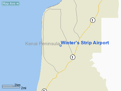
Winter's Strip Airport
Address:
Kenai Peninsula County, AK
Tel:
907-262-4259
Images
and information placed above are from
http://www.airport-data.com/airport/41AK/
We
thank them for the data!
| General
Info |
| Country |
United
States |
| State |
ALASKA
|
| FAA ID |
41AK
|
| Latitude |
60-18-41.903N
|
| Longitude |
151-19-13.971W
|
| Elevation |
112 feet
|
| Near City |
KASILOF
|
We don't guarantee the information is fresh and accurate. The data may
be wrong or outdated.
For more up-to-date information please refer to other sources.
|
|


