 |
|
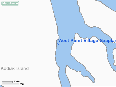
West Point Village Seaplane Base |
| West Point Village Seaplane Base |
| IATA: KWP – ICAO: none – FAA LID: KWP |
| Summary |
| Airport type |
Public |
| Owner |
West Point Canning Co. |
| Serves |
West Point, Alaska |
| Elevation AMSL |
0 ft / 0 m |
| Coordinates |
57°46′12″N 153°32′56″W / 57.77°N 153.54889°W / 57.77; -153.54889 |
| Runways |
| Direction |
Length |
Surface |
| ft |
m |
| E/W |
10,000 |
3,048 |
Water |
| Source: Federal Aviation Administration |
West Point Village Seaplane Base (IATA: KWP, FAA LID: KWP) is a public-use seaplane base located in West Point, in the Kodiak Island Borough of the U.S. state of Alaska. It is privately owned by the West Point Canning Co.
Scheduled seaplane service to Kodiak is subsidized by the Essential Air Service program. Facilities
West Point Village Seaplane Base has one seaplane landing area designated E/W which measures 10,000 by 500 feet (3,048 x 152 m).
Airline and destinations
- Island Air Service (Kodiak, Port Bailey, Uganik)
The above content comes from Wikipedia and is published under free licenses – click here to read more.
Location
& QuickFacts
|
FAA
Information Effective: |
2006-06-08 |
|
Airport
Identifier: |
KWP |
|
Longitude/Latitude: |
153-32-56.2130W/57-46-12.3940N
-153.548948/57.770109 (Estimated) |
|
Elevation: |
0 ft / 0.00 m (Estimated) |
|
Land: |
0 acres |
|
From
nearest city: |
0 nautical miles E of West Point, AK |
|
Location: |
Kodiak County, AK |
|
Magnetic Variation: |
22E (1985) |
Owner
& Manager
|
Ownership: |
Privately owned |
|
Owner: |
West Point Canning Co. |
|
Address: |
19804 Maplewood Dr
Edmonds, WA 98020 |
|
Address: |
|
Airport
Operations and Facilities
|
Airport
Use: |
Open to public |
|
Wind
indicator: |
No |
|
Segmented
Circle: |
No |
|
Control
Tower: |
No |
|
Attendance
Schedule: |
UNATNDD |
|
Landing
fee charge: |
No |
|
Sectional
chart: |
Kodiak |
|
Region: |
AAL - Alaska |
|
Boundary
ARTCC: |
ZAN - Anchorage |
|
Tie-in
FSS: |
ENA - Kenai |
|
FSS
on Airport: |
No |
|
FSS
Phone: |
800-478-3576 |
|
FSS
Toll Free: |
1-800-WX-BRIEF |
|
NOTAMs
Facility: |
ADQ (NOTAM-d service avaliable) |
Airport
Communications
Airport
Services
|
Airframe
Repair: |
NONE |
|
Power
Plant Repair: |
NONE |
|
Bottled
Oxygen: |
NONE |
|
Bulk
Oxygen: |
NONE |
|
Runway
Information
Runway E/W
|
Dimension: |
10000 x 500 ft / 3048.0 x 152.4 m |
|
Surface: |
WATER, |
|
|
Runway E |
Runway W |
|
Traffic
Pattern: |
Left |
Left |
|
Markings: |
None, |
None, |
|
Runway
End Identifier: |
No |
No |
|
Centerline
Lights: |
No |
No |
|
Touchdown
Lights: |
No |
No |
|
Radio Navigation
Aids
|
ID |
Type |
Name |
Ch |
Freq |
Var |
Dist |
|
RWO |
NDB |
Woody Island |
|
394.00 |
23E |
39.3 nm |
|
ODK |
VORTAC |
Kodiak |
118X |
117.10 |
23E |
38.8 nm |
Remarks
- SUBJ
TO STRONG DOWN DRAFTS DURG NW WINDS; N-S WINDS CAUSE HEAVY SWELLS; WATCH
FOR FISH NETS DURG SEASON.
- OPRG
AREA IN UGANIK BAY; ROCK & ISLAND NEAR BEACH & LNDG FAC.
Operational Statistics
|
Aircraft
Operations: |
14/Week |
|
Air Taxi: |
71.4% |
|
General
Aviation Itinerant: |
28.6% |
West Point Village Seaplane Base
Address:
Kodiak County, AK
Tel:
Images
and information placed above are from
http://www.airport-data.com/airport/KWP/
We
thank them for the data!
| General
Info |
| Country |
United
States |
| State |
ALASKA
|
| FAA ID |
KWP
|
| Latitude |
57-46-12.394N
|
| Longitude |
153-32-56.213W
|
| Elevation |
0 feet
|
| Near City |
WEST POINT
|
We don't guarantee the information is fresh and accurate. The data may
be wrong or outdated.
For more up-to-date information please refer to other sources.
|
|


