 |
|
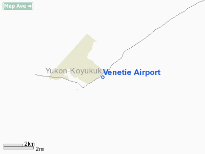
| Venetie Airport |
| IATA: VEE – ICAO: PAVE – FAA LID: VEE |
| Summary |
| Airport type |
Public |
| Owner |
Venetie Tribal Government |
| Serves |
Venetie, Alaska |
| Elevation AMSL |
574 ft / 175 m |
| Coordinates |
67°00′31″N 146°21′59″W / 67.00861°N 146.36639°W / 67.00861; -146.36639 |
| Runways |
| Direction |
Length |
Surface |
| ft |
m |
| 4/22 |
4,000 |
1,219 |
Gravel/Dirt |
| Statistics (2005) |
| Aircraft operations |
1,900 |
| Source: Federal Aviation Administration |
Venetie Airport (IATA: VEE, ICAO: PAVE, FAA LID: VEE) is a public use airport located in Venetie, in the Yukon-Koyukuk Census Area of the U.S. state of Alaska. It is privately owned by the Venetie Tribal Government. Facilities and aircraft
Venetie Airport has one runway designated 4/22 with a gravel and dirt surface measuring 4,000 by 75 feet (1,219 x 23 m). For the 12-month period ending December 31, 2005, the airport had 1,900 aircraft operations, an average of 158 per month: 79% air taxi and 21% general aviation.
Airlines and destinations
- Arctic Circle Air (Fairbanks)
- Everts Air
- Wright Air Service (Arctic Village, Birch Creek, Fairbanks, Fort Yukon)
The above content comes from Wikipedia and is published under free licenses – click here to read more.
Location
& QuickFacts
|
FAA
Information Effective: |
2006-06-08 |
|
Airport
Identifier: |
VEE |
|
Longitude/Latitude: |
146-21-58.8900W/67-00-31.2300N
-146.366358/67.008675 (Estimated) |
|
Elevation: |
574 ft / 174.96 m (Surveyed) |
|
Land: |
0 acres |
|
From
nearest city: |
0 nautical miles NE of Venetie, AK |
|
Location: |
Upper Yukon County, AK |
|
Magnetic Variation: |
29E (1985) |
Owner
& Manager
|
Ownership: |
Privately owned |
|
Owner: |
Venetie Tribal Government |
|
Address: |
Box 81080
Venetie, AK 99781 |
|
Phone number: |
907-849-9378 |
|
Manager: |
Joeseph Tritt |
|
Address: |
Po Box 81080
Venetie, AK 99781-0080 |
|
Phone number: |
907-849-9378 |
Airport
Operations and Facilities
|
Airport
Use: |
Open to public |
|
Wind
indicator: |
Yes |
|
Segmented
Circle: |
No |
|
Control
Tower: |
No |
|
Attendance
Schedule: |
UNATNDD |
|
Landing
fee charge: |
No |
|
Sectional
chart: |
Fairbanks |
|
Region: |
AAL - Alaska |
|
Boundary
ARTCC: |
ZAN - Anchorage |
|
Tie-in
FSS: |
FAI - Fairbanks |
|
FSS
on Airport: |
No |
|
FSS
Phone: |
907-474-0788 |
|
FSS
Toll Free: |
1-866-248-6516 |
|
NOTAMs
Facility: |
FAI (NOTAM-d service avaliable) |
|
Federal Agreements: |
N |
Airport
Communications
Airport
Services
|
Airframe
Repair: |
NONE |
|
Power
Plant Repair: |
NONE |
|
Bottled
Oxygen: |
NONE |
|
Bulk
Oxygen: |
NONE |
|
Runway Information
Runway 03/21
|
Dimension: |
4000
x 75 ft / 1219.2 x 22.9 m
SFC SOFT & MUDDY AFTER RAIN. SOME DIPS IN RWY. ROAD ON BOTH
SIDES. |
|
Surface: |
GRVL-DIRT, Poor Condition
RY 03/21 SURFACE SLIPPERY WHEN WET WHERE SPARSELY GRAVELED.
SURFACE
UNEVEN. |
|
|
Runway 03 |
Runway 21 |
|
Longitude: |
146-22-43.4100W |
146-21-14.3500W |
|
Latitude: |
67-00-22.0500N |
67-00-40.4000N |
|
Elevation: |
571.00 ft |
574.00 ft |
|
Traffic
Pattern: |
Left |
Left |
|
Markings: |
None, |
None, |
|
Runway
End Identifier: |
No |
No |
|
Centerline
Lights: |
No |
No |
|
Touchdown
Lights: |
No |
No |
|
Obstruction: |
20 ft tree, 325.0 ft from runway, 60 ft left
of centerline, 16:1 slope to clear |
, 20:1 slope to clear |
|
Radio Navigation
Aids
|
ID |
Type |
Name |
Ch |
Freq |
Var |
Dist |
|
FTO |
NDB |
Yukon River |
|
242.00 |
31E |
37.6 nm |
|
FYU |
VORTAC |
Fort Yukon |
091X |
114.40 |
31E |
36.7 nm |
Remarks
- PPR
BEFORE LNDG PHONE 907-849-8165.
- MAINT
IN WINTER VARIABLE.
- CONSTRUCTION
EQUIPMENT & PERSONS OPERATING ON & INVOF OF RY.
- RY
03/21 ACTIVE ROAD TRANSITS RY AT APRON.
- RY
03 ROAD TRANSITS RY APPROXIMATELY 300 FT FM THLD.
Based Aircraft
|
Aircraft
based on field: |
1 |
|
Single
Engine Airplanes: |
1 |
Operational Statistics
|
Aircraft
Operations: |
37/Week |
|
Air Taxi: |
78.9% |
|
General
Aviation Itinerant: |
21.1% |
Venetie Airport
Address:
Upper Yukon County, AK
Tel:
907-849-9378
Images
and information placed above are from
http://www.airport-data.com/airport/VEE/
We
thank them for the data!
| General
Info |
| Country |
United
States |
| State |
ALASKA
|
| FAA ID |
VEE
|
| Latitude |
67-01-21.700N
|
| Longitude |
146-24-49.591W
|
| Elevation |
550 feet
|
| Near City |
VENETIE
|
We don't guarantee the information is fresh and accurate. The data may
be wrong or outdated.
For more up-to-date information please refer to other sources.
|
|


