 |
|
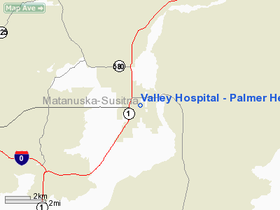
Valley Hospital - Palmer Heliport |
|
|
Location
& QuickFacts
|
FAA
Information Effective: |
2006-06-08 |
|
Airport
Identifier: |
AK42 |
|
Longitude/Latitude: |
149-06-20.8400W/61-36-03.1700N
-149.105789/61.600881 (Estimated) |
|
Elevation: |
248 ft / 75.59 m (Estimated) |
|
Land: |
0 acres |
|
From
nearest city: |
0 nautical miles N of Palmer, AK |
|
Location: |
Mata-sus Borough County, AK |
|
Magnetic Variation: |
24E (1995) |
Owner
& Manager
|
Ownership: |
Privately owned |
|
Owner: |
Valley Hospital Accociation, Inc |
|
Address: |
Po Box 1687
Palmer, AK 99645 |
|
Phone number: |
907-746-8600 |
|
Manager: |
Tracy Link |
|
Address: |
Po Box
Palmer, AK 99645 |
|
Phone number: |
907-746-8698 |
Airport
Operations and Facilities
|
Airport
Use: |
Private |
|
Segmented
Circle: |
No |
|
Control
Tower: |
No |
|
Attendance
Schedule: |
ALL/ALL/ALL |
|
Lighting
Schedule: |
PHONE REQ
FOR PERIMETER CALL - 907-746-8600. |
|
Sectional
chart: |
Anchorage |
|
Region: |
AAL - Alaska |
|
Boundary
ARTCC: |
ZAN - Anchorage |
|
Responsible
ARTCC: |
ZAN - Anchorage |
|
Tie-in
FSS: |
PAQ - Palmer |
|
FSS
Phone: |
907-745-2495 |
|
FSS
Toll Free: |
LC745-2495 |
|
Alternate
FSS: |
ENA - Kenai |
|
Alt.
FSS Toll Free: |
1-800-WX-BRIEF |
|
Runway Information
Helipad H1
|
Dimension: |
52 x 52 ft / 15.8 x 15.8 m |
|
Surface: |
ASPH, Good Condition |
|
|
Runway H1 |
Runway |
|
Traffic
Pattern: |
Left |
Left |
|
Radio Navigation
Aids
|
ID |
Type |
Name |
Ch |
Freq |
Var |
Dist |
|
CMQ |
NDB |
Campbell Lake |
|
338.00 |
21E |
37.5 nm |
|
BOB |
NDB |
Bruck |
|
387.00 |
21E |
40.4 nm |
|
EDF |
TACAN |
Elmendorf |
081X |
|
21E |
28.2 nm |
|
ANC |
VOR/DME |
Anchorage |
090X |
114.30 |
25E |
41.7 nm |
|
BGQ |
VORTAC |
Big Lake |
072X |
112.50 |
25E |
24.7 nm |
|
MRI |
VOT |
Merrill |
|
111.00 |
|
31.5 nm |
|
ANC |
VOT |
Anchorage |
|
108.40 |
|
35.9 nm |
Valley Hospital - Palmer Heliport
Address:
Mata-sus Borough County, AK
Tel:
907-746-8600, 907-746-8698
Images
and information placed above are from
http://www.airport-data.com/airport/AK42/
We
thank them for the data!
| General
Info |
| Country |
United
States |
| State |
ALASKA
|
| FAA ID |
AK42
|
| Latitude |
61-36-03.170N
|
| Longitude |
149-06-20.840W
|
| Elevation |
248 feet
|
| Near City |
PALMER
|
We don't guarantee the information is fresh and accurate. The data may
be wrong or outdated.
For more up-to-date information please refer to other sources.
|
|


