 |
|
|
|
|
|
Location
& QuickFacts
|
FAA
Information Effective: |
2006-06-08 |
|
Airport
Identifier: |
UMT |
|
Longitude/Latitude: |
152-08-08.3480W/69-22-15.9140N
-152.135652/69.371087 (Estimated) |
|
Elevation: |
266 ft / 81.08 m (Estimated) |
|
Land: |
290 acres |
|
From
nearest city: |
0 nautical miles N of Umiat, AK |
|
Location: |
Barrow County, AK |
|
Magnetic Variation: |
27E (1985) |
Owner
& Manager
|
Ownership: |
Publicly owned |
|
Owner: |
State Of Ak Dot/pf N Reg |
|
Address: |
2301 Peger Rd
Fairbanks, AK 99709 |
|
Phone number: |
907-451-5217 |
|
Manager: |
Bill O'halloran |
|
Address: |
Fairbanks, AK 99709 |
|
Phone number: |
907-451-5217 |
Airport
Operations and Facilities
|
Airport
Use: |
Open to public |
|
Wind
indicator: |
Yes |
|
Segmented
Circle: |
No |
|
Control
Tower: |
No |
|
Attendance
Schedule: |
UNATNDD |
|
Landing
fee charge: |
No |
|
Sectional
chart: |
Point Barrow |
|
Region: |
AAL - Alaska |
|
Boundary
ARTCC: |
ZAN - Anchorage |
|
Tie-in
FSS: |
FAI - Fairbanks |
|
FSS
on Airport: |
No |
|
FSS
Phone: |
907-474-0788 |
|
FSS
Toll Free: |
1-866-248-6516 |
|
NOTAMs
Facility: |
UMT (NOTAM-d service avaliable) |
Airport
Communications
|
CTAF: |
122.800 |
|
Unicom: |
122.800 |
Airport
Services
|
Fuel
available: |
100 A A1+ |
|
Airframe
Repair: |
NONE |
|
Power
Plant Repair: |
NONE |
|
Bottled
Oxygen: |
NONE |
|
Bulk
Oxygen: |
NONE |
|
Runway Information
Runway 05/23
|
Dimension: |
5400 x 100 ft / 1645.9 x 30.5 m |
|
Surface: |
GRVL, Fair Condition |
|
|
Runway 05 |
Runway 23 |
|
Longitude: |
152-09-28.9770W |
152-06-47.7830W |
|
Latitude: |
69-22-12.3330N |
69-22-19.5590N |
|
Elevation: |
264.00 ft |
265.00 ft |
|
Alignment: |
83 |
127 |
|
Traffic
Pattern: |
Left |
Left |
|
Obstruction: |
10 ft brush, 300.0 ft from runway, 30:1 slope
to clear |
13 ft brush, 100.0 ft from runway, 7:1 slope
to clear |
|
Radio Navigation
Aids
|
ID |
Type |
Name |
Ch |
Freq |
Var |
Dist |
|
ACU |
NDB |
East Kurupa |
|
268.00 |
26E |
40.7 nm |
Remarks
- MTN
RIDGES N & S.
- RY
CONDITION NOT MONITORED; RECOMMEND VISUAL INSPECTION PRIOR TO LANDING.
- RY
23 - 7 FT BRUSH 85 FT FM THR.
- BEAR
& BIRDS ON & INVOF RY.
- NO
WINTER MAINTENANCE OR SNOW REMOVAL.
Operational Statistics
|
Aircraft
Operations: |
17/Month |
|
Air Taxi: |
50.0% |
|
General
Aviation Itinerant: |
50.0% |
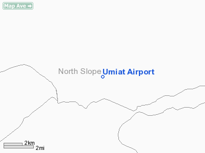
Umiat Airport
Address:
Barrow County, AK
Tel:
907-451-5217
Images
and information placed above are from
http://www.airport-data.com/airport/UMT/
We
thank them for the data!
| General
Info |
| Country |
United
States |
| State |
ALASKA
|
| FAA ID |
UMT
|
| Latitude |
69-22-15.914N
|
| Longitude |
152-08-08.348W
|
| Elevation |
266 feet
|
| Near City |
UMIAT
|
We don't guarantee the information is fresh and accurate. The data may
be wrong or outdated.
For more up-to-date information please refer to other sources.
|
|


