 |
|
|
|
|
|
Location
& QuickFacts
|
FAA
Information Effective: |
2006-06-08 |
|
Airport
Identifier: |
UGB |
|
Longitude/Latitude: |
157-44-23.5160W/57-25-31.2890N
-157.739866/57.425358 (Estimated) |
|
Elevation: |
132 ft / 40.23 m (Estimated) |
|
Land: |
0 acres |
|
From
nearest city: |
10 nautical miles SE of Pilot Point, AK |
|
Location: |
Bristol Bay County, AK |
|
Magnetic Variation: |
20E (1985) |
Owner
& Manager
|
Ownership: |
Publicly owned |
|
Owner: |
Blm--division Of Lands |
|
Address: |
6881 Abbott Loop Road
Anchorage, AK 99507 |
|
Phone
number: |
907-267-1248
EXT 256 |
|
Manager: |
District Mgr, Blm-anc |
|
Address: |
6881 Abbott Loop Road
Anchorage, AK 99507 |
|
Phone number: |
907-267-1248 |
Airport
Operations and Facilities
|
Airport
Use: |
Open to public |
|
Wind
indicator: |
No |
|
Segmented
Circle: |
No |
|
Control
Tower: |
No |
|
Attendance
Schedule: |
UNATNDD |
|
Landing
fee charge: |
No |
|
Sectional
chart: |
Kodiak |
|
Region: |
AAL - Alaska |
|
Boundary
ARTCC: |
ZAN - Anchorage |
|
Tie-in
FSS: |
ENA - Kenai |
|
FSS
on Airport: |
No |
|
FSS
Phone: |
800-478-3576 |
|
FSS
Toll Free: |
1-800-WX-BRIEF |
|
NOTAMs
Facility: |
PTH (NOTAM-d service avaliable) |
Airport
Communications
Airport
Services
|
Airframe
Repair: |
NONE |
|
Power
Plant Repair: |
NONE |
|
Bottled
Oxygen: |
NONE |
|
Bulk
Oxygen: |
NONE |
|
Runway Information
Runway 12/30
|
Dimension: |
5280 x 125 ft / 1609.3 x 38.1 m |
|
Surface: |
GRVL, Poor Condition
RY 12/30 SOFT WHEN WET; 4 INCH ROCKS LENGTH OF RY. |
|
|
Runway 12 |
Runway 30 |
|
Traffic
Pattern: |
Left |
Left |
|
Radio Navigation
Aids
|
ID |
Type |
Name |
Ch |
Freq |
Var |
Dist |
|
PDN |
NDB/DME |
Port Heiden |
032X |
371.00 |
19E |
41.0 nm |
Operational Statistics
|
Aircraft
Operations: |
5/Month |
|
General
Aviation Itinerant: |
100.0% |
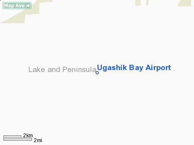
Ugashik Bay Airport
Address:
Bristol Bay County, AK
Tel:
907-267-1248
Images
and information placed above are from
http://www.airport-data.com/airport/UGB/
We
thank them for the data!
| General
Info |
| Country |
United
States |
| State |
ALASKA
|
| FAA ID |
UGB
|
| Latitude |
57-25-31.289N
|
| Longitude |
157-44-23.516W
|
| Elevation |
132 feet
|
| Near City |
PILOT
POINT |
We don't guarantee the information is fresh and accurate. The data may
be wrong or outdated.
For more up-to-date information please refer to other sources.
|
|


