 |
|
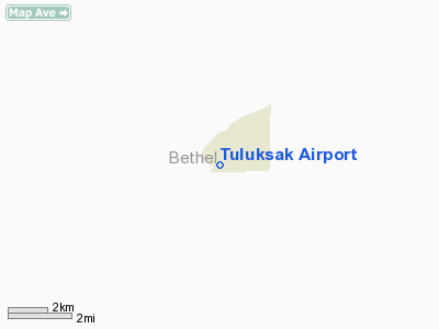
| Tuluksak Airport |
| IATA: TLT – ICAO: none – FAA LID: TLT |
| Summary |
| Airport type |
Public |
| Owner |
Alaska DOT&PF - Central Region |
| Serves |
Tuluksak, Alaska |
| Elevation AMSL |
30 ft / 9 m |
| Coordinates |
61°05′49″N 160°58′10″W / 61.09694°N 160.96944°W / 61.09694; -160.96944 |
| Runways |
| Direction |
Length |
Surface |
| ft |
m |
| 2/20 |
2,461 |
750 |
Gravel/Dirt |
| Source: Federal Aviation Administration |
Tuluksak Airport (IATA: TLT, FAA LID: TLT) is a state-owned public-use airport serving Tuluksak, in the Bethel Census Area of the U.S. state of Alaska. Facilities
Tuluksak Airport has one runway designated 2/20 with a gravel and dirt surface measuring 2,461 by 30 feet (750 x 9 m).
Airlines
- Hageland Aviation Services
The above content comes from Wikipedia and is published under free licenses – click here to read more.
Location
& QuickFacts
|
FAA
Information Effective: |
2006-02-16 |
|
Airport
Identifier: |
TLT |
|
Longitude/Latitude: |
160-58-10.1000W/61-05-48.6000N
-160.969472/61.096833 (Estimated) |
|
Elevation: |
30 ft / 9.14 m (Estimated) |
|
Land: |
0 acres |
|
From
nearest city: |
0 nautical miles W of Tuluksak, AK |
|
Location: |
Bethel County, AK |
|
Magnetic Variation: |
19E (1985) |
Owner
& Manager
|
Ownership: |
Publicly owned |
|
Owner: |
St Of Ak Dotpf/c Rgn |
|
Address: |
Po Box 196900
Anchorage, AK 99519-6900 |
|
Phone number: |
907-269-0747 |
|
Manager: |
L.j. Davis |
|
Address: |
Box 505
Bethel, AK 99559 |
|
Phone number: |
907-543-2495 |
Airport
Operations and Facilities
|
Airport
Use: |
Open to public |
|
Wind
indicator: |
Yes
WINDSOCK MAY BE UNRELIABLE. |
|
Segmented
Circle: |
No |
|
Control
Tower: |
No |
|
Attendance
Schedule: |
UNATNDD |
|
Landing
fee charge: |
No |
|
Sectional
chart: |
Mc Grath |
|
Region: |
AAL - Alaska |
|
Boundary
ARTCC: |
ZAN - Anchorage |
|
Tie-in
FSS: |
ENA - Kenai |
|
FSS
on Airport: |
No |
|
FSS
Phone: |
800-478-3576 |
|
FSS
Toll Free: |
1-800-WX-BRIEF |
|
NOTAMs
Facility: |
BET (NOTAM-d service avaliable) |
|
Federal Agreements: |
NS1 |
Airport
Communications
Airport
Services
|
Airframe
Repair: |
NONE |
|
Power
Plant Repair: |
NONE |
|
Bottled
Oxygen: |
NONE |
|
Bulk
Oxygen: |
NONE |
|
Runway Information
Runway 02/20
|
Dimension: |
2461 x 30 ft / 750.1 x 9.1 m |
|
Surface: |
GRVL-DIRT, Fair Condition
SOFT SPOTS W/DIPS MIDDLE 1/3 OF RY. |
|
|
Runway 02 |
Runway 20 |
|
Longitude: |
160-58-27.6934W |
160-57-52.4638W |
|
Latitude: |
61-05-40.0117N |
61-05-57.2328N |
|
Elevation: |
31.00 ft |
33.00 ft |
|
Alignment: |
45 |
127 |
|
Traffic
Pattern: |
Left |
Left |
|
Obstruction: |
7 ft brush, 138.0 ft from runway, 19:1 slope
to clear |
40 ft tree, 801.0 ft from runway, 50 ft right
of centerline, 20:1 slope to clear |
|
Radio Navigation
Aids
|
ID |
Type |
Name |
Ch |
Freq |
Var |
Dist |
|
ET |
NDB |
Bethel |
|
344.00 |
19E |
30.7 nm |
|
OSE |
NDB |
Oscarville |
|
251.00 |
19E |
32.1 nm |
|
ANI |
NDB |
Aniak |
|
359.00 |
18E |
49.4 nm |
|
BET |
VORTAC |
Bethel |
088X |
114.10 |
19E |
31.2 nm |
Remarks
- PLINE
ON APCH TO RY 20 - 30 FT HIGH 900 FT FM THR.
- CTN:
RWY COND NOT MONITORED; RECOMMEND VISUAL INSPECTION PRIOR TO USE.
- ROAD
CROSSES APCH END RY 20; 150 FT FM RY 20 THR.
- NIGHT
OPERATIONS PROHIBITED, EXCEPT ROTARY WING.
- PORTABLE
RUNWAY LIGHTS AVAILABLE FOR EMERGENCY USE ONLY. CONTACT
HEALTH CLINIC 907-695-6991.
Tuluksak Airport
Address:
Bethel County, AK
Tel:
907-269-0747, 907-543-2495
Images
and information placed above are from
http://www.airport-data.com/airport/TLT/
We
thank them for the data!
| General
Info |
| Country |
United
States |
| State |
ALASKA
|
| FAA ID |
TLT
|
| Latitude |
61-05-48.600N
|
| Longitude |
160-58-10.100W
|
| Elevation |
30 feet
|
| Near City |
TULUKSAK
|
We don't guarantee the information is fresh and accurate. The data may
be wrong or outdated.
For more up-to-date information please refer to other sources.
|
|


