 |
|
|
|
|
|
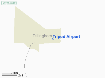
Location
& QuickFacts
|
FAA
Information Effective: |
2006-02-16 |
|
Airport
Identifier: |
Z25 |
|
Longitude/Latitude: |
158-33-27.9190W/59-15-47.3250N
-158.557755/59.263146 (Estimated) |
|
Elevation: |
225 ft / 68.58 m (Estimated) |
|
Land: |
0 acres |
|
From
nearest city: |
2 nautical miles SE of Aleknagik, AK |
|
Location: |
Bristol Bay County, AK |
|
Magnetic Variation: |
20E (1985) |
Owner
& Manager
|
Ownership: |
Publicly owned |
|
Owner: |
Public Domain |
|
Address: |
|
|
Address: |
|
Airport
Operations and Facilities
|
Airport
Use: |
Open to public |
|
Wind
indicator: |
No |
|
Segmented
Circle: |
No |
|
Control
Tower: |
No |
|
Attendance
Schedule: |
UNATNDD |
|
Landing
fee charge: |
No |
|
Sectional
chart: |
Kodiak |
|
Region: |
AAL - Alaska |
|
Boundary
ARTCC: |
ZAN - Anchorage |
|
Tie-in
FSS: |
DLG - Dillingham |
|
FSS
on Airport: |
No |
|
FSS
Phone: |
907-842-5275 |
|
FSS
Toll Free: |
LC842-5275 |
|
Alternate
FSS: |
ENA - Kenai |
|
Alt.
FSS Toll Free: |
1-800-WX-BRIEF |
|
NOTAMs
Facility: |
DLG (NOTAM-d service avaliable) |
Airport
Communications
Airport
Services
|
Airframe
Repair: |
NONE |
|
Power
Plant Repair: |
NONE |
|
Bottled
Oxygen: |
NONE |
|
Bulk
Oxygen: |
NONE |
|
Runway Information
Runway 11/29
|
Dimension: |
1250 x 50 ft / 381.0 x 15.2 m |
|
Surface: |
TURF-GRVL, Poor Condition
UNUSABLE DURING BREAKUP/RAIN DUE TO DIRT SURFACE.
ROCKS
TO 6 INCHES ON SURFACE. |
|
|
Runway 11 |
Runway 29 |
|
Traffic
Pattern: |
Left |
Left |
|
Obstruction: |
9 ft trees, 100.0 ft from runway, 120 ft right
of centerline, 11:1 slope to clear |
10 ft trees, 100.0 ft from runway, 10:1 slope
to clear |
|
Runway 18/36
|
Dimension: |
850 x 40 ft / 259.1 x 12.2 m |
|
Surface: |
GRVL-DIRT, Poor Condition
UNUSABLE DURING BREAKUP/RAIN DUE TO DIRT SURFACE.
ROCKS
TO 6 INCHES ON SURFACE. |
|
|
Runway 18 |
Runway 36 |
|
Traffic
Pattern: |
Left |
Left |
|
Obstruction: |
, 5:1 slope to clear |
25 ft brush, 25.0 ft from runway, 1:1 slope
to clear |
|
Radio Navigation
Aids
|
ID |
Type |
Name |
Ch |
Freq |
Var |
Dist |
|
BTS |
NDB |
Wood River |
|
429.00 |
20E |
15.8 nm |
|
DLG |
VOR/DME |
Dillingham |
111X |
116.40 |
20E |
16.2 nm |
Remarks
- RYS
NOT MAINTAINED.
- RY
18/36 NO LINE OF SIGHT BTN RY ENDS. RY
HIGH IN CENTER.
- RY
11/29 DIPS IN CENTER; HIGH ON ENDS. SEVERAL
POTHOLES.
Operational Statistics
|
Aircraft
Operations: |
11/Month |
|
Air Taxi: |
20.0% |
|
General
Aviation Itinerant: |
80.0% |
Tripod Airport
Address:
Bristol Bay County, AK
Tel:
Images
and information placed above are from
http://www.airport-data.com/airport/Z25/
We
thank them for the data!
| General
Info |
| Country |
United
States |
| State |
ALASKA
|
| FAA ID |
Z25
|
| Latitude |
59-15-47.325N
|
| Longitude |
158-33-27.919W
|
| Elevation |
225 feet
|
| Near City |
ALEKNAGIK
|
We don't guarantee the information is fresh and accurate. The data may
be wrong or outdated.
For more up-to-date information please refer to other sources.
|
|


