 |
|
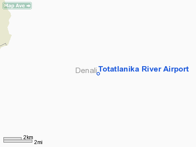
Totatlanika River Airport |
Location
& QuickFacts
|
FAA
Information Effective: |
2006-02-16 |
|
Airport
Identifier: |
9AK |
|
Longitude/Latitude: |
148-31-20.4150W/64-01-32.3750N
-148.522338/64.025660 (Estimated) |
|
Elevation: |
2717 ft / 828.14 m (Estimated) |
|
Land: |
0 acres |
|
From
nearest city: |
2 nautical miles SW of Totatlanika River,
AK |
|
Location: |
Yukon-koyukuk County, AK |
|
Magnetic Variation: |
27E (1985) |
Owner
& Manager
|
Ownership: |
Publicly owned |
|
Owner: |
Public Domain |
|
Address: |
|
|
Address: |
|
Airport
Operations and Facilities
|
Airport
Use: |
Open to public |
|
Wind
indicator: |
Yes |
|
Segmented
Circle: |
No |
|
Control
Tower: |
No |
|
Attendance
Schedule: |
UNATNDD |
|
Landing
fee charge: |
No |
|
Sectional
chart: |
Fairbanks |
|
Region: |
AAL - Alaska |
|
Boundary
ARTCC: |
ZAN - Anchorage |
|
Tie-in
FSS: |
FAI - Fairbanks |
|
FSS
on Airport: |
No |
|
FSS
Phone: |
907-474-0788 |
|
FSS
Toll Free: |
1-866-248-6516 |
|
NOTAMs
Facility: |
FAI (NOTAM-d service avaliable) |
Airport
Communications
Airport
Services
|
Airframe
Repair: |
NONE |
|
Power
Plant Repair: |
NONE |
|
Bottled
Oxygen: |
NONE |
|
Bulk
Oxygen: |
NONE |
|
Runway Information
Runway 07/25
|
Dimension: |
900 x 40 ft / 274.3 x 12.2 m |
|
Surface: |
GRVL, Poor Condition
ROUGH ROCK SURFACE; ROCK TO 4 INS. |
|
|
Runway 07 |
Runway 25 |
|
Traffic
Pattern: |
Left |
Left |
|
Markings: |
None, |
None, |
|
Runway
End Identifier: |
No |
No |
|
Centerline
Lights: |
No |
No |
|
Touchdown
Lights: |
No |
No |
|
Radio Navigation
Aids
|
ID |
Type |
Name |
Ch |
Freq |
Var |
Dist |
|
ICW |
NDB |
Ice Pool |
|
525.00 |
23E |
34.4 nm |
|
UMM |
NDB |
Summit |
|
326.00 |
27E |
45.0 nm |
|
ENN |
VORTAC |
Nenana |
105X |
115.80 |
27E |
36.8 nm |
|
FAI |
VORTAC |
Fairbanks |
023X |
108.60 |
28E |
48.4 nm |
Remarks
- RWY
LCTD ON TOP OF HILL; RWY RISES & FALLS AS MUCH AS 50'; SEVERE TURBC
IN ALL WINDS.
- ESTABD
PRIOR TO 1959.
Totatlanika River Airport
Address:
Yukon-koyukuk County, AK
Tel:
Images
and information placed above are from
http://www.airport-data.com/airport/9AK/
We
thank them for the data!
| General
Info |
| Country |
United
States |
| State |
ALASKA
|
| FAA ID |
9AK
|
| Latitude |
64-01-32.375N
|
| Longitude |
148-31-20.415W
|
| Elevation |
2717 feet
|
| Near City |
TOTATLANIKA
RIVER |
We don't guarantee the information is fresh and accurate. The data may
be wrong or outdated.
For more up-to-date information please refer to other sources.
|
|


