 |
|
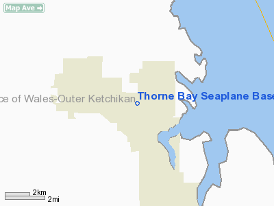
| Thorne Bay Seaplane Base |
| IATA: KTB – ICAO: none – FAA LID: KTB |
| Summary |
| Airport type |
Public |
| Owner |
Alaska DOT&PF - Southeast Region |
| Serves |
Thorne Bay, Alaska |
| Elevation AMSL |
0 ft / 0 m |
| Coordinates |
55°41′17″N 132°32′12″W / 55.68806°N 132.53667°W / 55.68806; -132.53667 |
| Runways |
| Direction |
Length |
Surface |
| ft |
m |
| NW/SE |
5,000 |
1,524 |
Water |
| Statistics (2006) |
| Aircraft operations |
1,519 |
| Source: Federal Aviation Administration |
Thorne Bay Seaplane Base (IATA: KTB, FAA LID: KTB) is a state-owned public-use seaplane base serving Thorne Bay, in the Prince of Wales-Hyder Census Area of the U.S. state of Alaska. Facilities and aircraft
Thorne Bay Seaplane Base has one seaplane landing area designated NW/SE which measures 5,000 by 2,000 feet (1,524 x 610 m). For the 12-month period ending December 31, 2006, the airport had 1,519 aircraft operations, an average of 126 per month: 49% air taxi, 42% scheduled commercial and 8% general aviation.
Airlines
The above content comes from Wikipedia and is published under free licenses – click here to read more.
Location
& QuickFacts
|
FAA
Information Effective: |
2006-02-16 |
|
Airport
Identifier: |
KTB |
|
Longitude/Latitude: |
132-32-12.0330W/55-41-16.6630N
-132.536676/55.687962 (Estimated) |
|
Elevation: |
0 ft / 0.00 m (Estimated) |
|
Land: |
0 acres |
|
From
nearest city: |
0 nautical miles NW of Thorne Bay, AK |
|
Location: |
Prince Of Wales County, AK |
|
Magnetic Variation: |
26E (1985) |
Owner
& Manager
|
Ownership: |
Publicly owned |
|
Owner: |
State Of Ak Dotpf Se Region |
|
Address: |
6860 Glacier Highway
Juneau, AK 99801 7999 |
|
Phone
number: |
907-789-6221 |
|
Manager: |
Brian Dixon Hbrmaster |
|
Address: |
City Of Thorne Bay Box 19110
Thorne Bay, AK 99919 |
|
Phone number: |
907-828-3380 |
Airport
Operations and Facilities
|
Airport
Use: |
Open to public |
|
Wind
indicator: |
Yes |
|
Segmented
Circle: |
No |
|
Control
Tower: |
No |
|
Attendance
Schedule: |
UNATNDD |
|
Landing
fee charge: |
No |
|
Sectional
chart: |
Ketchikan |
|
Region: |
AAL - Alaska |
|
Boundary
ARTCC: |
ZAN - Anchorage |
|
Tie-in
FSS: |
KTN - Ketchikan |
|
FSS
on Airport: |
No |
|
FSS
Phone: |
907-225-9481 |
|
FSS
Toll Free: |
LC225-9481 |
|
NOTAMs
Facility: |
KTN (NOTAM-d service avaliable) |
|
Federal Agreements: |
N |
Airport
Communications
Airport
Services
|
Airframe
Repair: |
NONE |
|
Power
Plant Repair: |
NONE |
|
Bottled
Oxygen: |
NONE |
|
Bulk
Oxygen: |
NONE |
|
Runway
Information
Runway NW/SE
|
Dimension: |
5000 x 2000 ft / 1524.0 x 609.6 m |
|
Surface: |
WATER, |
|
|
Runway NW |
Runway SE |
|
Traffic
Pattern: |
Left |
Left |
|
Markings: |
None, |
None, |
|
Runway
End Identifier: |
No |
No |
|
Centerline
Lights: |
No |
No |
|
Touchdown
Lights: |
No |
No |
|
Radio Navigation
Aids
|
ID |
Type |
Name |
Ch |
Freq |
Var |
Dist |
|
CMJ |
NDB |
Clam Cove |
|
396.00 |
27E |
35.2 nm |
|
ICK |
NDB |
Nichols |
|
266.00 |
27E |
48.9 nm |
|
AKW |
NDB/DME |
Klawock |
105X |
229.00 |
24E |
19.8 nm |
|
ANN |
VORTAC |
Annette Island |
118X |
117.10 |
27E |
49.9 nm |
|
ECH |
VOT |
Ketchikan |
|
111.00 |
|
34.9 nm |
Remarks
- OPERG
AREA IN THORNE BAY; FLOATING LOGS IN OPERG AREA.
Based Aircraft
|
Aircraft
based on field: |
2 |
|
Single
Engine Airplanes: |
2 |
Operational Statistics
|
Aircraft
Operations: |
37/Week |
|
Air Carrier: |
33.9% |
|
Air Taxi: |
12.7% |
|
General
Aviation Local: |
9.0% |
|
General
Aviation Itinerant: |
10.5% |
Thorne Bay Seaplane Base
Address:
Prince Of Wales County, AK
Tel:
907-789-6221,
907-828-3380
Images
and information placed above are from
http://www.airport-data.com/airport/KTB/
We
thank them for the data!
| General
Info |
| Country |
United
States |
| State |
ALASKA
|
| FAA ID |
KTB
|
| Latitude |
55-41-16.663N
|
| Longitude |
132-32-12.033W
|
| Elevation |
0 feet
|
| Near City |
THORNE
BAY |
We don't guarantee the information is fresh and accurate. The data may
be wrong or outdated.
For more up-to-date information please refer to other sources.
|
|


