 |
|
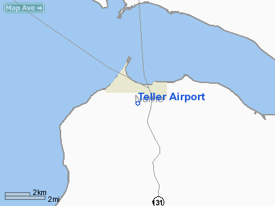
| Teller Airport |
| IATA: TLA – ICAO: PATE – FAA LID: TER |
| Summary |
| Airport type |
Public |
| Owner |
State of Alaska DOT&PF - Northern Region |
| Serves |
Teller, Alaska |
| Elevation AMSL |
294 ft / 90 m |
| Coordinates |
65°14′25″N 166°20′22″W / 65.24028°N 166.33944°W / 65.24028; -166.33944 |
| Runways |
| Direction |
Length |
Surface |
| ft |
m |
| 7/25 |
3,000 |
914 |
Gravel |
| Source: Federal Aviation Administration |
Teller Airport (IATA: TLA, ICAO: PATE, FAA LID: TER, formerly K54) is a state-owned public-use airport located two nautical miles (4 km) south of the central business district of Teller, a city in the Nome Census Area of the U.S. state of Alaska. Facilities and aircraft
Teller Airport has one runway designated 7/25 with a 3,000 x 60 ft (914 x 18 m) gravel surface.
Airlines destinations
- Bering Air (Brevig Mission, Nome, Wales)
- Frontier Flying Service
- Hageland Aviation Services
The above content comes from Wikipedia and is published under free licenses – click here to read more.
Location
& QuickFacts
|
FAA
Information Effective: |
2006-02-16 |
|
Airport
Identifier: |
TER |
|
Longitude/Latitude: |
166-20-21.6230W/65-14-25.3660N
-166.339340/65.240379 (Estimated) |
|
Elevation: |
294 ft / 89.61 m (Estimated) |
|
Land: |
0 acres |
|
From
nearest city: |
2 nautical miles S of Teller, AK |
|
Location: |
Nome County, AK |
|
Magnetic Variation: |
14E (2005) |
Owner
& Manager
|
Ownership: |
Publicly
owned |
|
Owner: |
St Of Ak Dotpf N Rgn |
|
Address: |
2301 Peger Rd
Fairbanks, AK 99701 |
|
Phone number: |
907-443-3444 |
|
Manager: |
Jerry Oliver |
|
Address: |
Box 1048
Nome, AK 99762 |
|
Phone number: |
907-443-3431 |
Airport
Operations and Facilities
|
Airport
Use: |
Open
to public |
|
Wind
indicator: |
Yes |
|
Segmented Circle: |
Yes |
|
Control
Tower: |
No |
|
Attendance Schedule: |
UNATNDD |
|
Lighting
Schedule: |
RDO-CTL
ACTVT MIRL RY 07/25 & ROTG BCN - CTAF. |
|
Beacon
Color: |
Clear-Green (lighted land airport) |
|
Landing
fee charge: |
No |
|
Sectional chart: |
Nome |
|
Region: |
AAL - Alaska |
|
Boundary
ARTCC: |
ZAN - Anchorage |
|
Tie-in
FSS: |
OME - Nome |
|
FSS
Phone: |
LC 443-2291 |
|
FSS
Toll Free: |
1-800-478-8400 |
|
Alternate FSS: |
FAI - Fairbanks |
|
Alt.
FSS Toll Free: |
1-866-248-6516 |
|
NOTAMs
Facility: |
OME (NOTAM-d service avaliable) |
|
Federal Agreements: |
NGY |
Airport
Communications
|
Runway Information
Runway 07/25
|
Dimension: |
3000
x 60 ft / 914.4 x 18.3 m |
|
Surface: |
GRVL, Good Condition |
|
Edge
Lights: |
Medium |
|
|
Runway 07 |
Runway 25 |
|
Longitude: |
166-20-56.8270W |
166-19-46.4190W |
|
Latitude: |
65-14-25.1140N |
65-14-25.6180N |
|
Elevation: |
277.00 ft |
294.00 ft |
|
Alignment: |
89 |
127 |
|
Traffic
Pattern: |
Left |
Left |
|
Radio Navigation
Aids
|
ID |
Type |
Name |
Ch |
Freq |
Var |
Dist |
|
TNC |
NDB/DME |
Tin City |
119Y |
347.00 |
13E |
44.1 nm |
|
OYN |
NDB/DME |
Gold |
085X |
208.00 |
14E |
49.5 nm |
Remarks
- RY
CONDITION NOT MONITORED; RECOMMEND VISUAL INSPECTION PRIOR TO LANDING.
Based Aircraft
|
Aircraft
based on field: |
1 |
|
Single
Engine Airplanes: |
1 |
Teller Airport
Address: Nome
County, AK
Tel:
907-443-3444, 907-443-3431
Images
and information placed above are from
http://www.airport-data.com/airport/TER/
We
thank them for the data!
| General
Info |
| Country |
United
States |
| State |
ALASKA
|
| FAA ID |
TER |
| Latitude |
65.240381
65� 14' 25.37" N |
| Longitude |
-166.339339
166� 20' 21.62" W |
| Elevation |
294 feet
90 meters |
| Magnetic
Variation |
013� E
(01/06) |
| Beacon |
Yes |
| Operating
Agency |
U.S.CIVIL
AIRPORT WHEREIN PERMIT COVERS USE BY TRANSIT MILITARY AIRCRAFT |
We don't guarantee the information is fresh and accurate. The data may
be wrong or outdated.
For more up-to-date information please refer to other sources.
|
|


