 |
|
|
|
|
|
Location
& QuickFacts
|
FAA
Information Effective: |
2006-02-16 |
|
Airport
Identifier: |
Z14 |
|
Longitude/Latitude: |
146-27-37.8790W/62-03-53.2390N
-146.460522/62.064789 (Estimated) |
|
Elevation: |
2450 ft / 746.76 m (Estimated) |
|
Land: |
0 acres |
|
From
nearest city: |
0 nautical miles SE of Tazlina, AK |
|
Location: |
Valdez-chitna-whitie County, AK |
|
Magnetic Variation: |
27E (1985) |
Owner
& Manager
|
Ownership: |
Publicly owned |
|
Owner: |
State Of Ak Dotpf-central Rgn |
|
Address: |
2301 Peger Road
Fairbanks, AK 99701 |
|
Phone
number: |
907-451-5217 |
|
Manager: |
George Herrman |
|
Address: |
Box 7
Glennallen, AK 99588 |
|
Phone number: |
822-3222 |
Airport
Operations and Facilities
|
Airport
Use: |
Open to public |
|
Wind
indicator: |
Yes |
|
Segmented
Circle: |
No |
|
Control
Tower: |
No |
|
Attendance
Schedule: |
UNATNDD |
|
Landing
fee charge: |
No |
|
Sectional
chart: |
Anchorage |
|
Region: |
AAL - Alaska |
|
Boundary
ARTCC: |
ZAN - Anchorage |
|
Tie-in
FSS: |
ENA - Kenai |
|
FSS
on Airport: |
No |
|
FSS
Phone: |
800-478-3576 |
|
FSS
Toll Free: |
1-800-WX-BRIEF |
|
NOTAMs
Facility: |
GKN (NOTAM-d service avaliable) |
Airport
Communications
Airport
Services
|
Airframe
Repair: |
NONE |
|
Power
Plant Repair: |
NONE |
|
Bottled
Oxygen: |
NONE |
|
Bulk
Oxygen: |
NONE |
|
Runway Information
Runway 13/31
|
Dimension: |
900 x 42 ft / 274.3 x 12.8 m |
|
Surface: |
GRAVEL, Fair Condition
TURF & WEEDS BEGINNING GROWTH ON RY. |
|
|
Runway 13 |
Runway 31 |
|
Traffic
Pattern: |
Left |
Left |
|
Markings: |
None,
/31 MARKED WITH REFLECTIVE ORANGE CONES; THR CONES & THR
PANELS. |
None, |
|
Runway
End Identifier: |
No |
No |
|
Centerline
Lights: |
No |
No |
|
Touchdown
Lights: |
No |
No |
|
Obstruction: |
40 ft trees, 600.0 ft from runway, 15:1 slope
to clear |
40 ft trees, 800.0 ft from runway, 20:1 slope
to clear |
|
Radio Navigation
Aids
|
ID |
Type |
Name |
Ch |
Freq |
Var |
Dist |
|
GLA |
NDB |
Glennallen |
|
248.00 |
28E |
29.0 nm |
|
GKN |
VOR/DME |
Gulkana |
103X |
115.60 |
28E |
28.9 nm |
Remarks
- NO
WINTER MAINT.
- DITCH
ALONG SW SIDE OF RY FIRST 1/3 OF RY 31; 6 FT DEEP.
- BERMS
ALONG FIRST 1/3 OF RY 31; BOTH SIDES 4 FT HIGH.
- RY
SLOPES DOWN TOWARDS CENTER. THR 31 DIFFERENCE OF 3'; THR 13 DIFFERENCE
OF 18'.
- RY
NOT MAINTAINED & CONDITION NOT MONITORED, RECOMMEND VISUAL INSPECTION
PRIOR TO LANDING.
Operational Statistics
|
Aircraft
Operations: |
9/Month |
|
Air Taxi: |
30.0% |
|
General
Aviation Itinerant: |
70.0% |
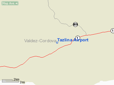
Tazlina Airport
Address:
Valdez-chitna-whitie County, AK
Tel:
907-451-5217
Images
and information placed above are from
http://www.airport-data.com/airport/Z14/
We
thank them for the data!
| General
Info |
| Country |
United
States |
| State |
ALASKA
|
| FAA ID |
Z14
|
| Latitude |
62-03-53.239N
|
| Longitude |
146-27-37.879W
|
| Elevation |
2450 feet
|
| Near City |
TAZLINA
|
We don't guarantee the information is fresh and accurate. The data may
be wrong or outdated.
For more up-to-date information please refer to other sources.
|
|


