 |
|
Location
& QuickFacts
|
FAA
Information Effective: |
2006-02-16 |
|
Airport
Identifier: |
AK49 |
|
Longitude/Latitude: |
164-47-55.7050W/65-40-45.3910N
-164.798807/65.679275 (Estimated) |
|
Elevation: |
440 ft / 134.11 m (Estimated) |
|
Land: |
0 acres |
|
From
nearest city: |
3 nautical miles SE of Taylor, AK |
|
Location: |
Nome County, AK |
|
Magnetic Variation: |
17E (1985) |
Owner
& Manager
|
Ownership: |
Privately owned |
|
Owner: |
N B Tweet |
|
Address: |
Box 1107
Nome, AK 99762 |
|
Address: |
|
Airport
Operations and Facilities
|
Airport
Use: |
Private |
|
Wind
indicator: |
Yes |
|
Segmented
Circle: |
No |
|
Control
Tower: |
No |
|
Attendance
Schedule: |
UNATNDD |
|
Landing
fee charge: |
No |
|
Sectional
chart: |
Nome |
|
Region: |
AAL - Alaska |
|
Boundary
ARTCC: |
ZAN - Anchorage |
|
Tie-in FSS: |
OME - Nome |
|
FSS on Airport: |
No |
|
FSS Phone: |
LC 443-2291 |
|
FSS Toll Free: |
1-800-478-8400 |
|
Alternate FSS: |
FAI - Fairbanks |
|
Alt. FSS Toll Free: |
1-866-248-6516 |
Airport
Communications
Airport
Services
|
Airframe
Repair: |
NONE |
|
Power
Plant Repair: |
NONE |
|
Bottled
Oxygen: |
NONE |
|
Bulk
Oxygen: |
NONE |
|
Runway Information
Runway 16/34
|
Dimension: |
1400 x 30 ft / 426.7 x 9.1 m |
|
Surface: |
GRAVEL, |
|
|
Runway 16 |
Runway 34 |
|
Traffic
Pattern: |
Left |
Left |
|
Markings: |
None, |
None, |
|
Runway
End Identifier: |
No |
No |
|
Centerline
Lights: |
No |
No |
|
Touchdown
Lights: |
No |
No |
|
Radio Navigation
Aids
|
ID |
Type |
Name |
Ch |
Freq |
Var |
Dist |
|
SHH |
NDB |
Shishmaref |
|
365.00 |
14E |
46.4 nm |
Remarks
- RWY
IN GOOD COND; NARROWS IN SOME PLACES; LARGE ROCKS.
- ESTABD
PRIOR TO 1959.
Based Aircraft
|
Aircraft
based on field: |
2 |
|
Single
Engine Airplanes: |
2 |
Operational Statistics
|
Aircraft
Operations: |
18/Month |
|
General
Aviation Local: |
14.6% |
|
General
Aviation Itinerant: |
85.4% |
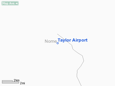
Taylor Airport
Address:
Nome County, AK
Tel:
Images
and information placed above are from
http://www.airport-data.com/airport/AK49/
We
thank them for the data!
| General
Info |
| Country |
United
States |
| State |
ALASKA
|
| FAA ID |
AK49
|
| Latitude |
65-40-45.391N
|
| Longitude |
164-47-55.705W
|
| Elevation |
440 feet
|
| Near City |
TAYLOR
|
We don't guarantee the information is fresh and accurate. The data may
be wrong or outdated.
For more up-to-date information please refer to other sources.
|
|


