 |
|
|
|
Location
& QuickFacts
|
FAA
Information Effective: |
2006-02-16 |
|
Airport
Identifier: |
8KA |
|
Longitude/Latitude: |
153-21-43.0310W/62-17-35.8330N
-153.361953/62.293287 (Estimated) |
|
Elevation: |
1490 ft / 454.15 m (Estimated) |
|
Land: |
0 acres |
|
From
nearest city: |
1 nautical miles S of Tatitna, AK |
|
Location: |
Kuskokwim County, AK |
|
Magnetic Variation: |
24E (1985) |
Owner
& Manager
|
Ownership: |
Publicly owned |
|
Owner: |
Us Gov-blm |
|
Address: |
6881 Abbot Loop Rd
Anchorage, AK 99507 |
|
Phone number: |
907-267-1213 |
|
Address: |
|
Airport
Operations and Facilities
|
Airport
Use: |
Open to public |
|
Segmented
Circle: |
No |
|
Control
Tower: |
No |
|
Attendance
Schedule: |
UNATNDD |
|
Landing
fee charge: |
No |
|
Sectional
chart: |
Mc Grath |
|
Region: |
AAL - Alaska |
|
Boundary
ARTCC: |
ZAN - Anchorage |
|
Tie-in
FSS: |
ENA - Kenai |
|
FSS
on Airport: |
No |
|
FSS
Phone: |
800-478-3576 |
|
FSS
Toll Free: |
1-800-WX-BRIEF |
|
NOTAMs
Facility: |
FKK (NOTAM-d service avaliable) |
Airport
Communications
Airport
Services
|
Airframe
Repair: |
NONE |
|
Power
Plant Repair: |
NONE |
|
Bottled
Oxygen: |
NONE |
|
Bulk
Oxygen: |
NONE |
|
Runway Information
Runway 06/24
|
Dimension: |
1200 x 12 ft / 365.8 x 3.7 m |
|
Surface: |
TURF-GRVL, Poor Condition
ROCKS ON SFC 3 TO 4 INCHES. UNEVEN GRADE & DIPS IN RY. |
|
|
Runway 06 |
Runway 24 |
|
Traffic
Pattern: |
Left |
Left |
|
Obstruction: |
2750 ft mtn, 5000.0 ft from runway, 1:1 slope
to clear |
23 ft trees, 325.0 ft from runway, 40 ft right
of centerline, 14:1 slope to clear |
|
Remarks
- ALSO
KNOWN AS RHONE RIVER & SHORT CUT STRIP.
- CAUTION:
WIND SHEER AND/OR DIRECTIONAL WIND CHANGE DUE TO PROXIMITY OF TWO PASSES.
- AIRSTRIP
USED AS IDITAROD CHECK POINT. HEAVY USE LATE FEB TO MID MARCH.
- RY
06 - 18 FT WOOD TWR 40 FT FM RY END 30 FT L OF CNTRLN.
- ESTABD
PRIOR TO 1959.
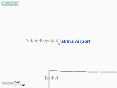
Tatitna Airport
Address:
Kuskokwim County, AK
Tel:
907-267-1213
Images
and information placed above are from
http://www.airport-data.com/airport/8KA/
We
thank them for the data!
| General
Info |
| Country |
United
States |
| State |
ALASKA
|
| FAA ID |
8KA
|
| Latitude |
62-17-35.833N
|
| Longitude |
153-21-43.031W
|
| Elevation |
1490 feet
|
| Near City |
TATITNA
|
We don't guarantee the information is fresh and accurate. The data may
be wrong or outdated.
For more up-to-date information please refer to other sources.
|
|


