 |
|
|
|
|
|
Location
& QuickFacts
|
FAA
Information Effective: |
2006-02-16 |
|
Airport
Identifier: |
A69 |
|
Longitude/Latitude: |
138-30-13.2140W/59-14-52.9510N
-138.503671/59.248042 (Estimated) |
|
Elevation: |
130 ft / 39.62 m (Estimated) |
|
Land: |
0 acres |
|
From
nearest city: |
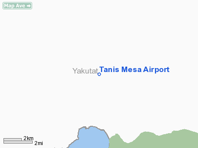
42 nautical miles E of Yakutat, AK |
|
Location: |
Skagway-yakutat County, AK |
|
Magnetic Variation: |
28E (1985) |
Owner
& Manager
|
Ownership: |
Publicly owned |
|
Owner: |
Usfs Chatham Area |
|
Address: |
204 Siginaka Way
Sitka, AK 99835 |
|
Phone number: |
907-747-6671 |
|
Manager: |
Usfs Yakutat Dist Mgr |
|
Address: |
Box 327
Yakutat, AK 99689 |
|
Phone number: |
907-784-3359 |
Airport
Operations and Facilities
|
Airport
Use: |
Open to public |
|
Wind
indicator: |
No |
|
Segmented
Circle: |
No |
|
Control
Tower: |
No |
|
Attendance
Schedule: |
UNATNDD |
|
Landing
fee charge: |
No |
|
Sectional
chart: |
Juneau |
|
Region: |
AAL - Alaska |
|
Boundary
ARTCC: |
ZAN - Anchorage |
|
Tie-in
FSS: |
JNU - Juneau |
|
FSS
on Airport: |
No |
|
FSS
Phone: |
907-586-7380 |
|
FSS
Toll Free: |
1-800-WX-BRIEF |
|
NOTAMs
Facility: |
YAK (NOTAM-d service avaliable) |
Airport
Communications
Airport
Services
|
Airframe
Repair: |
NONE |
|
Power
Plant Repair: |
NONE |
|
Bottled
Oxygen: |
NONE |
|
Bulk
Oxygen: |
NONE |
|
Runway Information
Runway 12/30
|
Dimension: |
1900 x 15 ft / 579.1 x 4.6 m |
|
Surface: |
TURF-GRVL, Fair Condition
SFC IS IRREGULAR GRASS & WEEDS TO ONE FT HIGH FULL LENGTH OF
RY & 25 FT EACH SIDE OF CENTERLINE. |
|
|
Runway 12 |
Runway 30 |
|
Traffic
Pattern: |
Left |
Left |
|
Markings: |
None, |
None, |
|
Runway
End Identifier: |
No |
No |
|
Centerline
Lights: |
No |
No |
|
Touchdown
Lights: |
No |
No |
|
Obstruction: |
60 ft trees, 800.0 ft from runway, 13:1 slope
to clear |
55 ft trees, 1000.0 ft from runway, 18:1 slope
to clear |
|
Radio Navigation
Aids
|
ID |
Type |
Name |
Ch |
Freq |
Var |
Dist |
|
OCC |
NDB |
Ocean Cape |
|
385.00 |
23E |
41.5 nm |
|
YAK |
VORTAC |
Yakutat |
080X |
113.30 |
23E |
38.4 nm |
Remarks
- BORROW
PTS 3' DEEP ALONG EDGES OF RY.
- 500
FT HILL 750 FT S; MOUNTAINS ONE MILE N.
- ESTABD
PRIOR TO 1959.
Operational Statistics
|
Aircraft
Operations: |
9/Month |
|
Air Taxi: |
50.0% |
|
General
Aviation Itinerant: |
50.0% |
Tanis Mesa Airport
Address:
Skagway-yakutat County, AK
Tel:
907-747-6671, 907-784-3359
Images
and information placed above are from
http://www.airport-data.com/airport/A69/
We
thank them for the data!
| General
Info |
| Country |
United
States |
| State |
ALASKA
|
| FAA ID |
A69
|
| Latitude |
59-14-52.951N
|
| Longitude |
138-30-13.214W
|
| Elevation |
130 feet
|
| Near City |
YAKUTAT
|
We don't guarantee the information is fresh and accurate. The data may
be wrong or outdated.
For more up-to-date information please refer to other sources.
|
|


