 |
|
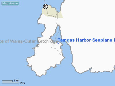
Tamgas Harbor Seaplane Base |
|
|
Location
& QuickFacts
|
FAA
Information Effective: |
2006-02-16 |
|
Airport
Identifier: |
Z43 |
|
Longitude/Latitude: |
131-33-25.0370W/55-04-04.7720N
-131.556955/55.067992 (Estimated) |
|
Elevation: |
0 ft / 0.00 m (Estimated) |
|
Land: |
0 acres |
|
From
nearest city: |
2 nautical miles NE of Annette, AK |
|
Location: |
Ketchikan County, AK |
|
Magnetic Variation: |
26E (1985) |
Owner
& Manager
|
Ownership: |
Publicly owned |
|
Owner: |
Council Of Annette Is |
|
Address: |
Metlakatla, AK 99926 |
|
Address: |
|
Airport
Operations and Facilities
|
Airport
Use: |
Open to public |
|
Wind
indicator: |
No |
|
Segmented
Circle: |
No |
|
Control
Tower: |
No |
|
Attendance
Schedule: |
UNATNDD |
|
Landing
fee charge: |
No |
|
Sectional
chart: |
Ketchikan |
|
Region: |
AAL - Alaska |
|
Boundary
ARTCC: |
ZAN - Anchorage |
|
Tie-in
FSS: |
KTN - Ketchikan |
|
FSS
on Airport: |
No |
|
FSS
Phone: |
907-225-9481 |
|
FSS
Toll Free: |
LC225-9481 |
|
NOTAMs
Facility: |
KTN (NOTAM-d service avaliable) |
|
Federal Agreements: |
1 |
Airport
Communications
Airport
Services
|
Airframe
Repair: |
NONE |
|
Power
Plant Repair: |
NONE |
|
Bottled
Oxygen: |
NONE |
|
Bulk
Oxygen: |
NONE |
|
Runway
Information
Runway NW/SE
|
Dimension: |
10560 x 1500 ft / 3218.7 x 457.2 m |
|
Surface: |
WATER, |
|
|
Runway NW |
Runway SE |
|
Traffic
Pattern: |
Left |
Left |
|
Markings: |
None, |
None, |
|
Runway
End Identifier: |
No |
No |
|
Centerline
Lights: |
No |
No |
|
Touchdown
Lights: |
No |
No |
|
Radio Navigation
Aids
|
ID |
Type |
Name |
Ch |
Freq |
Var |
Dist |
|
ICK |
NDB |
Nichols |
|
266.00 |
27E |
1.7 nm |
|
CMJ |
NDB |
Clam Cove |
|
396.00 |
27E |
17.3 nm |
|
ANN |
VORTAC |
Annette Island |
118X |
117.10 |
27E |
0.9 nm |
|
ECH |
VOT |
Ketchikan |
|
111.00 |
|
17.6 nm |
Remarks
- DOCK
IN BAD CONDITION IN AREA OF FLOAT PLANE TIE-UP.
Operational Statistics
|
Aircraft
Operations: |
13/Month |
|
Air Taxi: |
33.3% |
|
General
Aviation Local: |
33.3% |
|
General
Aviation Itinerant: |
33.3% |
Tamgas Harbor Seaplane Base
Address:
Ketchikan County, AK
Tel:
Images
and information placed above are from
http://www.airport-data.com/airport/Z43/
We
thank them for the data!
| General
Info |
| Country |
United
States |
| State |
ALASKA
|
| FAA ID |
Z43
|
| Latitude |
55-04-04.772N
|
| Longitude |
131-33-25.037W
|
| Elevation |
0 feet
|
| Near City |
ANNETTE
|
We don't guarantee the information is fresh and accurate. The data may
be wrong or outdated.
For more up-to-date information please refer to other sources.
|
|


