 |
|
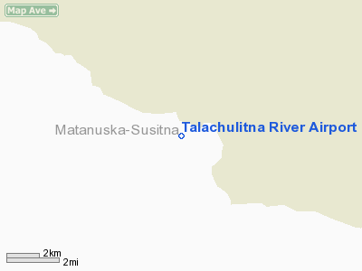
Talachulitna River Airport |
Location
& QuickFacts
|
FAA
Information Effective: |
2006-02-16 |
|
Airport
Identifier: |
1AK6 |
|
Longitude/Latitude: |
151-24-30.0000W/61-51-10.0000N
-151.408333/61.852778 (Estimated) |
|
Elevation: |
282 ft / 85.95 m (Estimated) |
|
Land: |
10 acres |
|
From
nearest city: |
10 nautical miles S of Sketna, AK |
|
Location: |
Matanuska Susitna County, AK |
|
Magnetic Variation: |
23E (1995) |
Owner
& Manager
|
Ownership: |
Privately owned |
|
Owner: |
Dan Perry |
|
Address: |
12945 Elmore Road
Anchorage, AK 99516 |
|
Phone number: |
907-271-2091 |
|
Manager: |
Dan Perry |
|
Address: |
12945 Elmore Road
Anchorage, AK 99516 |
|
Phone number: |
907-271-2091 |
Airport
Operations and Facilities
|
Airport
Use: |
Private |
|
Wind
indicator: |
Yes |
|
Segmented
Circle: |
No |
|
Control
Tower: |
No |
|
Attendance
Schedule: |
JUN-SEP/IREG/IREG |
|
Sectional
chart: |
Anchorage |
|
Region: |
AAL - Alaska |
|
Boundary
ARTCC: |
ZAN - Anchorage |
|
Tie-in
FSS: |
ENA - Kenai |
|
FSS
on Airport: |
No |
|
FSS
Phone: |
800-478-3576 |
|
FSS
Toll Free: |
1-800-WX-BRIEF |
|
Runway Information
Runway 08/26
|
Dimension: |
1800 x 50 ft / 548.6 x 15.2 m |
|
Surface: |
GRVL, |
|
|
Runway 08 |
Runway 26 |
|
Traffic
Pattern: |
Left |
Left |
|
Displaced
threshold: |
100.00 ft
/26 DSPLCD THLDS MKD WITH CONES. |
100.00 ft |
|
Obstruction: |
400 ft hill, 5280.0 ft from runway |
400 ft hill, 5280.0 ft from runway |
|
Radio Navigation
Aids
|
ID |
Type |
Name |
Ch |
Freq |
Var |
Dist |
|
PEE |
NDB |
Peters Creek |
|
305.00 |
26E |
46.8 nm |
|
TKA |
VOR/DME |
Talkeetna |
109X |
116.20 |
26E |
45.4 nm |
|
BGQ |
VORTAC |
Big Lake |
072X |
112.50 |
25E |
44.4 nm |
Remarks
- RY
08/26 MAY HAVE SOFT SPOTS AFTER RAIN.
- PERSONNEL;
EQUIPMENT & ANIMALS MAY BE ON RY 08/26.
- VISUAL
INSPN OF RY 08/26 RQRD BEFORE LNDG.
Talachulitna River Airport
Address:
Matanuska Susitna County, AK
Tel:
907-271-2091
Images
and information placed above are from
http://www.airport-data.com/airport/1AK6/
We
thank them for the data!
| General
Info |
| Country |
United
States |
| State |
ALASKA
|
| FAA ID |
1AK6
|
| Latitude |
61-58-45.000N
|
| Longitude |
151-10-03.000W
|
| Elevation |
365 feet
|
| Near City |
SKETNA
|
We don't guarantee the information is fresh and accurate. The data may
be wrong or outdated.
For more up-to-date information please refer to other sources.
|
|


