 |
|
|
|
|
|
Location
& QuickFacts
|
FAA Information Effective: |
2006-02-16 |
|
Airport Identifier: |
HNE |
|
Longitude/Latitude: |
147-18-15.8660W/61-54-05.1480N
-147.304407/61.901430 (Estimated) |
|
Elevation: |
2960 ft / 902.21 m (Estimated) |
|
Land: |
0 acres |
|
From nearest city: |
0 nautical miles SE of Tahneta Pass Lodge,
AK |
|
Location: |
Mata-sus Borough County, AK |
|
Magnetic Variation: |
26E (1985) |
Owner
& Manager
|
Ownership: |
Privately owned |
|
Owner: |
Eldon Brandt |
|
Address: |
Anchorage, AK |
|
Manager: |
Eldon Brandt |
|
Address: |
Anchorage, AK |
|
Phone number: |
907-822-3276 |
Airport
Operations and Facilities
|
Airport
Use: |
Open to public |
|
Wind
indicator: |
No |
|
Segmented
Circle: |
No |
|
Control
Tower: |
No |
|
Attendance
Schedule: |
UNATNDD |
|
Landing
fee charge: |
No |
|
Sectional
chart: |
Anchorage |
|
Region: |
AAL - Alaska |
|
Boundary
ARTCC: |
ZAN - Anchorage |
|
Tie-in
FSS: |
ENA - Kenai |
|
FSS
on Airport: |
No |
|
FSS
Phone: |
800-478-3576 |
|
FSS
Toll Free: |
1-800-WX-BRIEF |
|
NOTAMs
Facility: |
SMU (NOTAM-d service avaliable) |
Airport
Communications
|
CTAF: |
123.050 |
|
Unicom: |
123.050 |
Airport
Services
|
Airframe
Repair: |
NONE |
|
Power
Plant Repair: |
NONE |
|
Bottled
Oxygen: |
NONE |
|
Bulk
Oxygen: |
NONE |
|
Runway Information
Runway 03/21
|
Dimension: |
1100 x 20 ft / 335.3 x 6.1 m |
|
Surface: |
GRVL-DIRT, Poor Condition
HAS RUTS AND IS SOFT WHEN WET. THE EDGES ARE SOFT AND OVERGROWN
WITH BRUSH. |
|
|
Runway 03 |
Runway 21 |
|
Traffic
Pattern: |
Left |
Left |
|
Markings: |
None, |
None, |
|
Runway
End Identifier: |
No |
No |
|
Centerline
Lights: |
No |
No |
|
Touchdown
Lights: |
No |
No |
|
Obstruction: |
20 ft trees p lin, 80.0 ft from runway, 80
ft left of centerline, 4:1 slope to clear |
15 ft pole bldg, 160.0 ft from runway, 70 ft
left of centerline, 10:1 slope to clear |
|
Runway 04W/22W
|
Dimension: |
7000 x 1000 ft / 2133.6 x 304.8 m |
|
Surface: |
WATER,
HAS RUTS AND IS SOFT WHEN WET. THE EDGES ARE SOFT AND OVERGROWN
WITH BRUSH. |
|
|
Runway 04W |
Runway 22W |
|
Traffic
Pattern: |
Left |
Left |
|
Markings: |
None, |
None, |
|
Runway
End Identifier: |
No |
No |
|
Centerline
Lights: |
No |
No |
|
Touchdown
Lights: |
No |
No |
|
Remarks
- RY
SLOPES DOWN BOTH DIRECTIONS FROM HIGH POINT 400 FT FROM RY 03 THR.
RY 03 DIFFERENCE
OF 3 FT; RY 21 DIFFERENCE OF 9 FT.
- TAHNETA
PASS WX CAMERA AVBL ON INTERNET AT HTTP://AKWEATHERCAMS.FAA.GOV
- (ARPT
STATUS) ARPT CLSD INDEFLY.
Operational Statistics
|
Aircraft
Operations: |
5/Month |
|
General
Aviation Itinerant: |
100.0% |
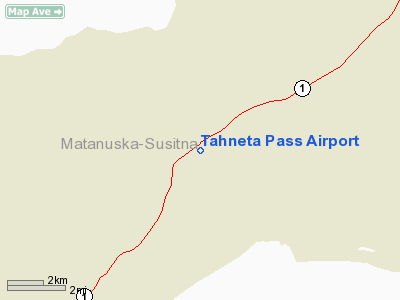
Tahneta Pass Airport
Address:
Mata-sus Borough County, AK
Tel:
907-822-3276
Images
and information placed above are from
http://www.airport-data.com/airport/HNE/
We
thank them for the data!
| General
Info |
| Country |
United
States |
| State |
ALASKA
|
| FAA ID |
HNE
|
| Latitude |
61-54-05.148N
|
| Longitude |
147-18-15.866W
|
| Elevation |
2960 feet
|
| Near City |
TAHNETA
PASS LODGE |
We don't guarantee the information is fresh and accurate. The data may
be wrong or outdated.
For more up-to-date information please refer to other sources.
|
|


