 |
|
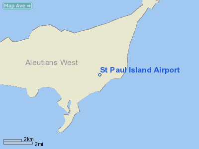
| St. Paul Island Airport |
| IATA: SNP – ICAO: PASN – FAA LID: SNP |
| Summary |
| Airport type |
Public |
| Owner |
Alaska DOT&PF - Central Region |
| Serves |
St. Paul Island, Alaska |
| Location |
St. Paul, Alaska |
| Elevation AMSL |
63 ft / 19 m |
| Coordinates |
57°10′02″N 170°13′14″W / 57.16722°N 170.22056°W / 57.16722; -170.22056 |
| Runways |
| Direction |
Length |
Surface |
| ft |
m |
| 18/36 |
6,500 |
1,981 |
Asphalt |
| Statistics (2006) |
| Aircraft operations |
410 |
| Enplanements (2008) |
3,301 |
| Source: Federal Aviation Administration |
St. Paul Island Airport (IATA: SNP, ICAO: PASN, FAA LID: SNP) is a state-owned, public-use airport located on St. Paul Island in the Bethel Census Area of the U.S. state of Alaska. It is situated near the city of St. Paul, the island's main settlement. Scheduled airline service to Anchorage International Airport is provided by Peninsula Airways (PenAir).
As per Federal Aviation Administration records, this airport had 3,301 commercial passenger boardings (enplanements) in calendar year 2008, an increase of 8% from the 3,064 enplanements in 2007. St. Paul Island Airport is included in the FAA's National Plan of Integrated Airport Systems (2009-2013), which categorizes it as a general aviation facility. Airlines and destinations
Facilities and aircraft
St. Paul Island Airport has one runway designated 18/36 with an asphalt surface measuring 6,500 by 150 feet (1,981 x 46 m). For the 12-month period ending December 31, 2006, the airport had 410 aircraft operations, an average of 34 per month: 63% air taxi, 24% military and 12% general aviation.
The above content comes from Wikipedia and is published under free licenses – click here to read more.
Location
& QuickFacts
|
FAA
Information Effective: |
2006-02-16 |
|
Airport
Identifier: |
SNP |
|
Longitude/Latitude: |
170-13-13.6000W/57-10-02.4000N
-170.220444/57.167333 (Estimated) |
|
Elevation: |
63 ft / 19.20 m (Surveyed) |
|
Land: |
0 acres |
|
From
nearest city: |
3 nautical miles NE of St Paul Island, AK |
|
Location: |
Bethel County, AK |
|
Magnetic Variation: |
10E (2005) |
Owner
& Manager
|
Ownership: |
Publicly owned |
|
Owner: |
St Of Ak Dotpf-central Region |
|
Address: |
Pouch 196900
Anchorage, AK 99519-6900 |
|
Phone number: |
907-269-0747 |
|
Manager: |
Norman Heyano |
|
Address: |
Po Box 250
Dillingham, AK 99576 |
|
Phone number: |
907-842-5511
OR 907-546-5000. |
Airport
Operations and Facilities
|
Airport
Use: |
Open to public |
|
Wind
indicator: |
Yes |
|
Segmented
Circle: |
Yes |
|
Control
Tower: |
No |
|
Attendance
Schedule: |
UNATNDD |
|
Lighting
Schedule: |
DUSK-DAWN
ACTVT HIRL RY 18/36; MALSF RYS 18 & 36; VASI RYS 18
& 36 - CTAF. |
|
Beacon
Color: |
Clear-Green (lighted land airport) |
|
Landing
fee charge: |
No |
|
Sectional
chart: |
Gnc 6 |
|
Region: |
AAL - Alaska |
|
Boundary
ARTCC: |
ZAN - Anchorage |
|
Tie-in
FSS: |
CDB - Cold Bay
COLD BAY 0800-1800; KENAI 1800-0800. |
|
FSS
on Airport: |
No |
|
FSS
Phone: |
907-532-2454 |
|
FSS
Toll Free: |
1-800-478-7250 |
|
Alternate
FSS: |
ENA - Kenai |
|
Alt.
FSS Toll Free: |
1-800-WX-BRIEF |
|
NOTAMs
Facility: |
SNP (NOTAM-d service avaliable) |
|
Certification type/date: |
?? ??/???? |
|
Federal Agreements: |
N1 |
Airport
Communications
Airport
Services
|
Airframe
Repair: |
NONE |
|
Power
Plant Repair: |
NONE |
|
Bottled
Oxygen: |
NONE |
|
Bulk
Oxygen: |
NONE |
|
Runway Information
Runway 18/36
|
Dimension: |
6500
x 150 ft / 1981.2 x 45.7 m
1000 FT SAFETY AREA ON N AND S END. |
|
Surface: |
ASPH, Good Condition |
|
Edge
Lights: |
High |
|
|
Runway 18 |
Runway 36 |
|
Longitude: |
170-13-03.7000W |
170-13-23.5000W |
|
Latitude: |
57-10-33.9000N |
57-09-30.8000N |
|
Elevation: |
63.00 ft |
32.00 ft |
|
Alignment: |
127 |
10 |
|
ILS
Type: |
MLS |
ILS |
|
Traffic
Pattern: |
Left |
Right |
|
Markings: |
Precision instrument, Good Condition |
Precision instrument, Good Condition |
|
Crossing
Height: |
32.00 ft |
32.00 ft |
|
VASI: |
4-box on right side |
4-box on left side |
|
Visual
Glide Angle: |
3.00� |
3.00� |
|
Approach
lights: |
MALSF |
MALSF |
|
Radio Navigation
Aids
|
ID |
Type |
Name |
Ch |
Freq |
Var |
Dist |
|
SNP |
NDB |
Reeve |
|
362.00 |
13E |
1.0 nm |
|
EGY |
NDB |
English Bay |
|
374.00 |
13E |
3.1 nm |
|
SPY |
NDB/DME |
St Paul Island |
036X |
314.00 |
13E |
0.7 nm |
|
SRI |
NDB/DME |
Pribilof |
096X |
399.00 |
11E |
40.3 nm |
Remarks
- 625
FT LIGHTED TOWER ONE MILE SW.
- 45'
TWR 350' WEST & 1000' NORTH THR RWY 36 LGTD.
- ARFF
EQUIP STAFFED DURG PDS OF ACR ACTVTY ONLY.
- SNOW
REMOVAL ICE REMOVAL & ARPT HAZ RPRTNG ONLY PERFORMED BY PRIOR ARNGMT
IN WRITING WITH ARPT MANAGEMENT.
- MAINTENANCE
DUTY HRS 0800-1700.
- PILOTS
ARE REQUESTED TO SELF-ANNOUNCE ON CTAF PRIOR TO TAXIING ON RWY FOR DEPARTURE;
LEAVING THE RWY AND WITHIN 10 NM OF THE ARPT WHEN APPROACHING TO LAND.
- WX
CAMERA AVBL ON INTERNET AT HTTP://AKWEATHERCAMS.FAA.GOV
Operational Statistics
|
Aircraft
Operations: |
13/Week |
|
Air Taxi: |
76.9% |
|
General
Aviation Itinerant: |
7.7% |
|
Military: |
15.4% |
St Paul Island Airport
Address:
Bethel County, AK
Tel:
907-269-0747, 907-842-5511
Images
and information placed above are from
http://www.airport-data.com/airport/SNP/
We
thank them for the data!
| General
Info |
| Country |
United
States |
| State |
ALASKA
|
| FAA ID |
SNP
|
| Latitude |
57-10-02.400N
|
| Longitude |
170-13-13.600W
|
| Elevation |
63 feet
|
| Near City |
ST PAUL
ISLAND |
We don't guarantee the information is fresh and accurate. The data may
be wrong or outdated.
For more up-to-date information please refer to other sources.
|
|


