 |
|
| St. Mary's Airport |
| IATA: KSM – ICAO: PASM – FAA LID: KSM |
| Summary |
| Airport type |
Public |
| Operator |
Alaska DOT&PF |
| Location |
St. Mary's, Alaska |
| Elevation AMSL |
312 ft / 95 m |
| Coordinates |
62°03′39″N 163°18′07″W / 62.06083°N 163.30194°W / 62.06083; -163.30194 |
| Runways |
| Direction |
Length |
Surface |
| ft |
m |
| 17/35 |
6,008 |
1,831 |
Gravel |
| 6/24 |
1,520 |
463 |
Gravel |
| Source: Federal Aviation Administration |
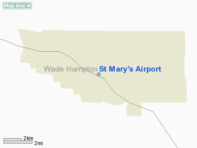
St. Mary's Airport (IATA: KSM, ICAO: PASM, FAA LID: KSM) is a public airport located four miles (6 km) west of the central business district of St. Mary's, in the Wade Hampton Census Area of the U.S. state of Alaska. This airport is publicly owned by the State of Alaska Department of Transportation and Public Facilities (DOT&PF) - Northern Region. Facilities
St. Mary's Airport covers an area of 3,600 acres (1,457 ha) and contains two gravel surfaced runways: 17/35 measuring 6,008 x 150 feet (1,831 x 46 m) and 6/24 measuring 1,520 x 60 feet (463 x 18 m).
Airlines and non-stop destinations
- Frontier Flying Service (Anchorage, Aniak, Emmonak, Mountain Village, Pilot Station)
- Hageland Aviation Services
The above content comes from Wikipedia and is published under free licenses – click here to read more.
Location
& QuickFacts
|
FAA
Information Effective: |
2006-02-16 |
|
Airport
Identifier: |
KSM |
|
Longitude/Latitude: |
163-18-07.5990W/62-03-37.7510N
-163.302111/62.060486 (Estimated) |
|
Elevation: |
311 ft / 94.79 m (Surveyed) |
|
Land: |
3600 acres |
|
From
nearest city: |
4 nautical miles W of St Mary's, AK |
|
Location: |
Wade Hampton County, AK |
|
Magnetic Variation: |
18E (1985) |
Owner
& Manager
|
Ownership: |
Publicly owned |
|
Owner: |
St Of Ak Dotpf Northern Rgn |
|
Address: |
2301 Peger Road
Fairbanks, AK 99709 |
|
Phone number: |
907-443-3444 |
|
Manager: |
George Beans |
|
Address: |
Box 135
St Mary's, AK 99658 |
|
Phone number: |
907-438-2416 |
Airport
Operations and Facilities
|
Airport
Use: |
Open to public |
|
Wind
indicator: |
Yes |
|
Segmented
Circle: |
Yes |
|
Control
Tower: |
No |
|
Attendance
Schedule: |
WINTER/ALL/0700-1530,SUMMER/MON-FRI/0700-1530 |
|
Lighting
Schedule: |
DUSK-DAWN
ACTVT MIRL RYS 16/34 & 06/24; VASI RYS 16 & 34;
MALSR RY 16 & REIL RY 34 - CTAF. |
|
Beacon
Color: |
Clear-Green (lighted land airport) |
|
Landing
fee charge: |
No |
|
Sectional
chart: |
Bethel |
|
Region: |
AAL - Alaska |
|
Boundary
ARTCC: |
ZAN - Anchorage |
|
Tie-in
FSS: |
ENA - Kenai |
|
FSS
on Airport: |
No |
|
FSS
Phone: |
800-478-3576 |
|
FSS
Toll Free: |
1-800-WX-BRIEF |
|
NOTAMs
Facility: |
KSM (NOTAM-d service avaliable) |
|
Federal Agreements: |
NGSY |
Airport
Communications
Airport
Services
|
Airframe
Repair: |
NONE |
|
Power
Plant Repair: |
NONE |
|
Bottled
Oxygen: |
NONE |
|
Bulk
Oxygen: |
NONE |
|
Runway Information
Runway 06/24
|
Dimension: |
1900 x 60 ft / 579.1 x 18.3 m |
|
Surface: |
GRAVEL, Good Condition |
|
Edge
Lights: |
Medium |
|
|
Runway 06 |
Runway 24 |
|
Longitude: |
163-18-43.8570W |
163-18-04.9670W |
|
Latitude: |
62-03-10.9860N |
62-03-15.0790N |
|
Elevation: |
311.00 ft |
301.00 ft |
|
Alignment: |
77 |
127 |
|
Traffic
Pattern: |
Left |
Left |
|
Displaced
threshold: |
0.00 ft |
375.00 ft
RWY 24 DSPLCD THLD MARKED BY STANDARD LGTS. |
|
Obstruction: |
145 ft hill, 3480.0 ft from runway, 24:1 slope
to clear |
100 ft hill, 4000.0 ft from runway, 525 ft
left of centerline, 40:1 slope to clear
RWY 24 APRCH SLOPE 43:1 TO THE DSPLCD THRLD
LOCALIZER STRUCTURE 400 FT FROM AND 20 FT ABOVE RWY 24 DSPLCD
THLD,120 FT LEFT. |
|
Runway 16/34
|
Dimension: |
6003 x 150 ft / 1829.7 x 45.7 m |
|
Surface: |
GRAVEL, Good Condition |
|
Edge
Lights: |
Medium |
|
|
Runway 16 |
Runway 34 |
|
Longitude: |
163-17-59.5840W |
163-18-04.9560W |
|
Latitude: |
62-04-15.0920N |
62-03-16.0450N |
|
Elevation: |
282.00 ft |
303.00 ft |
|
Alignment: |
127 |
2 |
|
ILS
Type: |
LOC/DME |
|
|
Traffic
Pattern: |
Left |
Left |
|
Crossing
Height: |
51.00 ft |
33.00 ft |
|
VASI: |
4-box on left side |
4-box on left side |
|
Visual
Glide Angle: |
3.00� |
3.00� |
|
Approach
lights: |
MALSR |
|
|
Runway
End Identifier: |
|
Yes |
|
Radio Navigation
Aids
|
ID |
Type |
Name |
Ch |
Freq |
Var |
Dist |
|
SMA |
NDB |
St Marys |
|
230.00 |
18E |
0.3 nm |
Remarks
- SNOW
& ICE REMOVAL AND ARPT HAZARD REPORTING ONLY PERFORMED DURING DUTY
HOURS UNLESS BY PRIOR ARRANGEMENT IN WRITING WITH AMGR.
- RWY
EDGES LGTS 30 INCHES IN HEIGHT.
- RY
SUBJECT TO DRIFTING SNOW & POOR BRAKING DURING WINTER STORMS RY
CONDITION REPORTS REFLECT DAYTIME OPNS ONLY.
- LOCALIZER
IS LOCATED 200 FT FOM RY END 34.
- ARPT
CLSD TO ACFT OPNS WHICH ARE REQUIRED TO CONDUCT PSGR SCREENING.
- RY
CONDITION NOT MONITORED; RECOMMEND VISUAL INSPECTION PRIOR TO LANDING.
Based Aircraft
|
Aircraft
based on field: |
7 |
|
Single
Engine Airplanes: |
7 |
St Mary's Airport
Address:
Wade Hampton County, AK
Tel:
907-443-3444, 907-438-2416
Images
and information placed above are from
http://www.airport-data.com/airport/KSM/
We
thank them for the data!
| General
Info |
| Country |
United
States |
| State |
ALASKA
|
| FAA ID |
KSM
|
| Latitude |
62-03-37.751N
|
| Longitude |
163-18-07.599W
|
| Elevation |
311 feet
|
| Near City |
ST MARY'S
|
We don't guarantee the information is fresh and accurate. The data may
be wrong or outdated.
For more up-to-date information please refer to other sources.
|
|


