 |
|
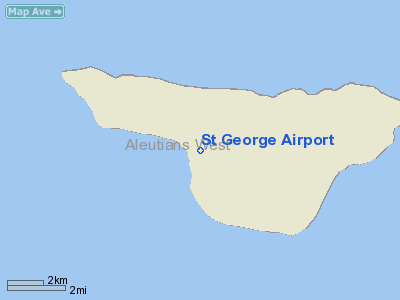
| St. George Airport |
| IATA: STG – ICAO: PAPB – FAA LID: PBV |
| Summary |
| Airport type |
Public |
| Owner |
Alaska DOT&PF - Central Region |
| Serves |
St. George, Alaska |
| Elevation AMSL |
125 ft / 38 m |
| Coordinates |
56°34′38″N 169°39′49″W / 56.57722°N 169.66361°W / 56.57722; -169.66361 |
| Runways |
| Direction |
Length |
Surface |
| ft |
m |
| 11/29 |
4,980 |
1,518 |
Asphalt |
| Statistics (2006) |
| Aircraft operations |
264 |
| Enplanements (2008) |
604 |
| Source: Federal Aviation Administration |
St. George Airport (IATA: STG, ICAO: PAPB, FAA LID: PBV) is a state-owned, public-use airport located four nautical miles (7 km) of the central business district of St. George, a city in the Aleutians West Census Area of the U.S. state of Alaska. Scheduled airline service to Anchorage International Airport is provided by Peninsula Airways (PenAir).
As per Federal Aviation Administration records, this airport had 604 commercial passenger boardings (enplanements) in calendar year 2008, a decrease of 5% from the 637 enplanements in 2007. St. George Airport is included in the FAA's National Plan of Integrated Airport Systems (2009-2013), which categorizes it as a general aviation facility. Airlines and destinations
Facilities and aircraft
St. George Airport covers an area of 278 acres (113 ha) at an elevation of 125 feet (38 m) above mean sea level. It has one runway designated 11/29 with an asphalt surface measuring 4,980 by 150 feet (1,518 x 46 m). For the 12-month period ending December 31, 2006, the airport had 264 aircraft operations, an average of 22 per month: 98.5% air taxi and 1.5% general aviation.
The above content comes from Wikipedia and is published under free licenses – click here to read more.
Location
& QuickFacts
|
FAA
Information Effective: |
2006-02-16 |
|
Airport
Identifier: |
PBV |
|
Longitude/Latitude: |
169-39-49.4500W/56-34-38.4700N
-169.663736/56.577353 (Estimated) |
|
Elevation: |
125 ft / 38.10 m (Surveyed) |
|
Land: |
278 acres |
|
From
nearest city: |
4 nautical miles SW of St George, AK |
|
Location: |
Bethel County, AK |
|
Magnetic Variation: |
11E (2000) |
Owner
& Manager
|
Ownership: |
Publicly owned |
|
Owner: |
St Of Ak Dot/pf-central Reg |
|
Address: |
Po Box 196900
Anchorage, AK 99519-6900 |
|
Phone
number: |
907-269-0747 |
|
Manager: |
Alvin Merculief |
|
Address: |
City Hall
St. George, AK 99591 |
|
Phone number: |
907-859-2269 |
Airport
Operations and Facilities
|
Airport
Use: |
Open to public |
|
Wind
indicator: |
Yes |
|
Segmented
Circle: |
Yes |
|
Control
Tower: |
No |
|
Attendance
Schedule: |
UNATNDD |
|
Lighting
Schedule: |
RDO-CTL
ACTVT ROTG BCN - 122.8. |
|
Beacon
Color: |
Clear-Green (lighted land airport) |
|
Sectional
chart: |
Kodiak |
|
Region: |
AAL - Alaska |
|
Boundary
ARTCC: |
ZAN - Anchorage |
|
Tie-in
FSS: |
ENA - Kenai |
|
FSS
Phone: |
800-478-3576 |
|
FSS
Toll Free: |
1-800-WX-BRIEF |
|
NOTAMs
Facility: |
PBV (NOTAM-d service avaliable) |
|
Federal Agreements: |
NGY |
Airport
Communications
|
Runway Information
Runway 11/29
|
Dimension: |
5000 x 150 ft / 1524.0 x 45.7 m |
|
Surface: |
GRAVEL, Fair Condition
NORTH SIDE OF RWY SOFT AT MID-FLD AFTER RAIN |
|
Edge
Lights: |
Medium |
|
|
Runway 11 |
Runway 29 |
|
Longitude: |
169-40-28.7600W |
169-39-10.1400W |
|
Latitude: |
56-34-50.1400N |
56-34-26.7900N |
|
Elevation: |
125.00 ft |
119.00 ft |
|
Alignment: |
118 |
127 |
|
ILS
Type: |
LOC/GS
|
|
|
Traffic
Pattern: |
Right |
Left |
|
VASI: |
4-light PAPI on left side |
|
|
Approach
lights: |
MALSF |
|
|
Runway
End Identifier: |
|
Yes |
|
Obstruction: |
60 ft gnd, 2040.0 ft from runway, 250 ft left
of centerline, 34:1 slope to clear |
30 ft ant, 1000.0 ft from runway, 250 ft left
of centerline, 33:1 slope to clear |
|
Radio Navigation
Aids
|
ID |
Type |
Name |
Ch |
Freq |
Var |
Dist |
|
EGY |
NDB |
English Bay |
|
374.00 |
13E |
38.5 nm |
|
SNP |
NDB |
Reeve |
|
362.00 |
13E |
39.1 nm |
|
SRI |
NDB/DME |
Pribilof |
096X |
399.00 |
11E |
0.6 nm |
|
SPY |
NDB/DME |
St Paul Island |
036X |
314.00 |
13E |
39.6 nm |
Remarks
- LARGE
CONCENTRATIONS OF SEABIRDS INVOF ARPT.
- PILOTS
ARE REQUESTED TO AVOID FLIGHTS BELOW 1000 FT AGL FROM MAY 1 THROUGH
OCT 31 IN THOSE AREAS OF ST. GEORGE ISLAND WITH ACTIVE BIRD POPULATIONS
AND COASTAL SEAL ROOKERIES.
- PILOTS
ARE REQUESTED TO SELF-ANNOUNCE ON CTAF PRIOR TO TAXIING ON RWY FOR DEPARTURE;
LEAVING THE RWY AND WITHIN 10 NM OF THE ARPT WHEN APPROACHING TO LAND.
Operational Statistics
|
Aircraft
Operations: |
28/Month |
|
Air Taxi: |
98.8% |
|
General
Aviation Itinerant: |
1.2% |
St George Airport
Address:
Bethel County, AK
Tel:
907-269-0747,
907-859-2269
Images
and information placed above are from
http://www.airport-data.com/airport/PBV/
We
thank them for the data!
| General
Info |
| Country |
United
States |
| State |
ALASKA
|
| FAA ID |
PBV
|
| Latitude |
56-34-38.470N
|
| Longitude |
169-39-49.450W
|
| Elevation |
125 feet
|
| Near City |
ST GEORGE
|
We don't guarantee the information is fresh and accurate. The data may
be wrong or outdated.
For more up-to-date information please refer to other sources.
|
|


