 |
|
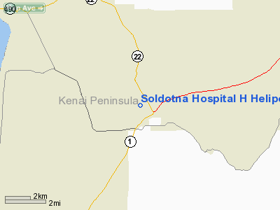
Soldotna Hospital Heliport |
|
|
Location
& QuickFacts
|
FAA
Information Effective: |
2006-02-16 |
|
Airport
Identifier: |
SD1 |
|
Longitude/Latitude: |
151-04-40.0060W/60-29-28.9440N
-151.077779/60.491373 (Estimated) |
|
Elevation: |
95 ft / 28.96 m (Estimated) |
|
Land: |
0 acres |
|
From
nearest city: |
1 nautical miles NW of Soldotna, AK |
|
Location: |
Kenai-cook Inlet County, AK |
|
Magnetic Variation: |
24E (1985) |
Owner
& Manager
|
Ownership: |
Privately owned |
|
Owner: |
Central Peninsula Gen Hos |
|
Address: |
Box 1268
Soldotna, AK 99669 |
|
Address: |
|
Airport
Operations and Facilities
|
Airport
Use: |
Open to public |
|
Wind
indicator: |
Yes |
|
Segmented
Circle: |
No |
|
Control
Tower: |
No |
|
Attendance
Schedule: |
ALL/ALL/ALL |
|
Landing
fee charge: |
No |
|
Sectional
chart: |
Anchorage |
|
Region: |
AAL - Alaska |
|
Boundary
ARTCC: |
ZAN - Anchorage |
|
Tie-in
FSS: |
ENA - Kenai |
|
FSS
on Airport: |
No |
|
FSS
Phone: |
800-478-3576 |
|
FSS
Toll Free: |
1-800-WX-BRIEF |
|
NOTAMs
Facility: |
SXQ (NOTAM-d service avaliable) |
Airport
Communications
Airport
Services
|
Airframe
Repair: |
NONE |
|
Power
Plant Repair: |
NONE |
|
Bottled
Oxygen: |
NONE |
|
Bulk
Oxygen: |
NONE |
|
Runway Information
Helipad H1
|
Dimension: |
80 x 48 ft / 24.4 x 14.6 m |
|
Surface: |
ASPH, |
|
|
Runway H1 |
Runway |
|
Elevation: |
95.00 ft |
0.00 ft |
|
Traffic
Pattern: |
Left |
Left |
|
Markings: |
Basic, |
, |
|
Runway
End Identifier: |
No |
|
|
Centerline
Lights: |
No |
|
|
Touchdown
Lights: |
No |
|
|
Radio Navigation
Aids
|
ID |
Type |
Name |
Ch |
Freq |
Var |
Dist |
|
IWW |
NDB |
Wildwood |
|
379.00 |
20E |
7.6 nm |
|
GRP |
NDB |
Granite Point |
|
356.00 |
24E |
29.2 nm |
|
DRF |
NDB |
Drift River |
|
368.00 |
24E |
32.1 nm |
|
BOB |
NDB |
Bruck |
|
387.00 |
21E |
48.5 nm |
|
OLT |
NDB/DME |
Soldotna |
106X |
346.00 |
24E |
6.0 nm |
|
ENA |
VOR/DME |
Kenai |
123X |
117.60 |
25E |
8.2 nm |
|
ANC |
VOR/DME |
Anchorage |
090X |
114.30 |
25E |
47.1 nm |
|
HOM |
VOR/DME |
Homer |
093X |
114.60 |
24E |
48.4 nm |
Remarks
- NO
OPRNS OVR HOSPITAL; UNMKD PLINE N & POLE NNW OF LNDG AREA.
Operational Statistics
|
Aircraft
Operations: |
10/Month |
|
Air Taxi: |
9.1% |
|
General
Aviation Itinerant: |
90.9% |
Soldotna Hospital H Heliport
Address:
Kenai-cook Inlet County, AK
Tel:
Images
and information placed above are from
http://www.airport-data.com/airport/SD1/
We
thank them for the data!
| General
Info |
| Country |
United
States |
| State |
ALASKA
|
| FAA ID |
SD1
|
| Latitude |
60-29-28.944N
|
| Longitude |
151-04-40.006W
|
| Elevation |
95 feet
|
| Near City |
SOLDOTNA
|
We don't guarantee the information is fresh and accurate. The data may
be wrong or outdated.
For more up-to-date information please refer to other sources.
|
|


