 |
|
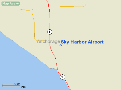
Location
& QuickFacts
|
FAA
Information Effective: |
2006-02-16 |
|
Airport
Identifier: |
9AK5 |
|
Longitude/Latitude: |
149-49-07.5700W/61-06-59.3300N
-149.818769/61.116481 (Estimated) |
|
Elevation: |
340 ft / 103.63 m (Estimated) |
|
Land: |
0 acres |
|
From
nearest city: |
7 nautical miles SE of Anchorage, AK |
|
Location: |
Anchorage County, AK |
|
Magnetic Variation: |
25E (1985) |
Owner
& Manager
|
Ownership: |
Privately owned |
|
Owner: |
Sky Hbr Prpty Owner Assoc
APPROXIMATELY 16 OWNERS. |
|
Address: |
11600 Cange Road
Anchorage, AK 99516 |
|
Address: |
|
Airport
Operations and Facilities
|
Airport Use: |
Private |
|
Wind indicator: |
Yes |
|
Segmented Circle: |
No |
|
Control Tower: |
No |
|
Attendance Schedule: |
UNATNDD |
|
Landing fee charge: |
No |
|
Sectional chart: |
Anchorage |
|
Region: |
AAL - Alaska |
|
Boundary ARTCC: |
ZAN - Anchorage |
|
Tie-in FSS: |
ENA - Kenai |
|
FSS on Airport: |
No |
|
FSS Phone: |
800-478-3576 |
|
FSS Toll Free: |
1-800-WX-BRIEF |
Airport
Services
|
Airframe
Repair: |
NONE |
|
Power
Plant Repair: |
NONE |
|
Bottled
Oxygen: |
NONE |
|
Bulk
Oxygen: |
NONE |
|
Runway Information
Runway 16/34
|
Dimension: |
1800 x 70 ft / 548.6 x 21.3 m |
|
Surface: |
GRAVEL, |
|
|
Runway 16 |
Runway 34 |
|
Traffic
Pattern: |
Left |
Left |
|
Markings: |
None, |
None, |
|
Runway
End Identifier: |
No |
No |
|
Centerline
Lights: |
No |
No |
|
Touchdown
Lights: |
No |
No |
|
Radio Navigation
Aids
|
ID |
Type |
Name |
Ch |
Freq |
Var |
Dist |
|
CMQ |
NDB |
Campbell Lake |
|
338.00 |
21E |
7.4 nm |
|
BOB |
NDB |
Bruck |
|
387.00 |
21E |
10.8 nm |
|
GRP |
NDB |
Granite Point |
|
356.00 |
24E |
45.1 nm |
|
OLT |
NDB/DME |
Soldotna |
106X |
346.00 |
24E |
49.5 nm |
|
EDF |
TACAN |
Elmendorf |
081X |
|
21E |
8.4 nm |
|
ANC |
VOR/DME |
Anchorage |
090X |
114.30 |
25E |
11.4 nm |
|
BGQ |
VORTAC |
Big Lake |
072X |
112.50 |
25E |
27.6 nm |
|
MRI |
VOT |
Merrill |
|
111.00 |
|
5.9 nm |
|
ANC |
VOT |
Anchorage |
|
108.40 |
|
6.0 nm |
Based Aircraft
|
Aircraft
based on field: |
50 |
|
Single
Engine Airplanes: |
50 |
Operational Statistics
|
Aircraft
Operations: |
125/Week |
|
General
Aviation Local: |
76.9% |
|
General
Aviation Itinerant: |
23.1% |
Sky Harbor Airport
Address:
Anchorage County, AK
Tel:
Images
and information placed above are from
http://www.airport-data.com/airport/9AK5/
We
thank them for the data!
| General
Info |
| Country |
United
States |
| State |
ALASKA
|
| FAA ID |
9AK5
|
| Latitude |
61-06-59.330N
|
| Longitude |
149-49-07.570W
|
| Elevation |
340 feet
|
| Near City |
ANCHORAGE
|
We don't guarantee the information is fresh and accurate. The data may
be wrong or outdated.
For more up-to-date information please refer to other sources.
|
|


