 |
|
|
|
|
|
Location
& QuickFacts
|
FAA
Information Effective: |
2006-02-16 |
|
Airport
Identifier: |
SKW |
|
Longitude/Latitude: |
151-11-28.9180W/61-57-55.0620N
-151.191366/61.965295 (Estimated) |
|
Elevation: |
148 ft / 45.11 m (Estimated) |
|
Land: |
130 acres |
|
From
nearest city: |
0 nautical miles NW of Skwentna, AK |
|
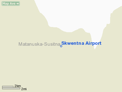
Location: |
Mata-sus Borough County, AK |
|
Magnetic Variation: |
25E (1985) |
Owner
& Manager
|
Ownership: |
Publicly owned |
|
Owner: |
State Of Ak Dotpf Cen Rgn |
|
Address: |
P.o. Box 196900
Anchorage, AK 99519-6900 |
|
Phone
number: |
907-269-0782 |
|
Manager: |
Kurt Devon |
|
Address: |
289 Inner Spring Loop
Palmer, AK 99645 |
|
Phone number: |
907-269-0782 |
Airport
Operations and Facilities
|
Airport
Use: |
Open to public |
|
Wind
indicator: |
Yes |
|
Segmented
Circle: |
Yes |
|
Control
Tower: |
No |
|
Attendance
Schedule: |
UNATNDD |
|
Lighting
Schedule: |
RDO-CTL
ACTVT ROTATING BEACON - CTAF. |
|
Beacon
Color: |
Clear-Green (lighted land airport) |
|
Landing
fee charge: |
No |
|
Sectional
chart: |
Anchorage |
|
Region: |
AAL - Alaska |
|
Boundary
ARTCC: |
ZAN - Anchorage |
|
Tie-in
FSS: |
ENA - Kenai |
|
FSS
on Airport: |
No |
|
FSS
Phone: |
800-478-3576 |
|
FSS
Toll Free: |
1-800-WX-BRIEF |
|
NOTAMs
Facility: |
SKW (NOTAM-d service avaliable) |
|
Federal Agreements: |
NGY |
Airport
Communications
Airport
Services
|
Fuel
available: |
100LL
FUEL AVBL FROM SKWENTNA ROAD HOUSE IN FIVE GALLON CANS ONLY. |
|
Airframe
Repair: |
NONE |
|
Power
Plant Repair: |
NONE |
|
Bottled
Oxygen: |
NONE |
|
Bulk
Oxygen: |
NONE |
|
Runway Information
Runway 09/27
|
Dimension: |
3400 x 75 ft / 1036.3 x 22.9 m |
|
Surface: |
GRAVEL, Good Condition |
|
Edge
Lights: |
Medium |
|
|
Runway 09 |
Runway 27 |
|
Traffic
Pattern: |
Left |
Left |
|
Obstruction: |
42 ft trees, 930.0 ft from runway, 22:1 slope
to clear |
68 ft trees, 1050.0 ft from runway, 16:1 slope
to clear |
|
Radio Navigation
Aids
|
ID |
Type |
Name |
Ch |
Freq |
Var |
Dist |
|
PEE |
NDB |
Peters Creek |
|
305.00 |
26E |
37.8 nm |
|
TKA |
VOR/DME |
Talkeetna |
109X |
116.20 |
26E |
36.5 nm |
|
BGQ |
VORTAC |
Big Lake |
072X |
112.50 |
25E |
42.2 nm |
Remarks
- SOFT
DURG SPRING THAW; SKI STRIP WEST OFF WEST THR; TWO 100' TWRS 1.5 NM
W.
- RY
CONDITION UNMONITORED. RECOMMEND VISUAL INSPECTION PRIOR TO LANDING.
Based Aircraft
|
Aircraft
based on field: |
3 |
|
Single
Engine Airplanes: |
3 |
Operational Statistics
|
Aircraft
Operations: |
71/Week |
|
Air Taxi: |
27.4% |
|
General
Aviation Local: |
4.1% |
|
General
Aviation Itinerant: |
68.5% |
Skwentna Airport
Address:
Mata-sus Borough County, AK
Tel:
907-269-0782
Images
and information placed above are from
http://www.airport-data.com/airport/SKW/
We
thank them for the data!
| General
Info |
| Country |
United
States |
| State |
ALASKA
|
| FAA ID |
SKW
|
| Latitude |
61-57-55.062N
|
| Longitude |
151-11-28.918W
|
| Elevation |
148 feet
|
| Near City |
SKWENTNA
|
We don't guarantee the information is fresh and accurate. The data may
be wrong or outdated.
For more up-to-date information please refer to other sources.
|
|


