 |
|
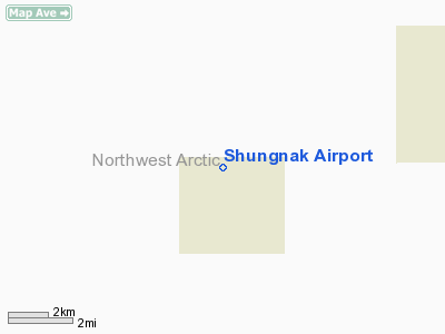
| Shungnak Airport |
| IATA: SHG – ICAO: PAGH – FAA LID: SHG |
| Summary |
| Airport type |
Public |
| Owner |
State of Alaska DOT&PF |
| Serves |
Shungnak, Alaska |
| Elevation AMSL |
197 ft / 60 m |
| Coordinates |
66°53′17″N 157°09′45″W / 66.88806°N 157.1625°W / 66.88806; -157.1625 |
| Runways |
| Direction |
Length |
Surface |
| ft |
m |
| 9/27 |
4,000 |
1,219 |
Gravel |
| Source: Federal Aviation Administration |
Shungnak Airport (IATA: SHG, ICAO: PAGH, FAA LID: SHG) is a state-owned public-use airport located in Shungnak, a city in the Northwest Arctic of the U.S. state of Alaska. Facilities
Shungnak Airport has one runway designated 9/27 with a 4,000 x 60 ft (1,219 x 18 m) gravel surface.
Airlines and non-stop destinations
- Bering Air (Ambler, Kobuk, Kotzebue)
The above content comes from Wikipedia and is published under free licenses – click here to read more.
Location
& QuickFacts
|
FAA
Information Effective: |
2006-02-16 |
|
Airport
Identifier: |
SHG |
|
Longitude/Latitude: |
157-09-44.6450W/66-53-17.0760N
-157.162401/66.888077 (Estimated) |
|
Elevation: |
197 ft / 60.05 m (Estimated) |
|
Land: |
0 acres |
|
From
nearest city: |
0 nautical miles NW of Shungnak, AK |
|
Location: |
Kobuk County, AK |
|
Magnetic Variation: |
19E (2005) |
Owner
& Manager
|
Ownership: |
Publicly owned |
|
Owner: |
State Of Ak Dotpf |
|
Address: |
2301 Peger Road
Fairbanks, AK 99709 |
|
Phone number: |
907-451-2200 |
|
Manager: |
Kenny Gallahorn |
|
Address: |
Box 55
Kotzebue, AK 99752 |
|
Phone number: |
907-442-3147 |
Airport
Operations and Facilities
|
Airport
Use: |
Open to public |
|
Wind
indicator: |
Yes |
|
Segmented
Circle: |
Yes |
|
Control
Tower: |
No |
|
Attendance
Schedule: |
UNATNDD |
|
Lighting
Schedule: |
DUSK-DAWN
ACTVT MIRL RY 09/27 & PAPI RY 09 - CTAF. |
|
Beacon
Color: |
Clear-Green (lighted land airport) |
|
Landing
fee charge: |
No |
|
Sectional
chart: |
Fairbanks |
|
Region: |
AAL - Alaska |
|
Boundary
ARTCC: |
ZAN - Anchorage |
|
Tie-in
FSS: |
OTZ - Kotzebue |
|
FSS
on Airport: |
No |
|
FSS
Phone: |
907-442-3310 |
|
FSS
Toll Free: |
1-478-7460 |
|
Alternate
FSS: |
FAI - Fairbanks |
|
Alt.
FSS Toll Free: |
1-866-248-6516 |
|
NOTAMs
Facility: |
OTZ (NOTAM-d service avaliable) |
|
Federal Agreements: |
N |
Airport
Communications
Airport
Services
|
Airframe
Repair: |
NONE |
|
Power
Plant Repair: |
NONE |
|
Bottled
Oxygen: |
NONE |
|
Bulk
Oxygen: |
NONE |
|
Runway Information
Runway 09/27
|
Dimension: |
4000 x 60 ft / 1219.2 x 18.3 m |
|
Surface: |
GRVL, Good Condition
HAS SOFT SPOTS. |
|
Edge
Lights: |
Medium |
|
|
Runway 09 |
Runway 27 |
|
Longitude: |
157-10-29.4420W |
157-08-59.8470W |
|
Latitude: |
66-53-25.8780N |
66-53-08.2730N |
|
Elevation: |
166.00 ft |
197.00 ft |
|
Alignment: |
117 |
127 |
|
Traffic
Pattern: |
Left |
Left |
|
Crossing
Height: |
35.00 ft |
0.00 ft |
|
VASI: |
4-light PAPI on right side |
|
|
Visual
Glide Angle: |
3.00� |
0.00� |
|
Runway
End Identifier: |
No |
No |
|
Centerline
Lights: |
No |
No |
|
Touchdown
Lights: |
No |
No |
|
Radio Navigation
Aids
|
ID |
Type |
Name |
Ch |
Freq |
Var |
Dist |
|
AMF |
NDB/DME |
Ambler |
108X |
403.00 |
23E |
21.0 nm |
Remarks
- HEAVY
EQUIPMENT PARKED ON RAMP.
- RY
CONDITION NOT MONITORED; RECOMMEND VISUAL INSPECTION PRIOR TO LANDING.
Shungnak Airport
Address:
Kobuk County, AK
Tel:
907-451-2200, 907-442-3147
Images
and information placed above are from
http://www.airport-data.com/airport/SHG/
We
thank them for the data!
| General
Info |
| Country |
United
States |
| State |
ALASKA
|
| FAA ID |
SHG
|
| Latitude |
66-53-17.076N
|
| Longitude |
157-09-44.645W
|
| Elevation |
197 feet
|
| Near City |
SHUNGNAK
|
We don't guarantee the information is fresh and accurate. The data may
be wrong or outdated.
For more up-to-date information please refer to other sources.
|
|


