 |
|
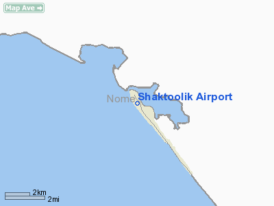
| Shaktoolik Airport |
| IATA: SKK – ICAO: PFSH – FAA LID: 2C7 |
| Summary |
| Airport type |
Public |
| Owner |
State of Alaska DOT&PF |
| Serves |
Shaktoolik, Alaska |
| Elevation AMSL |
24 ft / 7 m |
| Coordinates |
64°22′16″N 161°13′26″W / 64.37111°N 161.22389°W / 64.37111; -161.22389 |
| Runways |
| Direction |
Length |
Surface |
| ft |
m |
| 14/32 |
4,001 |
1,220 |
Gravel |
| Source: Federal Aviation Administration |
Shaktoolik Airport (IATA: SKK, ICAO: PFSH, FAA LID: 2C7) is a state-owned public-use airport located one nautical mile (1.8 km) northwest of the central business district of Shaktoolik, a city in the Nome Census Area of the U.S. state of Alaska. Facilities
Shaktoolik Airport covers an area of 156 acres (63 ha) at an elevation of 24 feet (7 m) above mean sea level. It has one runway designated 14/32 with a 4,001 x 75 ft (1,220 x 23 m) gravel surface.
Airlines and non-stop destinations
- Bering Air (Elim, Golowin, Koyuk, Nome, Unalakleet, White Mountain)
The above content comes from Wikipedia and is published under free licenses – click here to read more.
Location
& QuickFacts
|
FAA
Information Effective: |
2006-02-16 |
|
Airport
Identifier: |
2C7 |
|
Longitude/Latitude: |
161-13-26.0000W/64-22-16.0000N
-161.223889/64.371111 (Estimated) |
|
Elevation: |
21 ft / 6.40 m (Estimated) |
|
Land: |
156 acres |
|
From
nearest city: |
1 nautical miles NW of Shaktoolik, AK |
|
Location: |
Nome County, AK |
|
Magnetic Variation: |
17E (2000) |
Owner
& Manager
|
Ownership: |
Publicly owned |
|
Owner: |
St. Of Alaska Dotpf |
|
Address: |
2301 Peger Rd.
Fairbanks, AK 99701 |
|
Phone number: |
907-452-1911 |
|
Manager: |
Harry Johnson |
|
Address: |
Box 192
Unalakleet, AK 99684 |
|
Phone number: |
907-624-3261 |
Airport
Operations and Facilities
|
Airport
Use: |
Open to public |
|
Wind
indicator: |
Yes |
|
Segmented
Circle: |
Yes |
|
Control
Tower: |
No |
|
Attendance
Schedule: |
UNATNDD |
|
Lighting
Schedule: |
DUSK-DAWN
ACTVT MIRL RY 14/32, PAPI RY 32 & REIL RY 32 - CTAF. |
|
Beacon
Color: |
Clear-Green (lighted land airport) |
|
Sectional chart: |
Nome |
|
Region: |
AAL - Alaska |
|
Boundary ARTCC: |
ZAN - Anchorage |
|
Tie-in FSS: |
OME - Nome |
|
FSS Phone: |
LC 443-2291 |
|
FSS Toll Free: |
1-800-478-8400 |
|
Alternate FSS: |
FAI - Fairbanks |
|
Alt. FSS Toll Free: |
1-866-248-6516 |
|
NOTAMs Facility: |
OME |
Airport
Communications
|
CTAF: |
122.800 |
|
Unicom: |
122.800 |
|
Runway Information
Runway 14/32
|
Dimension: |
4000 x 75 ft / 1219.2 x 22.9 m |
|
Surface: |
GRVL, Good Condition |
|
Edge
Lights: |
Medium |
|
|
Runway 14 |
Runway 32 |
|
Traffic
Pattern: |
Left |
Left |
|
Crossing
Height: |
0.00 ft |
25.00 ft |
|
VASI: |
|
4-light PAPI on left side |
|
Visual
Glide Angle: |
0.00� |
3.00� |
|
Runway
End Identifier: |
No |
Yes |
|
Radio Navigation
Aids
|
ID |
Type |
Name |
Ch |
Freq |
Var |
Dist |
|
OAY |
NDB |
Norton Bay |
|
263.00 |
19E |
29.2 nm |
|
JNR |
NDB |
North River |
|
382.00 |
20E |
29.9 nm |
|
KKA |
NDB/DME |
Koyuk |
083X |
299.00 |
16E |
33.8 nm |
|
MOS |
VOR/DME |
Moses Point |
110X |
116.30 |
19E |
29.4 nm |
|
UNK |
VOR/DME |
Unalakleet |
116X |
116.90 |
20E |
32.1 nm |
Remarks
- RY
CONDITION NOT MONITORED RECOMMEND VISUAL INSPECTION PRIOR TO LANDING.
Shaktoolik Airport
Address:
Nome County, AK
Tel:
907-452-1911, 907-624-3261
Images
and information placed above are from
http://www.airport-data.com/airport/2C7/
We
thank them for the data!
| General
Info |
| Country |
United
States |
| State |
ALASKA
|
| FAA ID |
2C7
|
| Latitude |
64-22-16.000N
|
| Longitude |
161-13-26.000W
|
| Elevation |
21 feet
|
| Near City |
SHAKTOOLIK
|
We don't guarantee the information is fresh and accurate. The data may
be wrong or outdated.
For more up-to-date information please refer to other sources.
|
|


