 |
|
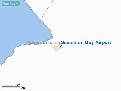
| Scammon Bay Airport |
| IATA: SCM – ICAO: PACM – FAA LID: SCM |
| Summary |
| Airport type |
Public |
| Owner |
Alaska DOT&PF - Central Region |
| Serves |
Scammon Bay, Alaska |
| Elevation AMSL |
14 ft / 4 m |
| Coordinates |
61°50′43″N 165°34′17″W / 61.84528°N 165.57139°W / 61.84528; -165.57139 |
| Runways |
| Direction |
Length |
Surface |
| ft |
m |
| 10/28 |
3,000 |
914 |
Gravel |
| 4W/22W |
10,000 |
3,048 |
Water |
| Source: Federal Aviation Administration |
Scammon Bay Airport (IATA: SCM, ICAO: PACM, FAA LID: SCM) is a state-owned public-use airport located in Scammon Bay, a city in the Wade Hampton Census Area of the U.S. state of Alaska. Facilities
Scammon Bay Airport covers an area of 103 acres (42 ha) at an elevation of 14 feet (4 m) above mean sea level. It has one runways designated 10/28 with a 3,000 by 75 feet (914 x 23 m) gravel surface, and one seaplane landing area designated 4W/22W which measures 10,000 by 500 feet (3,048 x 152 m).
Airlines
- Hageland Aviation Services
The above content comes from Wikipedia and is published under free licenses – click here to read more.
Location
& QuickFacts
|
FAA
Information Effective: |
2006-02-16 |
|
Airport
Identifier: |
SCM |
|
Longitude/Latitude: |
165-34-16.7000W/61-50-43.2000N
-165.571306/61.845333 (Estimated) |
|
Elevation: |
14 ft / 4.27 m (Surveyed) |
|
Land: |
103 acres |
|
From
nearest city: |
0 nautical miles N of Scammon Bay, AK |
|
Location: |
Wade Hampton County, AK |
|
Magnetic Variation: |
16E (1985) |
Owner
& Manager
|
Ownership: |
Publicly owned |
|
Owner: |
State Of Ak Dot/pf Cent Reg |
|
Address: |
Po Box 196900
Anchorage, AK 99519-6900 |
|
Phone
number: |
907-266-1735 |
|
Manager: |
L.j. Davis |
|
Address: |
Po Box 505
Bethel, AK 99559 |
|
Phone
number: |
907-543-2495 |
Airport
Operations and Facilities
|
Airport
Use: |
Open to public |
|
Wind
indicator: |
Yes
WINDSOCK LIGHTS OTS. WINDSOCK MAY BE UNRELIABLE. |
|
Segmented
Circle: |
Yes |
|
Control
Tower: |
No |
|
Attendance
Schedule: |
UNATNDD |
|
Lighting
Schedule: |
RDO-CTL
ACTVT MIRL RY 10/28 & ROTG BCN - CTAF. |
|
Beacon
Color: |
Clear-Green (lighted land airport) |
|
Landing
fee charge: |
No |
|
Sectional
chart: |
Bethel |
|
Region: |
AAL - Alaska |
|
Boundary
ARTCC: |
ZAN - Anchorage |
|
Tie-in
FSS: |
ENA - Kenai |
|
FSS
on Airport: |
No |
|
FSS
Phone: |
800-478-3576 |
|
FSS
Toll Free: |
1-800-WX-BRIEF |
|
NOTAMs
Facility: |
PACZ (NOTAM-d service avaliable) |
|
Federal Agreements: |
NGY |
Airport
Communications
|
CTAF: |
123.000 |
|
Unicom: |
123.000 |
Airport
Services
|
Airframe
Repair: |
NONE |
|
Power
Plant Repair: |
NONE |
|
Bottled
Oxygen: |
NONE |
|
Bulk
Oxygen: |
NONE |
|
Runway Information
Runway 04W/22W
|
Dimension: |
10000 x 500 ft / 3048.0 x 152.4 m |
|
Surface: |
WATER,
ROAD CROSSES RWY TO RIVER; RWY SOFT DURG SPRING BREAKUP - AFTER
RAINS & DRG EXTREME HIGH TIDES. |
|
|
Runway 04W |
Runway 22W |
|
Traffic
Pattern: |
Left |
Left |
|
Runway 10/28
|
Dimension: |
3000 x 75 ft / 914.4 x 22.9 m |
|
Surface: |
GRVL, Good Condition
ROAD CROSSES RWY TO RIVER; RWY SOFT DURG SPRING BREAKUP - AFTER
RAINS & DRG EXTREME HIGH TIDES. |
|
Edge
Lights: |
Medium |
|
|
Runway 10 |
Runway 28 |
|
Longitude: |
165-34-54.1750W |
165-33-56.8200W |
|
Latitude: |
61-50-46.2230N |
61-50-34.4730N |
|
Elevation: |
9.00 ft |
14.00 ft |
|
Alignment: |
113 |
127 |
|
Traffic
Pattern: |
Left |
Left |
|
Radio Navigation
Aids
|
ID |
Type |
Name |
Ch |
Freq |
Var |
Dist |
|
CZF |
NDB/DME |
Cape Romanzof |
114Y |
275.00 |
16E |
11.8 nm |
|
HPB |
VOR/DME |
Hooper Bay |
099X |
115.20 |
16E |
25.6 nm |
Remarks
- CAUTION:
RWY CONDITION NOT MONITORED; RECOMMEND VISUAL INSPECTION PRIOR TO USING.
- BIRDS
ON RY.
- RY
10 HAS SMALL HOLES APPROXIMATELY 325 FT FM THLD & 23 FT R OF CNTRLN.
- WX
CAMERA AVBL ON INTERNET AT HTTP://AKWEATHERCAMS.FAA.GOV
- SPB
ASP: ESTABD PRIOR TO 1959.
Scammon Bay Airport
Address:
Wade Hampton County, AK
Tel:
907-266-1735, 907-543-2495
Images
and information placed above are from
http://www.airport-data.com/airport/SCM/
We
thank them for the data!
| General
Info |
| Country |
United
States |
| State |
ALASKA
|
| FAA ID |
SCM
|
| Latitude |
61-50-40.348N
|
| Longitude |
165-34-25.497W
|
| Elevation |
14 feet
|
| Near City |
SCAMMON
BAY |
We don't guarantee the information is fresh and accurate. The data may
be wrong or outdated.
For more up-to-date information please refer to other sources.
|
|


