 |
|
|
|
|
|
Location
& QuickFacts
|
FAA
Information Effective: |
2006-02-16 |
|
Airport
Identifier: |
Z81 |
|
Longitude/Latitude: |
165-00-45.4590W/64-54-33.2920N
-165.012628/64.909248 (Estimated) |
|
Elevation: |
490 ft / 149.35 m (Estimated) |
|
Land: |
0 acres |
|
From
nearest city: |
0 nautical miles NW of Salmon Lake, AK |
|
Location: |
Nome County, AK |
|
Magnetic Variation: |
17E (1985) |
Owner
& Manager
|
Ownership: |
Publicly owned |
|
Owner: |
State Of Alaska Dotpf |
|
Address: |
2301 Peger Rd
Fairbanks, AK 99709 |
|
Phone
number: |
907-451-2200 |
|
Manager: |
Jerry Oliver |
|
Address: |
Box 1048
Nome, AK 99762 |
|
Phone number: |
443-3431 |
Airport
Operations and Facilities
|
Airport
Use: |
Open to public |
|
Wind
indicator: |
Yes |
|
Segmented
Circle: |
No |
|
Control
Tower: |
No |
|
Attendance
Schedule: |
UNATNDD |
|
Landing
fee charge: |
No |
|
Sectional
chart: |
Nome |
|
Region: |
AAL - Alaska |
|
Boundary
ARTCC: |
ZAN - Anchorage |
|
Tie-in
FSS: |
OME - Nome |
|
FSS
on Airport: |
No |
|
FSS
Phone: |
LC 443-2291 |
|
FSS
Toll Free: |
1-800-478-8400 |
|
Alternate
FSS: |
FAI - Fairbanks |
|
Alt.
FSS Toll Free: |
1-866-248-6516 |
|
NOTAMs
Facility: |
OME (NOTAM-d service avaliable) |
Airport
Communications
Airport
Services
|
Airframe
Repair: |
NONE |
|
Power
Plant Repair: |
NONE |
|
Bottled
Oxygen: |
NONE |
|
Bulk
Oxygen: |
NONE |
|
Runway Information
Runway 15/33
|
Dimension: |
1860 x 55 ft / 566.9 x 16.8 m |
|
Surface: |
GRAVEL, Poor Condition
RY EDGES AND SHOULDERS SOFT WITH WET ROCKS TO 6 IN.
HAS NUMEROUS SOFT AREAS & RUTS WHEN WET. NUMEROUS RUTS NORTH
END RY IRREGULAR LOOSE ROCKS TO 4 IN. |
|
|
Runway 15 |
Runway 33 |
|
Traffic
Pattern: |
Left |
Left |
|
Obstruction: |
640 ft hill, 3960.0 ft from runway, 500 ft
left of centerline, 6:1 slope to clear |
, 50:1 slope to clear |
|
Radio Navigation
Aids
|
ID |
Type |
Name |
Ch |
Freq |
Var |
Dist |
|
FDV |
NDB |
Fort Davis |
|
529.00 |
14E |
26.1 nm |
|
OYN |
NDB/DME |
Gold |
085X |
208.00 |
14E |
26.2 nm |
|
OME |
VOR/DME |
Nome |
097X |
115.00 |
17E |
26.2 nm |
Remarks
- END
RWY 33 ROCKY.
- RY
NOT MAINTAINED & CONDITION NOT MONITORED, RECOMMEND VISUAL INSPECTION
PRIOR TO LANDING.
- STEEL
FRAME LAYING ON EDGE OF RY NE END.
- RY
USED AS A ROAD.
- HIGH
TERRAIN ALL QUADRANTS.
- 6
IN HIGH ROCK BERM ALONG EDGES OF RY WITH SCATTERED ROCKS TO 18 IN.
- NO
MAINTENANCE.
- ESTABD
PRIOR TO 1959.
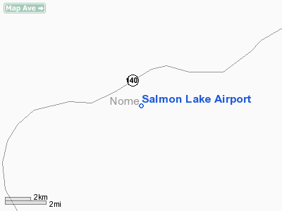
Salmon Lake Airport
Address:
Nome County, AK
Tel:
907-451-2200, 907-443-3431
Images
and information placed above are from
http://www.airport-data.com/airport/Z81/
We
thank them for the data!
| General
Info |
| Country |
United
States |
| State |
ALASKA
|
| FAA ID |
Z81
|
| Latitude |
64-54-33.292N
|
| Longitude |
165-00-45.459W
|
| Elevation |
490 feet
|
| Near City |
SALMON
LAKE |
We don't guarantee the information is fresh and accurate. The data may
be wrong or outdated.
For more up-to-date information please refer to other sources.
|
|


