 |
|
|
|
|
|
Location
& QuickFacts
|
FAA
Information Effective: |
2006-02-16 |
|
Airport
Identifier: |
A23 |
|
Longitude/Latitude: |
134-09-30.1960W/56-53-10.7960N
-134.158388/56.886332 (Estimated) |
|
Elevation: |
0 ft / 0.00 m (Estimated) |
|
Land: |
0 acres |
|
From
nearest city: |
0 nautical miles NE of Saginaw Bay, AK |
|
Location: |
Wrangell-petersburg County, AK |
|
Magnetic Variation: |
27E (1985) |
Owner
& Manager
|
Ownership: |
Privately owned |
|
Owner: |
M Hammer |
|
Address: |
Saginaw Bay, AK |
|
Manager: |
M Hammer |
|
Address: |
Saginaw Bay, AK |
Airport
Operations and Facilities
|
Airport
Use: |
Open to public |
|
Wind
indicator: |
No |
|
Segmented
Circle: |
No |
|
Control
Tower: |
No |
|
Attendance
Schedule: |
UNATNDD |
|
Landing
fee charge: |
No |
|
Sectional
chart: |
Juneau |
|
Region: |
AAL - Alaska |
|
Boundary
ARTCC: |
ZAN - Anchorage |
|
Tie-in
FSS: |
SIT - Sitka |
|
FSS
on Airport: |
No |
|
FSS
Phone: |
907-966-2221 |
|
FSS
Toll Free: |
1-478-6300 |
|
Alternate
FSS: |
JNU - Juneau |
|
Alt.
FSS Toll Free: |
1-800-WX-BRIEF |
|
NOTAMs
Facility: |
SIT (NOTAM-d service avaliable) |
Airport
Communications
Airport
Services
|
Airframe
Repair: |
NONE |
|
Power
Plant Repair: |
NONE |
|
Bottled
Oxygen: |
NONE |
|
Bulk
Oxygen: |
NONE |
|
Runway
Information
Runway NW/SE
|
Dimension: |
10000 x 1000 ft / 3048.0 x 304.8 m |
|
Surface: |
WATER, |
|
|
Runway NW |
Runway SE |
|
Traffic
Pattern: |
Left |
Left |
|
Markings: |
None, |
None, |
|
Runway
End Identifier: |
No |
No |
|
Centerline
Lights: |
No |
No |
|
Touchdown
Lights: |
No |
No |
|
Radio Navigation
Aids
|
ID |
Type |
Name |
Ch |
Freq |
Var |
Dist |
|
IME |
NDB |
Mount Edgecumbe |
|
414.00 |
28E |
40.7 nm |
|
SQM |
NDB |
Sumner Strait |
|
529.00 |
28E |
43.2 nm |
|
FPN |
NDB |
Fredericks Point |
|
372.00 |
28E |
44.3 nm |
|
SIT |
NDB |
Sitka |
|
358.00 |
28E |
45.2 nm |
|
AFE |
NDB/DME |
Kake |
091X |
223.00 |
26E |
9.3 nm |
|
LVD |
VOR/DME |
Level Island |
112X |
116.50 |
28E |
43.5 nm |
|
BKA |
VORTAC |
Biorka Island |
085X |
113.80 |
28E |
45.8 nm |
Remarks
- ROCKS
& SHALLOW WATER NEAR SHORE SE OF FLOAT.
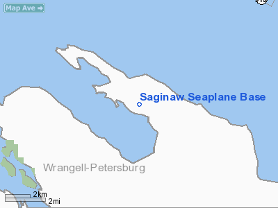
Saginaw Seaplane Base
Address:
Wrangell-petersburg County, AK
Tel:
Images
and information placed above are from
http://www.airport-data.com/airport/A23/
We
thank them for the data!
| General
Info |
| Country |
United
States |
| State |
ALASKA
|
| FAA ID |
A23
|
| Latitude |
56-53-10.796N
|
| Longitude |
134-09-30.196W
|
| Elevation |
0 feet
|
| Near City |
SAGINAW
BAY |
We don't guarantee the information is fresh and accurate. The data may
be wrong or outdated.
For more up-to-date information please refer to other sources.
|
|


