 |
|
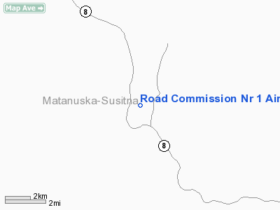
Road Commission Nr 1 Airport |
Location
& QuickFacts
|
FAA
Information Effective: |
2006-02-16 |
|
Airport
Identifier: |
0Z2 |
|
Longitude/Latitude: |
147-31-55.1250W/63-06-29.3770N
-147.531979/63.108160 (Estimated) |
|
Elevation: |
2525 ft / 769.62 m (Estimated) |
|
Land: |
0 acres |
|
From
nearest city: |
3 nautical miles S of Denali, AK |
|
Location: |
Mata-sus Borough County, AK |
|
Magnetic Variation: |
27E (1985) |
Owner
& Manager
|
Ownership: |
Publicly owned |
|
Owner: |
Public Domain |
|
Address: |
|
|
Address: |
|
Airport
Operations and Facilities
|
Airport
Use: |
Open to public |
|
Wind
indicator: |
No |
|
Segmented
Circle: |
No |
|
Control
Tower: |
No |
|
Attendance
Schedule: |
UNATNDD |
|
Landing
fee charge: |
No |
|
Sectional
chart: |
Anchorage |
|
Region: |
AAL - Alaska |
|
Boundary
ARTCC: |
ZAN - Anchorage |
|
Tie-in
FSS: |
ENA - Kenai |
|
FSS
on Airport: |
No |
|
FSS
Phone: |
800-478-3576 |
|
FSS
Toll Free: |
1-800-WX-BRIEF |
|
NOTAMs
Facility: |
PXK (NOTAM-d service avaliable) |
Airport
Communications
Airport
Services
|
Airframe
Repair: |
NONE |
|
Power
Plant Repair: |
NONE |
|
Bottled
Oxygen: |
NONE |
|
Bulk
Oxygen: |
NONE |
|
Runway Information
Runway 16/34
|
Dimension: |
1000 x 30 ft / 304.8 x 9.1 m |
|
Surface: |
GRVL-DIRT, Poor Condition
SURFACE SOFT; IRREGULAR & RUTTED; LARGE SOFT & RUTTED SECTION
MIDPOINT. |
|
|
Runway 16 |
Runway 34 |
|
Traffic
Pattern: |
Left |
Left |
|
Obstruction: |
15 ft road, 15.0 ft from runway, 1:1 slope
to clear |
30 ft trees, 150.0 ft from runway, 150 ft left
of centerline, 5:1 slope to clear |
|
Radio Navigation
Aids
|
ID |
Type |
Name |
Ch |
Freq |
Var |
Dist |
|
UMM |
NDB |
Summit |
|
326.00 |
27E |
45.3 nm |
Remarks
- DENALI
HWY CROSSES ARPT; FACILITY NOT MAINTAINED.
- FIRST
200 FT OF RY 34 SLOPES DOWN TO THR.
- TURNAROUND
AREA BEYOND RY 34 THR SOFT & RUTTED; SLOPES DOWN & HAS BRUSH
TO 3 FT.
- CAMPFIRE
RINGS ON EDGES OF RY.
- BRUSH
TO 5' ALONG RY EDGES.
- RY
USED AS A ROAD.
Operational Statistics
|
Aircraft
Operations: |
6/Month |
|
Air
Taxi: |
28.6% |
|
General
Aviation Itinerant: |
71.4% |
Road Commission Nr 1 Airport
Address:
Mata-sus Borough County, AK
Tel:
Images
and information placed above are from
http://www.airport-data.com/airport/0Z2/
We
thank them for the data!
| General
Info |
| Country |
United
States |
| State |
ALASKA
|
| FAA ID |
0Z2
|
| Latitude |
63-06-29.377N
|
| Longitude |
147-31-55.125W
|
| Elevation |
2525 feet
|
| Near City |
DENALI
|
We don't guarantee the information is fresh and accurate. The data may
be wrong or outdated.
For more up-to-date information please refer to other sources.
|
|


