 |
|
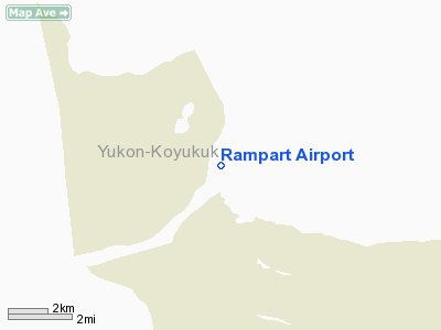
| Rampart Airport |
| IATA: RMP – ICAO: none – FAA LID: RMP |
| Summary |
| Airport type |
Public |
| Owner |
Alaska DOT&PF - Northern Region |
| Serves |
Rampart, Alaska |
| Elevation AMSL |
302 ft / 92 m |
| Coordinates |
65°30′28″N 150°08′27″W / 65.50778°N 150.14083°W / 65.50778; -150.14083 |
| Runways |
| Direction |
Length |
Surface |
| ft |
m |
| 11/29 |
3,500 |
1,067 |
Gravel |
| Statistics (2005) |
| Aircraft operations |
350 |
| Source: Federal Aviation Administration |
Rampart Airport (IATA: RMP, FAA LID: RMP) is a state-owned public-use airport located two nautical miles (3.7 km) east of the central business district of Rampart, in the Yukon-Koyukuk Census Area of the U.S. state of Alaska, United States. Commercial service is subsidized by the Essential Air Service program. Facilities and aircraft
Rampart Airport has one runway designated 11/29 with a gravel surface measuring 3,500 by 75 feet (1,067 x 23 m). For the 12-month period ending December 31, 2005, the airport had 350 aircraft operations, an average of 29 per month: 71% air taxi and 29% general aviation.
Airlines and destinations
- Arctic Circle Air (Fairbanks)
- Warbelow's Air Ventures (Fairbanks)
The above content comes from Wikipedia and is published under free licenses – click here to read more.
Location
& QuickFacts
|
FAA
Information Effective: |
2006-02-16 |
|
Airport
Identifier: |
RMP |
|
Longitude/Latitude: |
150-08-27.0000W/65-30-28.4400N
-150.140833/65.507900 (Estimated) |
|
Elevation: |
302 ft / 92.05 m (Estimated) |
|
Land: |
0 acres |
|
From
nearest city: |
2 nautical miles E of Rampart, AK |
|
Location: |
Yukon-koyukuk County, AK |
|
Magnetic Variation: |
24E (2000) |
Owner
& Manager
|
Ownership: |
Publicly owned |
|
Owner: |
State Of Ak Dot/pf N Rgn |
|
Address: |
2301 Peger Road
Fairbanks, AK 99709 |
|
Phone number: |
907-451-5217 |
|
Manager: |
Bill O'halloran |
|
Address: |
2301 Peger Rd
Fairbanks, AK 99709 |
|
Phone number: |
907-451-5217 |
Airport
Operations and Facilities
|
Airport
Use: |
Open to public |
|
Wind
indicator: |
Yes
WIND SOCK AT END OF RY 11 & 29 UNUSABLE. |
|
Segmented
Circle: |
Yes |
|
Control
Tower: |
No |
|
Attendance
Schedule: |
UNATNDD |
|
Lighting
Schedule: |
DUSK-DAWN
ACTVT MIRL RY 11/29 & REIL RYS 11 & 29 & PAPI
RY 11 - CTAF. |
|
Beacon
Color: |
Clear-Green (lighted land airport) |
|
Landing
fee charge: |
No |
|
Sectional
chart: |
Fairbanks |
|
Region: |
AAL - Alaska |
|
Boundary
ARTCC: |
ZAN - Anchorage |
|
Tie-in
FSS: |
FAI - Fairbanks |
|
FSS
on Airport: |
No |
|
FSS
Phone: |
907-474-0788 |
|
FSS
Toll Free: |
1-866-248-6516 |
|
NOTAMs
Facility: |
FAI (NOTAM-d service avaliable) |
|
Federal Agreements: |
NGY |
Airport
Communications
Airport
Services
|
Airframe
Repair: |
NONE |
|
Power
Plant Repair: |
NONE |
|
Bottled
Oxygen: |
NONE |
|
Bulk
Oxygen: |
NONE |
|
Runway Information
Runway 11/29
|
Dimension: |
3500 x 75 ft / 1066.8 x 22.9 m |
|
Surface: |
GRVL, Good Condition |
|
Edge
Lights: |
Medium |
|
|
Runway 11 |
Runway 29 |
|
Longitude: |
150-08-54.4700W |
150-07-59.5300W |
|
Latitude: |
65-30-41.3500N |
65-30-15.5300N |
|
Elevation: |
273.00 ft |
302.00 ft |
|
Alignment: |
127 |
127 |
|
Traffic
Pattern: |
Left |
Left |
|
Crossing
Height: |
25.00 ft |
0.00 ft |
|
VASI: |
4-light PAPI on left side |
|
|
Visual
Glide Angle: |
3.00� |
0.00� |
|
Runway
End Identifier: |
Yes |
Yes |
|
Obstruction: |
, 50:1 slope to clear |
60 ft trees, 860.0 ft from runway, 65 ft right
of centerline, 14:1 slope to clear |
|
Remarks
- FREQUENT
CROSSWINDS & TURBULENCE FM EACH RY END.
- RY
SLOPES GRADUALLY UPHILL FROM RIVER.
- SNOW
REMOVAL OPERATIONS DURING WINTER--MONITOR CTAF.
- RY
CONDITION NOT MONITORED; RECOMMEND VISUAL INSPECTION PRIOR TO LANDING.
Operational Statistics
|
Aircraft
Operations: |
30/Month |
|
Air Taxi: |
71.4% |
|
General
Aviation Itinerant: |
28.6% |
Rampart Airport
Address:
Yukon-koyukuk County, AK
Tel:
907-451-5217
Images
and information placed above are from
http://www.airport-data.com/airport/RMP/
We
thank them for the data!
| General
Info |
| Country |
United
States |
| State |
ALASKA
|
| FAA ID |
RMP
|
| Latitude |
65-30-28.440N
|
| Longitude |
150-08-27.000W
|
| Elevation |
302 feet
|
| Near City |
RAMPART
|
We don't guarantee the information is fresh and accurate. The data may
be wrong or outdated.
For more up-to-date information please refer to other sources.
|
|


