 |
|
|
|
|
|
Location
& QuickFacts
|
FAA
Information Effective: |
2006-02-16 |
|
Airport
Identifier: |
20K |
|
Longitude/Latitude: |
149-45-44.0070W/65-21-14.3310N
-149.762224/65.353981 (Estimated) |
|
Elevation: |
1550 ft / 472.44 m (Estimated) |
|
Land: |
0 acres |
|
From
nearest city: |
1 nautical miles S of Quail Creek, AK |
|
Location: |
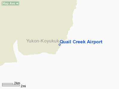
Yukon-koyukuk County, AK |
|
Magnetic Variation: |
27E (1985) |
Owner
& Manager
|
Ownership: |
Publicly owned |
|
Owner: |
State Of Alaska |
|
Address: |
Po Box 196900
Anchorage, AK 99709 |
|
Phone number: |
907-455-9198 |
|
Manager: |
Carl J. Congdon |
|
Address: |
925 Commerce Street
Fairbanks, AK 99709 |
|
Phone number: |
907-455-8198 |
Airport
Operations and Facilities
|
Airport
Use: |
Open to public |
|
Wind
indicator: |
No |
|
Segmented
Circle: |
No |
|
Control
Tower: |
No |
|
Attendance
Schedule: |
UNATNDD |
|
Landing
fee charge: |
No |
|
Sectional
chart: |
Fairbanks |
|
Region: |
AAL - Alaska |
|
Boundary
ARTCC: |
ZAN - Anchorage |
|
Tie-in
FSS: |
FAI - Fairbanks |
|
FSS
on Airport: |
No |
|
FSS
Phone: |
907-474-0788 |
|
FSS
Toll Free: |
1-866-248-6516 |
|
NOTAMs
Facility: |
FAI (NOTAM-d service avaliable) |
Airport
Communications
Airport
Services
|
Airframe
Repair: |
NONE |
|
Power
Plant Repair: |
NONE |
|
Bottled
Oxygen: |
NONE |
|
Bulk
Oxygen: |
NONE |
|
Runway Information
Runway 16/34
|
Dimension: |
1750 x 30 ft / 533.4 x 9.1 m |
|
Surface: |
DIRT, Poor Condition
SOFT WHEN WET; RUTTED; BRUSH GROWING ON RY. |
|
|
Runway 16 |
Runway 34 |
|
Traffic
Pattern: |
Left |
Left |
|
Markings: |
None, |
None, |
|
Runway
End Identifier: |
No |
No |
|
Centerline
Lights: |
No |
No |
|
Touchdown
Lights: |
No |
No |
|
Obstruction: |
50 ft trees, 60.0 ft from runway, 50 ft right
of centerline, 1:1 slope to clear |
30 ft trees, 30.0 ft from runway, 50 ft right
of centerline, 4:1 slope to clear |
|
Radio Navigation
Aids
|
ID |
Type |
Name |
Ch |
Freq |
Var |
Dist |
|
ENN |
VORTAC |
Nenana |
105X |
115.80 |
27E |
49.2 nm |
Remarks
- RY
NOT MAINTAINED RECOMMEND VISUAL INSPECTION PRIOR TO LDG.
- RY
16/34 LOCATED IN RAVINE.
- STEEP
AND/OR TURNING APPROACH REQUIRED EITHER DIRECTION.
- ANCHORAGE
WX CAMERA AVBL ON INTERNET AT HTTP://AKWEATHERCAMS.FAA.GOV
- ESABD
PRIOR TO 1959.
Operational Statistics
|
Aircraft
Operations: |
1/Month |
|
General
Aviation Local: |
100.0% |
Quail Creek Airport
Address:
Yukon-koyukuk County, AK
Tel:
907-455-9198, 907-455-8198
Images
and information placed above are from
http://www.airport-data.com/airport/20K/
We
thank them for the data!
| General
Info |
| Country |
United
States |
| State |
ALASKA
|
| FAA ID |
20K
|
| Latitude |
65-21-14.331N
|
| Longitude |
149-45-44.007W
|
| Elevation |
1550 feet
|
| Near City |
QUAIL
CREEK |
We don't guarantee the information is fresh and accurate. The data may
be wrong or outdated.
For more up-to-date information please refer to other sources.
|
|


