 |
|
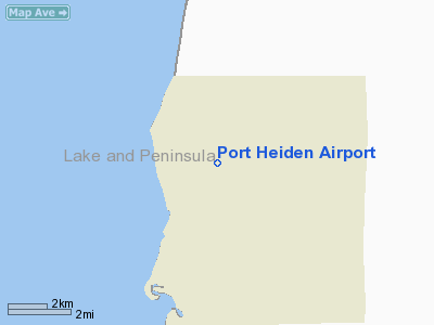
| Port Heiden Airport |
 |
| IATA: PTH – ICAO: PAPH – FAA LID: PTH |
| Summary |
| Airport type |
Public |
| Owner |
State of Alaska DOT&PF - Central Region |
| Serves |
Port Heiden, Alaska |
| Elevation AMSL |
95 ft / 29 m |
| Coordinates |
56°57′33″N 158°38′00″W / 56.95917°N 158.6333333°W / 56.95917; -158.6333333 |
| Runways |
| Direction |
Length |
Surface |
| ft |
m |
| 5/23 |
5,000 |
1,524 |
Gravel |
| 13/31 |
4,000 |
1,219 |
Gravel |
| Statistics |
| Aircraft operations (2006) |
1,000 |
| Enplanements (2008) |
919 |
| Source: Federal Aviation Administration |
Port Heiden Airport (IATA: PTH, ICAO: PAPH, FAA LID: PTH) is a state-owned, public-use airport located six nautical miles (11 km) northeast of the central business district of Port Heiden, in the Lake and Peninsula Borough of the U.S. state of Alaska. Scheduled airline service to King Salmon Airport is provided by Peninsula Airways (PenAir).
As per Federal Aviation Administration records, this airport had 919 commercial passenger boardings (enplanements) in calendar year 2008, a decrease of 9.6% from the 1,017 enplanements in 2007. Port Heiden is included in the FAA's National Plan of Integrated Airport Systems (2009–2013), which categorizes it as a general aviation facility. Airlines and destinations
Facilities and aircraft
Port Heiden Airport has two runways with gravel surfaces: 5/23 is 5,000 by 100 feet (1,524 x 30 m) and 13/31 is 4,000 by 100 feet (1,219 x 30 m). For the 12-month period ending December 31, 2006, the airport had 1,000 aircraft operations, an average of 83 per month: 50% air taxi and 50% general aviation.
History
The airport was built in 1942 after the World War II Japanese attack on the Aleutian Islands. On 17 June 1942 the United States Army established a garrison of 1,400 officers and enlisted men at Port Heiden on the north side of the Alaska Peninsula, with the mission of developing and holding an air base intermediate between the Kodiak and Cold Bay fields, this new garrison becoming the Army's Fort Morrow Army Airfield. The airfield did not have any permanent assigned units during the war, but hosted numerous temporary assigned USAAF and Naval Air units during the Aleutian Campaign and aided in the defense of Kodiak Island.
Incidents and accidents
On 30 April 2008, a Cessna Citation Excel business jet veered off the gravel runway 23 upon landing in a crosswind. The plane sustained substantial damage, thought there were no injuries among the six occupants.
The above content comes from Wikipedia and is published under free licenses – click here to read more.
Location
& QuickFacts
|
FAA
Information Effective: |
2006-02-16 |
|
Airport
Identifier: |
PTH |
|
Longitude/Latitude: |
158-38-00.1030W/56-57-32.7640N
-158.633362/56.959101 (Estimated)
158-38-00.108W |
|
Elevation: |
95 ft / 28.96 m (Estimated) |
|
Land: |
0 acres |
|
From
nearest city: |
6 nautical miles NE of Port Heiden, AK |
|
Location: |
Aleutian Islands County, AK |
|
Magnetic Variation: |
19E (1985) |
Owner
& Manager
|
Ownership: |
Publicly owned |
|
Owner: |
State Of Ak Dotpf-central Rgn |
|
Address: |
Pouch 196900
Anchorage, AK 99519-6900 |
|
Phone
number: |
907-266-1735 |
|
Manager: |
Zane Walker |
|
Address: |
Po Box 65
King Salmon, AK 99613 |
|
Phone
number: |
907-246-3325 |
Airport
Operations and Facilities
|
Airport
Use: |
Open to public |
|
Wind
indicator: |
Yes |
|
Segmented
Circle: |
Yes |
|
Control
Tower: |
No |
|
Attendance
Schedule: |
UNATNDD |
|
Lighting
Schedule: |
DUSK-DAWN
ACTVT MIRL RYS 05/23 & 13/31, REIL RY 05, VASI RYS 05
& 23 AND PAPI RYS 13 & 31 - CTAF. |
|
Beacon
Color: |
Clear-Green (lighted land airport) |
|
Landing
fee charge: |
No |
|
Sectional
chart: |
Kodiak |
|
Region: |
AAL - Alaska |
|
Boundary
ARTCC: |
ZAN - Anchorage |
|
Tie-in
FSS: |
ENA - Kenai |
|
FSS
on Airport: |
No |
|
FSS
Phone: |
800-478-3576 |
|
FSS
Toll Free: |
1-800-WX-BRIEF |
|
NOTAMs
Facility: |
PTH (NOTAM-d service avaliable) |
|
Certification
type/date: |
I AS ??/???? |
|
Federal
Agreements: |
NGY |
Airport
Communications
Airport
Services
|
Airframe
Repair: |
NONE |
|
Power
Plant Repair: |
NONE |
|
Bottled
Oxygen: |
NONE |
|
Bulk
Oxygen: |
NONE |
|
Runway Information
Runway 05/23
|
Dimension: |
5000 x 100 ft / 1524.0 x 30.5 m |
|
Surface: |
GRAVEL, Fair Condition |
|
Edge
Lights: |
Medium |
|
|
Runway 05 |
Runway 23 |
|
Longitude: |
158-38-03.2500W |
158-36-38.3100W |
|
Latitude: |
56-57-24.7800N |
56-57-41.3400N |
|
Elevation: |
90.00 ft |
95.00 ft |
|
Alignment: |
70 |
127 |
|
ILS
Type: |
MLS |
|
|
Traffic
Pattern: |
Left |
Left |
|
Crossing
Height: |
27.00 ft |
25.00 ft |
|
VASI: |
4-box on left side |
4-box on left side |
|
Visual
Glide Angle: |
3.00� |
3.00� |
|
Runway
End Identifier: |
Yes |
|
|
Obstruction: |
63 ft ant, 2800.0 ft from runway, 43:1 slope to
clear |
, 50:1 slope to clear |
|
Runway 13/31
|
Dimension: |
4000 x 100 ft / 1219.2 x 30.5 m |
|
Surface: |
GRAVEL, Fair Condition |
|
Edge
Lights: |
Medium |
|
|
Runway 13 |
Runway 31 |
|
Longitude: |
158-39-08.6600W |
158-38-29.8600W |
|
Latitude: |
56-57-49.0100N |
56-57-15.7800N |
|
Elevation: |
76.00 ft |
83.00 ft |
|
Alignment: |
127 |
127 |
|
Traffic
Pattern: |
Left |
Left |
|
Crossing
Height: |
28.00 ft |
39.00 ft |
|
VASI: |
4-light PAPI on left side |
4-light PAPI on left side |
|
Visual
Glide Angle: |
3.00� |
3.00� |
|
Runway
End Identifier: |
Yes |
|
|
Radio Navigation
Aids
|
ID |
Type |
Name |
Ch |
Freq |
Var |
Dist |
|
PDN |
NDB/DME |
Port Heiden |
032X |
371.00 |
19E |
0.6 nm |
Remarks
- RYS
SOFT WHEN WET & DURING SPRING THAW; SAFETY AREAS SOFT WITH RUTS
AFTER HEAVY RAINS & DURING RUNOFF.
- MAINTENANCE
DUTY HRS 0800-1700.
- PILOTS
ARE REQUESTED TO SELF-ANNOUNCE ON CTAF PRIOR TO TAXIING ON RWY FOR DEPARTURE;
LEAVING THE RWY AND WITHIN 10 NM OF THE ARPT WHEN APPROACHING TO LAND.
Based Aircraft
|
Aircraft
based on field: |
22 |
|
Single
Engine Airplanes: |
20 |
|
Helicopters: |
2 |
Operational Statistics
|
Aircraft
Operations: |
114/Week |
|
Air Carrier: |
20.3% |
|
Air Taxi: |
25.4% |
|
General
Aviation Local: |
8.5% |
|
General
Aviation Itinerant: |
25.4% |
Port Heiden Airport
Address:
Aleutian Islands County, AK
Tel:
907-266-1735, 907-246-3325
Images
and information placed above are from
http://www.airport-data.com/airport/PTH/
We
thank them for the data!
| General
Info |
| Country |
United
States |
| State |
ALASKA
|
| FAA ID |
PTH
|
| Latitude |
56-57-33.960N
|
| Longitude |
158-37-54.555W
|
| Elevation |
88 feet
|
| Near City |
PORT HEIDEN
|
We don't guarantee the information is fresh and accurate. The data may
be wrong or outdated.
For more up-to-date information please refer to other sources.
|
|


