 |
|
|
|
|
|
Location
& QuickFacts
|
FAA
Information Effective: |
2006-02-16 |
|
Airport
Identifier: |
AK11 |
|
Longitude/Latitude: |
148-40-56.0540W/70-24-06.0370N
-148.682237/70.401677 (Estimated) |
|
Elevation: |
15 ft / 4.57 m (Estimated) |
|
Land: |
0 acres |
|
From
nearest city: |
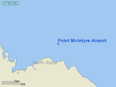
0 nautical miles S of Point Mcintyre, AK |
|
Location: |
Upper Yukon County, AK |
|
Magnetic Variation: |
30E (1985) |
Owner
& Manager
|
Ownership: |
Publicly owned |
|
Owner: |
Us Govt Usn Onr Ars |
|
Address: |
Navy Research Site
Pt Barrow, AK 99723 |
|
Address: |
|
Airport
Operations and Facilities
|
Airport
Use: |
Open to public |
|
Wind
indicator: |
No |
|
Segmented
Circle: |
No |
|
Control
Tower: |
No |
|
Attendance
Schedule: |
UNATNDD |
|
Landing
fee charge: |
No |
|
Sectional
chart: |
Point Barrow |
|
Region: |
AAL - Alaska |
|
Boundary
ARTCC: |
ZAN - Anchorage |
|
Tie-in
FSS: |
SCC - Deadhorse |
|
FSS
on Airport: |
No |
|
FSS
Phone: |
907-659-2505 |
|
FSS
Toll Free: |
LC659-2401 |
|
Alternate
FSS: |
FAI - Fairbanks |
|
Alt.
FSS Toll Free: |
1-866-248-6516 |
|
NOTAMs
Facility: |
SCC (NOTAM-d service avaliable) |
Airport
Communications
Airport
Services
|
Airframe
Repair: |
NONE |
|
Power
Plant Repair: |
NONE |
|
Bottled
Oxygen: |
NONE |
|
Bulk
Oxygen: |
NONE |
|
Runway Information
Runway 04/22
|
Dimension: |
1540 x 70 ft / 469.4 x 21.3 m |
|
Surface: |
GRAVEL, Poor Condition
SOFT SPOTS; EROSION & BRUSH ON RY. |
|
Edge
Lights: |
Medium |
|
|
Runway 04 |
Runway 22 |
|
Traffic
Pattern: |
Left |
Left |
|
Radio Navigation
Aids
|
ID |
Type |
Name |
Ch |
Freq |
Var |
Dist |
|
PVQ |
NDB |
Put River |
|
376.00 |
31E |
12.0 nm |
|
PYC |
NDB |
Pitsand |
|
290.00 |
30E |
19.8 nm |
|
UQS |
NDB |
Nuiqsut Village |
|
241.00 |
28E |
48.3 nm |
|
SCC |
VOR/DME |
Deadhorse |
086X |
113.90 |
31E |
13.3 nm |
Remarks
- RY
04/22 NOT MAINTAINED; RECOMMEND EMERGENCY USE ONLY.
Operational Statistics
|
Aircraft
Operations: |
9/Month |
|
Air Taxi: |
50.0% |
|
General
Aviation Itinerant: |
50.0% |
Point Mcintyre Airport
Address:
Upper Yukon County, AK
Tel:
Images
and information placed above are from
http://www.airport-data.com/airport/AK11/
We
thank them for the data!
| General
Info |
| Country |
United
States |
| State |
ALASKA
|
| FAA ID |
AK11
|
| Latitude |
70-24-06.037N
|
| Longitude |
148-40-56.054W
|
| Elevation |
15 feet
|
| Near City |
POINT
MCINTYRE |
We don't guarantee the information is fresh and accurate. The data may
be wrong or outdated.
For more up-to-date information please refer to other sources.
|
|


