 |
|
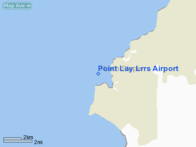
| Point Lay LRRS Airport |
| IATA: PIZ – ICAO: PPIZ – FAA LID: PIZ |
| Summary |
| Airport type |
Public / Military |
| Owner |
U.S. Government 11 TCW/LGO Elmendorf |
| Location |
Point Lay, Alaska |
| Elevation AMSL |
25 ft / 8 m |
| Coordinates |
69°43′56″N 163°00′40″W / 69.73222°N 163.01111°W / 69.73222; -163.01111 |
| Runways |
| Direction |
Length |
Surface |
| ft |
m |
| 5/23 |
3,519 |
1,073 |
Gravel |
| Statistics (2005) |
| Aircraft operations |
120 |
| Source: Federal Aviation Administration |
Point Lay LRRS Airport (IATA: PIZ, ICAO: PPIZ, FAA LID: PIZ) is a public and military use airport owned by the United States Government and located in Point Lay, in the North Slope Borough of the U.S. state of Alaska. It is also known as Point Lay Airport. The acronym LRRS stands for Long Range Radar Site or Long Range Radar Station. Facilities and aircraft
Point Lay LRRS Airport has one runway designated 5/23 with a gravel surface measuring 3,519 by 80 feet (1,073 x 24 m). For the 12-month period ending December 31, 2005, the airport had 120 aircraft operations, an average of 10 per month: 42% air taxi, 42% military and 16% general aviation.
Airlines
- Frontier Flying Service (Barrow, Point Hope)
- Hageland Aviation Services
The above content comes from Wikipedia and is published under free licenses – click here to read more.
Location
& QuickFacts
|
FAA
Information Effective: |
2006-02-16 |
|
Airport
Identifier: |
PIZ |
|
Longitude/Latitude: |
163-00-19.2300W/69-43-58.3500N
-163.005342/69.732875 (Estimated) |
|
Elevation: |
25 ft / 7.62 m (Surveyed) |
|
Land: |
0 acres |
|
From
nearest city: |
0 nautical miles S of Point Lay, AK |
|
Location: |
Barrow County, AK |
|
Magnetic Variation: |
18E (2000) |
Owner
& Manager
|
Ownership: |
Publicly owned |
|
Owner: |
Us Gov 11tcw/lgo Elemdorf |
|
Address: |
6900 9th St Suite 301
Eafb, AK 99506 |
|
Phone number: |
907-557-4146 |
|
Manager: |
North Slope Borough |
|
Address: |
Po Box 69
Barrow, AK 99723 |
|
Phone number: |
907-852-0340 |
Airport
Operations and Facilities
|
Airport
Use: |
Open to public |
|
Wind
indicator: |
Yes |
|
Segmented
Circle: |
No |
|
Control
Tower: |
No |
|
Attendance
Schedule: |
ALL/ALL/ALL |
|
Lighting
Schedule: |
DUSK-DAWN
ACTVT MIRL RY 05/23 - 122.8. |
|
Beacon
Color: |
Clear-Green (lighted land airport) |
|
Landing
fee charge: |
No |
|
Sectional
chart: |
Cape Lisburne |
|
Region: |
AAL - Alaska |
|
Boundary
ARTCC: |
ZAN - Anchorage |
|
Tie-in
FSS: |
FAI - Fairbanks |
|
FSS
on Airport: |
No |
|
FSS
Phone: |
907-474-0788 |
|
FSS
Toll Free: |
1-866-248-6516
FOR A TOLL FREE CALL TO BARROW FSS CALL 1-800-779-7709. |
|
NOTAMs
Facility: |
PIZ (NOTAM-d service avaliable) |
|
Federal Agreements: |
NGY |
Airport
Communications
Airport
Services
|
Airframe
Repair: |
NONE |
|
Power
Plant Repair: |
NONE |
|
Bottled
Oxygen: |
NONE |
|
Bulk
Oxygen: |
NONE |
|
Runway Information
Runway 05/23
|
Dimension: |
3519 x 80 ft / 1072.6 x 24.4 m |
|
Surface: |
GRVL, Fair Condition |
|
Edge
Lights: |
Non-standard lighting system
NSTD MIRL. |
|
|
Runway 05 |
Runway 23 |
|
Longitude: |
163-01-26.6170W |
162-59-53.4970W |
|
Latitude: |
69-43-49.2230N |
69-44-01.8380N |
|
Elevation: |
24.00 ft |
15.00 ft |
|
Alignment: |
69 |
127 |
|
Traffic
Pattern: |
Left |
Left |
|
Markings: |
None,
NSTD THLD MARKERS. |
None, |
|
Runway
End Identifier: |
Yes |
Yes |
|
Centerline
Lights: |
No |
No |
|
Touchdown
Lights: |
No |
No |
|
Radio Navigation
Aids
|
ID |
Type |
Name |
Ch |
Freq |
Var |
Dist |
|
PIZ |
NDB |
Point Lay |
|
362.00 |
18E |
0.2 nm |
Remarks
- WX
CAMERA AVBL ON INTERNET AT HTTP://AKWEATHERCAMS.FAA.GOV
Based Aircraft
|
Aircraft
based on field: |
1 |
|
Single
Engine Airplanes: |
1 |
Operational Statistics
|
Aircraft
Operations: |
10/Month |
|
Air Taxi: |
41.7% |
|
General
Aviation Itinerant: |
16.7% |
|
Military: |
41.7% |
Point Lay Lrrs Airport
Address:
Barrow County, AK
Tel:
907-557-4146, 907-852-0340
Images
and information placed above are from
http://www.airport-data.com/airport/PIZ/
We
thank them for the data!
| General
Info |
| Country |
United
States |
| State |
ALASKA
|
| FAA ID |
PIZ
|
| Latitude |
69-43-58.350N
|
| Longitude |
163-00-19.230W
|
| Elevation |
25 feet
|
| Near City |
POINT
LAY |
We don't guarantee the information is fresh and accurate. The data may
be wrong or outdated.
For more up-to-date information please refer to other sources.
|
|


