 |
|
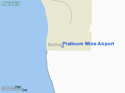
Location
& QuickFacts
|
FAA
Information Effective: |
2006-02-16 |
|
Airport
Identifier: |
6AK1 |
|
Longitude/Latitude: |
161-42-50.0100W/58-54-42.1770N
-161.713892/58.911716 (Estimated) |
|
Elevation: |
100 ft / 30.48 m (Estimated) |
|
Land: |
0 acres |
|
From
nearest city: |
1 nautical miles SE of Platinum, AK |
|
Location: |
Bethel County, AK |
|
Magnetic Variation: |
18E (1985) |
Owner
& Manager
|
Ownership: |
Privately owned |
|
Owner: |
R.a. Hanson Co. |
|
Address: |
P.o. Box 7400
Spokane, WA 99207 |
|
Phone number: |
509-467-0770 |
|
Manager: |
None |
|
Address: |
|
Airport
Operations and Facilities
|
Airport
Use: |
Private |
|
Wind
indicator: |
Yes |
|
Segmented
Circle: |
No |
|
Control
Tower: |
No |
|
Attendance
Schedule: |
UNATNDD |
|
Landing
fee charge: |
No |
|
Sectional
chart: |
Kodiak |
|
Region: |
AAL - Alaska |
|
Boundary ARTCC: |
ZAN - Anchorage |
|
Tie-in FSS: |
ENA - Kenai |
|
FSS on Airport: |
No |
|
FSS Phone: |
800-478-3576 |
|
FSS Toll Free: |
1-800-WX-BRIEF |
Airport
Services
|
Airframe
Repair: |
NONE |
|
Power
Plant Repair: |
NONE |
|
Bottled
Oxygen: |
NONE |
|
Bulk
Oxygen: |
NONE |
|
Runway Information
Runway 16/34
|
Dimension: |
2000 x 75 ft / 609.6 x 22.9 m |
|
Surface: |
GRAVEL, |
|
|
Runway 16 |
Runway 34 |
|
Traffic
Pattern: |
Left |
Left |
|
Markings: |
None, |
None, |
|
Runway
End Identifier: |
No |
No |
|
Centerline
Lights: |
No |
No |
|
Touchdown
Lights: |
No |
No |
|
Radio Navigation
Aids
|
ID |
Type |
Name |
Ch |
Freq |
Var |
Dist |
|
EHM |
NDB |
Cape Newenham |
|
385.00 |
18E |
19.1 nm |
|
TOG |
NDB/DME |
Togiak |
114X |
393.00 |
19E |
42.5 nm |
Operational Statistics
|
Aircraft
Operations: |
25/Month |
|
Air Taxi: |
33.3% |
|
General
Aviation Itinerant: |
66.7% |
Platinum Mine Airport
Address:
Bethel County, AK
Tel:
509-467-0770
Images
and information placed above are from
http://www.airport-data.com/airport/6AK1/
We
thank them for the data!
| General
Info |
| Country |
United
States |
| State |
ALASKA
|
| FAA ID |
6AK1
|
| Latitude |
58-54-42.177N
|
| Longitude |
161-42-50.010W
|
| Elevation |
100 feet
|
| Near City |
PLATINUM
|
We don't guarantee the information is fresh and accurate. The data may
be wrong or outdated.
For more up-to-date information please refer to other sources.
|
|


