 |
|
|
|
|
|
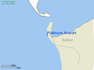
Location
& QuickFacts
|
FAA
Information Effective: |
2006-02-16 |
|
Airport
Identifier: |
PTU |
|
Longitude/Latitude: |
161-49-10.7980W/59-00-40.8820N
-161.819666/59.011356 (Estimated) |
|
Elevation: |
15 ft / 4.57 m (Surveyed) |
|
Land: |
0 acres |
|
From
nearest city: |
0 nautical miles W of Platinum, AK |
|
Location: |
Bethel County, AK |
|
Magnetic Variation: |
16E (2000) |
Owner
& Manager
|
Ownership: |
Publicly owned |
|
Owner: |
State Of Ak Dotpf-central Rgn |
|
Address: |
Box 196900-6900
Anchorage, AK 99519-6900 |
|
Phone number: |
907-269-0747 |
|
Manager: |
Lawrence Davis |
|
Address: |
Box 505
Bethel, AK 99559 |
|
Phone number: |
907-543-2495 |
Airport
Operations and Facilities
|
Airport
Use: |
Open to public |
|
Wind
indicator: |
Yes
WINDSOCK MAY BE UNRELIABLE. |
|
Segmented
Circle: |
No |
|
Control
Tower: |
No |
|
Attendance
Schedule: |
UNATNDD |
|
Landing
fee charge: |
No |
|
Sectional
chart: |
Kodiak |
|
Region: |
AAL - Alaska |
|
Boundary
ARTCC: |
ZAN - Anchorage |
|
Tie-in
FSS: |
ENA - Kenai |
|
FSS
on Airport: |
No |
|
FSS
Phone: |
800-478-3576 |
|
FSS
Toll Free: |
1-800-WX-BRIEF |
|
NOTAMs
Facility: |
PAEH (NOTAM-d service avaliable) |
|
Federal Agreements: |
N |
Airport
Communications
Airport
Services
|
Airframe
Repair: |
NONE |
|
Power
Plant Repair: |
NONE |
|
Bottled
Oxygen: |
NONE |
|
Bulk
Oxygen: |
NONE |
|
Runway Information
Runway 09/27
|
Dimension: |
1924
x 50 ft / 586.4 x 15.2 m
TUNDRA ENCROACHMENT WIDTH OF RY.
A032 RY 13 USABLE WIDTH FIRST 900 FEET REDUCED TO 40 FEET. |
|
Surface: |
GRVL, Poor Condition
RY 13/31 SOFT WHEN WET, ALSO ROUGH WITH RUTS & SWALES. |
|
|
Runway 09 |
Runway 27 |
|
Longitude: |
161-49-29.7760W |
161-48-54.9200W |
|
Latitude: |
59-00-42.8290N |
59-00-36.9300N |
|
Elevation: |
15.00 ft |
9.00 ft |
|
Alignment: |
108 |
127 |
|
Traffic
Pattern: |
Left |
Left |
|
Markings: |
None,
RYS 09 /27 & 13/31 RWY EDGES MKD WITH ORANGE/WHITE REFLECTIVE
CONES |
None, |
|
Runway
End Identifier: |
No |
No |
|
Centerline
Lights: |
No |
No |
|
Touchdown
Lights: |
No |
No |
|
Obstruction: |
, 50:1 slope to clear |
20 ft pole, 113.0 ft from runway, 112 ft left
of centerline, 6:1 slope to clear |
|
Runway 13/31
|
Dimension: |
3304
x 50 ft / 1007.1 x 15.2 m
TUNDRA ENCROACHMENT WIDTH OF RY.
A032 RY 13 USABLE WIDTH FIRST 900 FEET REDUCED TO 40 FEET. |
|
Surface: |
GRVL, Fair Condition
RY 13/31 SOFT WHEN WET, ALSO ROUGH WITH RUTS & SWALES. |
|
|
Runway 13 |
Runway 31 |
|
Longitude: |
161-49-23.3040W |
161-48-56.4890W |
|
Latitude: |
59-00-56.1940N |
59-00-26.7360N |
|
Elevation: |
10.00 ft |
11.00 ft |
|
Alignment: |
127 |
127 |
|
Traffic
Pattern: |
Left |
Left |
|
Markings: |
None, |
None, |
|
Runway
End Identifier: |
No |
No |
|
Centerline
Lights: |
No |
No |
|
Touchdown
Lights: |
No |
No |
|
Radio Navigation
Aids
|
ID |
Type |
Name |
Ch |
Freq |
Var |
Dist |
|
EHM |
NDB |
Cape Newenham |
|
385.00 |
18E |
22.8 nm |
|
TOG |
NDB/DME |
Togiak |
114X |
393.00 |
19E |
44.8 nm |
Remarks
- CAUTION:
RWY CONDITION NOT MONITORED; RECOMMEND VISUAL INSPECTION PRIOR TO USING.
- 20
FT POWER LINE 113 FT E OF RY 27 THLD 112 FT L OF CNTRLN.
- PORTABLE
RUNWAY LIGHTS AVAILABLE FOR EMERGENCY USE ONLY. CONTACT HEALTH CLINIC
967-8128 FOR DEPLOYMENT.
- WX
CAMERA AVBL ON INTERNET AT HTTP://AKWEATHERCAMS.FAA.GOV
Platinum Airport
Address:
Bethel County, AK
Tel:
907-269-0747, 907-543-2495
Images
and information placed above are from
http://www.airport-data.com/airport/PTU/
We
thank them for the data!
| General
Info |
| Country |
United
States |
| State |
ALASKA
|
| ICAO ID |
PAPM
|
| FAA ID |
PTU
|
| Latitude |
59.011356
59� 00' 40.88" N |
| Longitude |
-161.819664
161� 49' 10.79" W |
| Elevation |
15 feet
5 meters |
| Magnetic
Variation |
014� E
(01/06) |
| Operating
Agency |
U.S.CIVIL
AIRPORT WHEREIN PERMIT COVERS USE BY TRANSIT MILITARY AIRCRAFT
|
We don't guarantee the information is fresh and accurate. The data may
be wrong or outdated.
For more up-to-date information please refer to other sources.
|
|


