 |
|
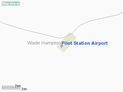
| Pilot Station Airport |
| IATA: PQS – ICAO: none – FAA LID: 0AK |
| Summary |
| Airport type |
Public |
| Owner |
State of Alaska DOT&PF - Northern Region |
| Serves |
Pilot Station, Alaska |
| Elevation AMSL |
305 ft / 93 m |
| Coordinates |
61°56′04″N 162°53′58″W / 61.93444°N 162.89944°W / 61.93444; -162.89944Coordinates: 61°56′04″N 162°53′58″W / 61.93444°N 162.89944°W / 61.93444; -162.89944 |
| Runways |
| Direction |
Length |
Surface |
| ft |
m |
| 7/25 |
2,541 |
774 |
Gravel |
| Statistics (2005) |
| Aircraft operations |
700 |
| Source: Federal Aviation Administration |
Pilot Station Airport (IATA: PQS, FAA LID: 0AK) is a state-owned public-use airport located one nautical mile (2 km) southwest of the central business district of Pilot Station, a city in the Wade Hampton Census Area of the U.S. state of Alaska. Facilities and aircraft
Pilot Station Airport covers an area of 103 acres (42 ha) at an elevation of 305 feet (93 m) above mean sea level. It has one runway designated 7/25 with a 2,541 x 55 ft (774 x 17 m) gravel surface. For the 12-month period ending August 31, 2005, the airport had 700 aircraft operations, an average of 58 per month: 71% air taxi and 29% general aviation.
Airlines and non-stop destinations
- Frontier Flying Service (Bethel, Mountain Village, St. Mary's)
The above content comes from Wikipedia and is published under free licenses – click here to read more.
Location
& QuickFacts
|
FAA
Information Effective: |
2006-02-16 |
|
Airport
Identifier: |
0AK |
|
Longitude/Latitude: |
162-53-58.4000W/61-56-04.4000N
-162.899556/61.934556 (Estimated) |
|
Elevation: |
305 ft / 92.96 m (Estimated) |
|
Land: |
103 acres |
|
From
nearest city: |
1 nautical miles SW of Pilot Station, AK |
|
Location: |
Wade Hampton County, AK |
|
Magnetic Variation: |
18E (1985) |
Owner
& Manager
|
Ownership: |
Publicly owned |
|
Owner: |
St Of Ak Dotpf Northern Rgn |
|
Address: |
2301 Peger Road
Fairbanks, AK 99709 |
|
Phone number: |
907-443-3444 |
|
Manager: |
George Beans |
|
Address: |
Box 135
St Mary's, AK 99658 |
|
Phone number: |
907-438-2416 |
Airport
Operations and Facilities
|
Airport
Use: |
Open to public |
|
Wind
indicator: |
Yes |
|
Segmented
Circle: |
Yes |
|
Control
Tower: |
No |
|
Attendance
Schedule: |
UNATNDD |
|
Lighting
Schedule: |
DUSK-DAWN
ACTVT ROTG BCN & MIRL RY 07/25 - 122.9. |
|
Beacon
Color: |
Clear-Green (lighted land airport) |
|
Landing
fee charge: |
No |
|
Sectional
chart: |
Bethel |
|
Region: |
AAL - Alaska |
|
Boundary
ARTCC: |
ZAN - Anchorage |
|
Tie-in
FSS: |
ENA - Kenai |
|
FSS
on Airport: |
No |
|
FSS
Phone: |
800-478-3576 |
|
FSS
Toll Free: |
1-800-WX-BRIEF |
|
NOTAMs
Facility: |
KSM (NOTAM-d service avaliable) |
|
Federal Agreements: |
N |
Airport
Communications
Airport
Services
|
Airframe
Repair: |
NONE |
|
Power
Plant Repair: |
NONE |
|
Bottled
Oxygen: |
NONE |
|
Bulk
Oxygen: |
NONE |
|
Runway Information
Runway 07/25
|
Dimension: |
2541 x 55 ft / 774.5 x 16.8 m |
|
Surface: |
GRVL, Good Condition |
|
Edge
Lights: |
Medium |
|
|
Runway 07 |
Runway 25 |
|
Longitude: |
162-54-24.9460W |
162-53-31.8633W |
|
Latitude: |
61-56-04.6607N |
61-56-04.0630N |
|
Elevation: |
305.00 ft |
288.00 ft |
|
Alignment: |
91 |
127 |
|
Traffic
Pattern: |
Left |
Left |
|
Obstruction: |
150 ft hill, 3000.0 ft from runway, 20:1 slope
to clear
APCH SLOPE 20:1 TO DSPLCD THR. |
, 50:1 slope to clear |
|
Radio Navigation
Aids
|
ID |
Type |
Name |
Ch |
Freq |
Var |
Dist |
|
SMA |
NDB |
St Marys |
|
230.00 |
18E |
13.3 nm |
Remarks
- RY
CONDITION NOT MONITORED; RECOMMEND VISUAL INSPECTION PRIOR TO LANDING.
Based Aircraft
|
Aircraft
based on field: |
1 |
|
Single
Engine Airplanes: |
1 |
Operational Statistics
|
Aircraft
Operations: |
14/Week |
|
Air Taxi: |
71.4% |
|
General
Aviation Itinerant: |
28.6% |
Pilot Station Airport
Address:
Wade Hampton County, AK
Tel:
907-443-3444, 907-438-2416
Images
and information placed above are from
http://www.airport-data.com/airport/0AK/
We
thank them for the data!
| General
Info |
| Country |
United
States |
| State |
ALASKA
|
| FAA ID |
0AK
|
| Latitude |
61-56-04.400N
|
| Longitude |
162-53-58.400W
|
| Elevation |
305 feet
|
| Near City |
PILOT
STATION |
We don't guarantee the information is fresh and accurate. The data may
be wrong or outdated.
For more up-to-date information please refer to other sources.
|
|


