 |
|
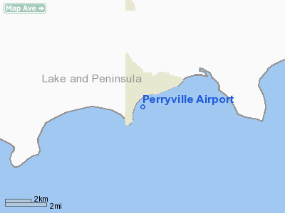
| Perryville Airport |
| IATA: KPV – ICAO: PAPE – FAA LID: PEV |
| Summary |
| Airport type |
Public |
| Owner |
Alaska DOT&PF - Central Region |
| Serves |
Perryville, Alaska |
| Elevation AMSL |
29 ft / 9 m |
| Coordinates |
55°54′24″N 159°09′39″W / 55.90667°N 159.16083°W / 55.90667; -159.16083 |
| Runways |
| Direction |
Length |
Surface |
| ft |
m |
| 2/20 |
3,300 |
1,006 |
Gravel |
| Statistics (2005) |
| Aircraft operations |
410 |
| Enplanements (2008) |
714 |
| Source: Federal Aviation Administration |
Perryville Airport (IATA: KPV, ICAO: PAPE, FAA LID: PEV, formerly AK5) is a state-owned, public-use airport located one nautical mile (1.85 km) southwest of the central business district of Perryville, in the Lake and Peninsula Borough of the U.S. state of Alaska. Scheduled airline service to King Salmon Airport is provided by Peninsula Airways (PenAir).
As per Federal Aviation Administration records, this airport had 714 commercial passenger boardings (enplanements) in calendar year 2008, an increase of 5% from the 683 enplanements in 2007. Perryville Airport is included in the FAA's National Plan of Integrated Airport Systems (2009-2013), which categorizes it as a general aviation facility.
Although most U.S. airports use the same three-letter location identifier for the FAA and IATA, this airport is assigned PEV by the FAA and KPV by the IATA.. Airlines and destinations
Facilities and aircraft
Perryville Airport covers an area of 149 acres (60 ha) at an elevation of 29 feet (9 m) above mean sea level. It has one runway designated 2/20 with a gravel surface measuring 3,300 by 75 feet (1,006 x 23 m). The airport is unattended.
The airport's former runway was designated 3/21 and measured 2,467 by 50 feet (752 × 15 m).
For the 12-month period ending December 31, 2005, the airport had 410 aircraft operations, an average of 34 per month: 51% air taxi and 49% general aviation.
The above content comes from Wikipedia and is published under free licenses – click here to read more.
Location
& QuickFacts
|
FAA
Information Effective: |
2006-02-16 |
|
Airport
Identifier: |
PEV |
|
Longitude/Latitude: |
159-09-20.0000W/55-54-03.0000N
-159.155556/55.900833 (Estimated) |
|
Elevation: |
24 ft / 7.32 m (Surveyed) |
|
Land: |
0 acres |
|
From
nearest city: |
1 nautical miles SW of Perryville, AK |
|
Location: |
Aleutian Islands County, AK |
|
Magnetic Variation: |
19E (1985) |
Owner
& Manager
|
Ownership: |
Publicly owned |
|
Owner: |
St Of Ak Dotpf/c Rgn |
|
Address: |
Po Box 196900
Anchorage, AK 99519-6900 |
|
Phone
number: |
907-269-0747 |
|
Manager: |
Zane Walker |
|
Address: |
Po Box 65
King Salmon, AK 99613 |
|
Phone number: |
907-246-3325 |
Airport
Operations and Facilities
|
Airport
Use: |
Open to public |
|
Wind
indicator: |
Yes |
|
Segmented
Circle: |
No |
|
Control
Tower: |
No |
|
Attendance
Schedule: |
UNATNDD |
|
Landing
fee charge: |
No |
|
Sectional
chart: |
Cold Bay |
|
Region: |
AAL - Alaska |
|
Boundary
ARTCC: |
ZAN - Anchorage |
|
Tie-in
FSS: |
CDB - Cold Bay |
|
FSS
on Airport: |
No |
|
FSS
Phone: |
907-532-2454 |
|
FSS
Toll Free: |
1-800-478-7250 |
|
Alternate
FSS: |
ENA - Kenai |
|
Alt.
FSS Toll Free: |
1-800-WX-BRIEF |
|
NOTAMs
Facility: |
AJC (NOTAM-d service avaliable) |
|
Federal Agreements: |
NGY |
Airport
Communications
Airport
Services
|
Airframe
Repair: |
NONE |
|
Power
Plant Repair: |
NONE |
|
Bottled
Oxygen: |
NONE |
|
Bulk
Oxygen: |
NONE |
|
Runway Information
Runway 03/21
|
Dimension: |
2467
x 40 ft / 751.9 x 12.2 m
USABLE WIDTH 40 FT- SCATTERED EDGE CONES OBSCURED BY WEEDS |
|
Surface: |
GRVL, Fair Condition
SAFETY AREA NE END SOFT AND ROUGH. USABLE SAFETY AREA NE END ONLY
102' SW SAFETY AREA ONLY 10'USABLE.
OCCASIONAL
SOFT SPOTS & RUTS AT TWY/RY INTERSECTION. |
|
|
Runway 03 |
Runway 21 |
|
Longitude: |
159-09-45.6660W |
159-09-16.0960W |
|
Latitude: |
55-54-20.1420N |
55-54-37.8930N |
|
Elevation: |
20.00 ft |
20.00 ft |
|
Alignment: |
43 |
127 |
|
Traffic
Pattern: |
Left |
Left |
|
Obstruction: |
115 ft hill, 3800.0 ft from runway, 300 ft
right of centerline, 33:1 slope to clear |
, 50:1 slope to clear |
|
Remarks
- ROAD
CROSSES APCH TO RY 21.
- CAUTION:
RWY CONDITION NOT MONTRD; RECOMMEND VISUAL INSPECTION PRIOR TO USING.
- SAFETY
AREAS 100 X 2500
- PILOTS
ARE REQUESTED TO SELF-ANNOUNCE ON CTAF PRIOR TO TAXIING ON RWY FOR DEPARTURE;
LEAVING THE RWY AND WITHIN 10 NM OF THE ARPT WHEN APPROACHING TO LAND.
Based Aircraft
|
Aircraft
based on field: |
1 |
|
Single
Engine Airplanes: |
1 |
Operational Statistics
|
Aircraft
Operations: |
10/Week |
|
Air Taxi: |
41.5% |
|
General
Aviation Local: |
19.0% |
|
General
Aviation Itinerant: |
39.5% |
Perryville Airport
Address:
Aleutian Islands County, AK
Tel:
907-269-0747,
907-246-3325
Images
and information placed above are from
http://www.airport-data.com/airport/PEV/
We
thank them for the data!
| General
Info |
| Country |
United
States |
| State |
ALASKA
|
| FAA ID |
PEV
|
| Latitude |
55.900833
55� 54' 03.00" N |
| Longitude |
-159.155556
159� 09' 20.00" W |
| Elevation |
24 feet
7 meters |
| Magnetic
Variation |
015� E
(01/06) |
| Operating
Agency |
U.S.CIVIL
AIRPORT WHEREIN PERMIT COVERS USE BY TRANSIT MILITARY AIRCRAFT
|
We don't guarantee the information is fresh and accurate. The data may
be wrong or outdated.
For more up-to-date information please refer to other sources.
|
|


