 |
|
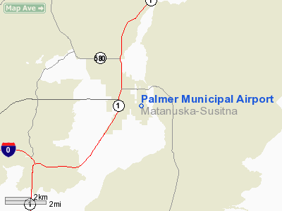
| Palmer Municipal Airport |
| IATA: PAQ – ICAO: PAAQ – FAA LID: PAQ |
| Summary |
| Airport type |
Public |
| Owner |
City of Palmer |
| Location |
Palmer, Alaska |
| Elevation AMSL |
242 ft / 74 m |
| Coordinates |
61°35′42″N 149°05′19″W / 61.595°N 149.08861°W / 61.595; -149.08861 |
| Runways |
| Direction |
Length |
Surface |
| ft |
m |
| 9/27 |
3,617 |
1,102 |
Asphalt |
| 16/34 |
6,009 |
1,832 |
Asphalt |
| 16S/34S |
1,560 |
475 |
Gravel |
| Statistics |
| Based aircraft |
227 |
| Source: Federal Aviation Administration |
Palmer Municipal Airport (IATA: PAQ, ICAO: PAAQ, FAA LID: PAQ) is a public airport located one mile (1.6 km) southeast of the central business district of Palmer, a city in Matanuska-Susitna Borough, Alaska, United States. This airport is owned by City of Palmer.
Facilities
Palmer Municipal Airport has three runways:
- Runway 9/27: 3,617 x 75 ft. (1,102 x 23 m), Surface: Asphalt
- Runway 16/34: 6,009 x 100 ft. (1,832 x 30 m), Surface: Asphalt
- Runway 16S/34S: 1,560 x 60 ft. (475 x 18 m), Surface: Gravel
There are 227 aircraft based at this airport: 88% single engine, 7% multi-engine, 3% helicopters and 2% gliders.
The above content comes from Wikipedia and is published under free licenses – click here to read more.
Location
& QuickFacts
|
FAA
Information Effective: |
2006-02-16 |
|
Airport
Identifier: |
PAQ |
|
Longitude/Latitude: |
149-05-19.7610W/61-35-41.0680N
-149.088823/61.594741 (Estimated) |
|
Elevation: |
242 ft / 73.76 m (Estimated) |
|
Land: |
0 acres |
|
From
nearest city: |
1 nautical miles SE of Palmer, AK |
|
Location: |
Mata-sus Borough County, AK |
|
Magnetic Variation: |
23E (2000) |
Owner
& Manager
|
Ownership: |
Publicly owned |
|
Owner: |
City Of Palmer |
|
Address: |
231 W Evergreen
Palmer, AK 99645-6952 |
|
Phone number: |
907-745-3271 |
|
Manager: |
Jane Dale |
|
Address: |
231 W Evergreen
Palmer, AK 99645 |
|
Phone number: |
907-761-1311 |
Airport
Operations and Facilities
|
Airport
Use: |
Open to public |
|
Wind
indicator: |
Yes |
|
Segmented
Circle: |
Yes |
|
Control
Tower: |
No |
|
Attendance
Schedule: |
ALL/ALL/0800-1700 |
|
Lighting
Schedule: |
DUSK-DAWN
WHEN FSS CLSD ACTVT MIRL RYS 16/34 & 09/27 AND VASI
RYS 16 &34 - CTAF. |
|
Beacon
Color: |
Clear-Green (lighted land airport) |
|
Landing
fee charge: |
No |
|
Sectional
chart: |
Anchorage |
|
Region: |
AAL - Alaska |
|
Boundary
ARTCC: |
ZAN - Anchorage |
|
Tie-in
FSS: |
PAQ - Palmer
FOR A TOLL FREE CALL TO KENAI AFSS DIAL 1-WX-BRIEF. |
|
FSS
on Airport: |
Yes |
|
FSS
Phone: |
907-745-2495 |
|
FSS
Toll Free: |
LC745-2495 |
|
Alternate
FSS: |
ENA - Kenai |
|
Alt.
FSS Toll Free: |
1-800-WX-BRIEF |
|
NOTAMs
Facility: |
PAQ (NOTAM-d service avaliable) |
|
Federal Agreements: |
NGSY |
Airport
Communications
Airport
Services
|
Fuel
available: |
100LLA1 B
FUEL AVBL:CREDIT CARD 24 HRS N. RAMP; CASH OR CHECK 0800-1700
MON-SAT CALL 907-745-2344; SVC CHARGE AFTER 1700 OR ON SUNDAY. |
|
Airframe
Repair: |
MAJOR |
|
Power
Plant Repair: |
MAJOR |
|
Bottled
Oxygen: |
NONE |
|
Bulk
Oxygen: |
NONE |
|
Runway Information
Runway 09/27
|
Dimension: |
3617 x 75 ft / 1102.5 x 22.9 m |
|
Surface: |
ASPH, Fair Condition |
|
Edge
Lights: |
Low |
|
|
Runway 09 |
Runway 27 |
|
Longitude: |
149-06-02.3200W |
149-04-53.6700W |
|
Latitude: |
61-35-41.9600N |
61-35-27.8600N |
|
Elevation: |
230.00 ft |
220.00 ft |
|
Alignment: |
113 |
127 |
|
Traffic
Pattern: |
Left |
Left |
|
Markings: |
Basic, Fair Condition |
Basic, Fair Condition |
|
Obstruction: |
51 ft tree, 1200.0 ft from runway, 40L/ ft
right of centerline, 19:1 slope to clear |
22 ft trees, 642.0 ft from runway, 120 ft left
of centerline, 20:1 slope to clear |
|
Runway 16/34
|
Dimension: |
6009 x 100 ft / 1831.5 x 30.5 m |
|
Surface: |
ASPH, Good Condition |
|
Weight
Limit: |
Single wheel: 180000 lbs. |
|
Edge
Lights: |
Medium |
|
|
Runway 16 |
Runway 34 |
|
Longitude: |
149-05-14.9900W |
149-05-14.6200W |
|
Latitude: |
61-36-14.3600N |
61-35-15.1900N |
|
Elevation: |
240.00 ft |
215.00 ft |
|
Alignment: |
127 |
127 |
|
Traffic
Pattern: |
Left |
Left |
|
Markings: |
Basic, Fair Condition |
Basic, Fair Condition |
|
Crossing
Height: |
36.00 ft |
43.00 ft |
|
Displaced
threshold: |
500.00 ft |
0.00 ft |
|
VASI: |
4-box on left side |
2-light PAPI on right side |
|
Visual
Glide Angle: |
3.00� |
3.00� |
|
Obstruction: |
61 ft trees, 1200.0 ft from runway, 16:1 slope
to clear |
51 ft trees, 1020.0 ft from runway, 24 ft left
of centerline, 16:1 slope to clear |
|
Runway 16S/34S
|
Dimension: |
1560 x 60 ft / 475.5 x 18.3 m |
|
Surface: |
GRVL, Good Condition |
|
|
Runway 16S |
Runway 34S |
|
Traffic
Pattern: |
Left |
Left |
|
Radio Navigation
Aids
|
ID |
Type |
Name |
Ch |
Freq |
Var |
Dist |
|
CMQ |
NDB |
Campbell Lake |
|
338.00 |
21E |
37.6 nm |
|
BOB |
NDB |
Bruck |
|
387.00 |
21E |
40.5 nm |
|
EDF |
TACAN |
Elmendorf |
081X |
|
21E |
28.3 nm |
|
ANC |
VOR/DME |
Anchorage |
090X |
114.30 |
25E |
41.8 nm |
|
BGQ |
VORTAC |
Big Lake |
072X |
112.50 |
25E |
25.2 nm |
|
MRI |
VOT |
Merrill |
|
111.00 |
|
31.6 nm |
|
ANC |
VOT |
Anchorage |
|
108.40 |
|
36.0 nm |
Remarks
- 7'
FENCE 435' WEST OF APPROACH THR OF RY 09
- FLOCKS
OF SEAGULLS & RAVENS ON ARPT. MIGRATORY WATERFOWL ON ARPT SPRING
& FALL.
- BE
ALERT: GLIDER ACTIVITY ON & INVOF ARPT APR THRU SEP.
- SHEEP
MOUNTAIN WX CAMERA AVBL ON INTERNET AT HTTP://AKWEATHERCAMS.FAA.GOV
Based Aircraft
| Aircraft based
on field: |
217 |
| Single
Engine Airplanes: |
200 |
| Multi Engine
Airplanes: |
15 |
| Helicopters: |
2 |
Palmer Municipal Airport
Address:
Mata-sus Borough County, AK
Tel:
907-745-3271,
907-761-1311
Images
and information placed above are from
http://www.airport-data.com/airport/PAQ/
We
thank them for the data!
| General
Info |
| Country |
United
States |
| State |
ALASKA
|
| FAA ID |
PAQ
|
| Latitude |
61-35-45.820N
|
| Longitude |
149-05-21.010W
|
| Elevation |
248 feet
|
| Near City |
PALMER
|
We don't guarantee the information is fresh and accurate. The data may
be wrong or outdated.
For more up-to-date information please refer to other sources.
|
|


