 |
|
|
|
|
|
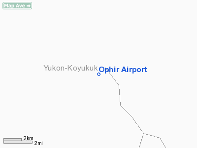
Location
& QuickFacts
|
FAA
Information Effective: |
2006-02-16 |
|
Airport
Identifier: |
Z17 |
|
Longitude/Latitude: |
156-31-47.5140W/63-08-45.7350N
-156.529865/63.146037 (Estimated) |
|
Elevation: |
575 ft / 175.26 m (Estimated) |
|
Land: |
0 acres |
|
From
nearest city: |
0 nautical miles NW of Ophir, AK |
|
Location: |
Kuskokwim County, AK |
|
Magnetic Variation: |
22E (1985) |
Owner
& Manager
|
Ownership: |
Publicly owned |
|
Owner: |
State Of Ak Dotpf |
|
Address: |
Po Box 196900
Anchorage, AK 99619-6900 |
|
Phone
number: |
907-243-1111 |
|
Manager: |
Mc Grath Station Manager |
|
Address: |
Po Box 21
Mc Grath, AK 99627 |
|
Phone number: |
907-524-3241 |
Airport
Operations and Facilities
|
Airport
Use: |
Open to public |
|
Wind
indicator: |
No |
|
Segmented
Circle: |
No |
|
Control
Tower: |
No |
|
Attendance
Schedule: |
UNATNDD |
|
Landing
fee charge: |
No |
|
Sectional
chart: |
Mc Grath |
|
Region: |
AAL - Alaska |
|
Boundary
ARTCC: |
ZAN - Anchorage |
|
Tie-in
FSS: |
ENA - Kenai |
|
FSS
on Airport: |
No |
|
FSS
Phone: |
800-478-3576 |
|
FSS
Toll Free: |
1-800-WX-BRIEF |
|
NOTAMs
Facility: |
PATL (NOTAM-d service avaliable) |
|
Federal Agreements: |
N |
Airport
Communications
Airport
Services
|
Airframe
Repair: |
NONE |
|
Power
Plant Repair: |
NONE |
|
Bottled
Oxygen: |
NONE |
|
Bulk
Oxygen: |
NONE |
|
Runway Information
Runway 11/29
|
Dimension: |
1500
x 40 ft / 457.2 x 12.2 m
WIDTH VARIBLE AND UNDETERMINED. RY OVERGROWN WITH BRUSH OF UNDETERMINED
HEIGHT. RY
NOT MAINTAINED & NOT RECOMMENDED FOR USE. |
|
Surface: |
TURF-GRVL, |
|
|
Runway 11 |
Runway 29 |
|
Traffic
Pattern: |
Left |
Left |
|
Radio Navigation
Aids
|
ID |
Type |
Name |
Ch |
Freq |
Var |
Dist |
|
VTR |
NDB |
Takotna River |
|
350.00 |
23E |
29.1 nm |
|
MCG |
VORTAC |
Mc Grath |
102X |
115.50 |
23E |
27.6 nm |
Remarks
- RY
NOT USABLE AND NOT MAINTAINED; ACFT PARKING ADJ RY 29.
- BRUSH
GROWN ON RWY SIDES AND ALONG RWY CENTERLINE.
- PILOTS
ARE REQUESTED TO SELF-ANNOUNCE ON CTAF PRIOR TO TAXIING ON RWY FOR DEPARTURE;
LEAVING THE RWY AND WITHIN 10 NM OF THE ARPT WHEN APPROACHING TO LAND.
- ESTABD
PRIOR TO 1959.
Operational Statistics
|
Aircraft
Operations: |
6/Month |
|
Air Taxi: |
76.9% |
|
General
Aviation Itinerant: |
23.1% |
Ophir Airport
Address:
Kuskokwim County, AK
Tel:
907-243-1111,
907-524-3241
Images
and information placed above are from
http://www.airport-data.com/airport/Z17/
We
thank them for the data!
| General
Info |
| Country |
United
States |
| State |
ALASKA
|
| FAA ID |
Z17
|
| Latitude |
63-08-45.735N
|
| Longitude |
156-31-47.514W
|
| Elevation |
575 feet
|
| Near City |
OPHIR
|
We don't guarantee the information is fresh and accurate. The data may
be wrong or outdated.
For more up-to-date information please refer to other sources.
|
|


