 |
|
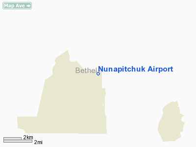
| Nunapitchuk Airport |
| IATA: NUP – ICAO: none – FAA LID: 16A |
| Summary |
| Airport type |
Public |
| Owner |
State of Alaska DOT&PF |
| Serves |
Nunapitchuk, Alaska |
| Elevation AMSL |
12 ft / 4 m |
| Coordinates |
60°54′21″N 162°26′21″W / 60.90583°N 162.43917°W / 60.90583; -162.43917 |
| Runways |
| Direction |
Length |
Surface |
| ft |
m |
| 18/36 |
2,040 |
622 |
Gravel |
| NE/SW |
3,000 |
914 |
Water |
| Source: Federal Aviation Administration |
Nunapitchuk Airport (IATA: NUP, FAA LID: 16A) is a state-owned public-use airport located in Nunapitchuk, a city in the Bethel Census Area of the U.S. state of Alaska. Facilities
Nunapitchuk Airport has one runway designated 18/36 with a 2,040 x 60 ft (622 x 18 m) gravel surface. It also has one seaplane landing area designated NE/SW which measures 3,000 x 300 ft (914 x 91 m).
Airlines and non-stop destinations
- Flight Alaska (Bethel)
- Frontier Flying Service (Atmautluak)
- Hageland Aviation Services
The above content comes from Wikipedia and is published under free licenses – click here to read more.
Location
& QuickFacts
|
FAA
Information Effective: |
2006-02-16 |
|
Airport
Identifier: |
16A |
|
Longitude/Latitude: |
162-26-20.8170W/60-54-20.9820N
-162.439116/60.905828 (Estimated) |
|
Elevation: |
12 ft / 3.66 m (Estimated) |
|
Land: |
0 acres |
|
From
nearest city: |
0 nautical miles E of Nunapitchuk, AK |
|
Location: |
Bethel County, AK |
|
Magnetic Variation: |
18E (1985) |
Owner
& Manager
|
Ownership: |
Publicly owned |
|
Owner: |
State Of Ak Dotpf |
|
Address: |
Pouch 196900
Anchorage, AK 99516-6900 |
|
Phone number: |
907-269-0747 |
|
Manager: |
L.j. Davis |
|
Address: |
Box 505
Bethel, AK 99559 |
|
Phone number: |
907-543-2495 |
Airport
Operations and Facilities
|
Airport
Use: |
Open to public |
|
Wind
indicator: |
Yes
WINDSOCK MAY BE UNRELIABLE. |
|
Segmented
Circle: |
Yes |
|
Control
Tower: |
No |
|
Attendance
Schedule: |
UNATNDD |
|
Sectional
chart: |
Bethel |
|
Region: |
AAL - Alaska |
|
Boundary
ARTCC: |
ZAN - Anchorage |
|
Tie-in
FSS: |
ENA - Kenai |
|
FSS
Phone: |
800-478-3576 |
|
FSS
Toll Free: |
1-800-WX-BRIEF |
|
NOTAMs
Facility: |
BET (NOTAM-d service avaliable) |
|
Federal Agreements: |
N |
Airport
Communications
|
Runway Information
Runway 18/36
|
Dimension: |
2040 x 60 ft / 621.8 x 18.3 m |
|
Surface: |
GRVL, Fair Condition |
|
|
Runway 18 |
Runway 36 |
|
Traffic
Pattern: |
Left |
Left |
|
Runway NE/SW
|
Dimension: |
3000 x 300 ft / 914.4 x 91.4 m |
|
Surface: |
WATER, |
|
|
Runway NE |
Runway SW |
|
Traffic
Pattern: |
Left |
Left |
|
Radio Navigation
Aids
|
ID |
Type |
Name |
Ch |
Freq |
Var |
Dist |
|
OSE |
NDB |
Oscarville |
|
251.00 |
19E |
18.0 nm |
|
ET |
NDB |
Bethel |
|
344.00 |
19E |
19.2 nm |
|
BET |
VORTAC |
Bethel |
088X |
114.10 |
19E |
19.4 nm |
Remarks
- RY
COND NOT MONTRD - RCMD VISUAL INSP PRIOR TO USE.
- DIPS
& SINKHOLES ALONG RY EDGES.
- PILOTS
ARE REQUESTED TO SELF-ANNOUNCE ON CTAF BEFORE TAXIING ON THE RWY FOR
DEPARTURE, LEAVING THE RWY AND WITHIN 5 NM OF THE AIRPORT WHEN APPROACHING
TO LAND.
Nunapitchuk Airport
Address:
Bethel County, AK
Tel:
907-269-0747, 907-543-2495
Images
and information placed above are from
http://www.airport-data.com/airport/16A/
We
thank them for the data!
| General
Info |
| Country |
United
States |
| State |
ALASKA
|
| FAA ID |
16A
|
| Latitude |
60-54-20.982N
|
| Longitude |
162-26-20.817W
|
| Elevation |
12 feet
|
| Near City |
NUNAPITCHUK
|
We don't guarantee the information is fresh and accurate. The data may
be wrong or outdated.
For more up-to-date information please refer to other sources.
|
|


