 |
|
|
|
|
|
Location
& QuickFacts
|
FAA
Information Effective: |
2006-02-16 |
|
Airport
Identifier: |
FSP |
|
Longitude/Latitude: |
154-21-30.3650W/63-01-06.8150N
-154.358435/63.018560 (Estimated) |
|
Elevation: |
441 ft / 134.42 m (Surveyed) |
|
Land: |
76 acres |
|
From
nearest city: |
1 nautical miles NE of Nikolai, AK |
|
Location: |
Kuskokwim County, AK |
|
Magnetic Variation: |
23E (1985) |
Owner
& Manager
|
Ownership: |
Publicly owned |
|
Owner: |
St Of Ak Dotpf/c Rgn |
|
Address: |
Po Box 196900
Anchorage, AK 99519-6900 |
|
Phone number: |
907-269-0782 |
|
Manager: |
Douglas Lyman |
|
Address: |
Box 21
Mc Grath, AK 99627 |
|
Phone number: |
907-524-3241 |
Airport
Operations and Facilities
|
Airport
Use: |
Open to public |
|
Wind
indicator: |
Yes |
|
Segmented
Circle: |
Yes |
|
Control
Tower: |
No |
|
Attendance
Schedule: |
UNATNDD |
|
Lighting
Schedule: |
RDO-CTL
ACTVT BEACON/MIRL RY 04/22 & REIL RYS 04 & 22 -
122.8. |
|
Beacon
Color: |
Clear (unlighted land airport) |
|
Landing
fee charge: |
No |
|
Sectional
chart: |
Mc Grath |
|
Region: |
AAL - Alaska |
|
Boundary
ARTCC: |
ZAN - Anchorage |
|
Tie-in
FSS: |
ENA - Kenai |
|
FSS
on Airport: |
No |
|
FSS
Phone: |
800-478-3576 |
|
FSS
Toll Free: |
1-800-WX-BRIEF |
|
NOTAMs
Facility: |
MCG (NOTAM-d service avaliable) |
|
Federal Agreements: |
NGY |
Airport
Communications
Airport
Services
|
Airframe
Repair: |
NONE |
|
Power
Plant Repair: |
NONE |
|
Bottled
Oxygen: |
NONE |
|
Bulk
Oxygen: |
NONE |
|
Runway Information
Runway 04/22
|
Dimension: |
4003 x 75 ft / 1220.1 x 22.9 m |
|
Surface: |
GRVL, Good Condition |
|
Edge
Lights: |
Medium |
|
|
Runway 04 |
Runway 22 |
|
Longitude: |
154-22-09.1200W |
154-20-51.6100W |
|
Latitude: |
63-00-57.9700N |
63-01-15.6600N |
|
Elevation: |
441.00 ft |
441.00 ft |
|
Alignment: |
63 |
127 |
|
Traffic
Pattern: |
Left |
Left |
|
Markings: |
None,
/22 MKD WITH CONES. |
None, |
|
Crossing
Height: |
26.00 ft |
28.00 ft |
|
VASI: |
4-light PAPI on left side |
4-light PAPI on left side |
|
Visual
Glide Angle: |
3.20� |
3.20� |
|
Runway
End Identifier: |
Yes |
Yes |
|
Centerline
Lights: |
No |
No |
|
Touchdown
Lights: |
No |
No |
|
Obstruction: |
, 50:1 slope to clear |
49 ft trees, 1404.0 ft from runway, 28:1 slope
to clear |
|
Radio Navigation
Aids
|
ID |
Type |
Name |
Ch |
Freq |
Var |
Dist |
|
VTR |
NDB |
Takotna River |
|
350.00 |
23E |
33.0 nm |
|
MCG |
VORTAC |
Mc Grath |
102X |
115.50 |
23E |
34.4 nm |
Remarks
- CTN:
RWY CONDITION NOT MONITORED; RECOMMEND VISUAL INSPECTION PRIOR TO USING.
- PILOTS
ARE REQUESTED TO SELF-ANNOUNCE ON CTAF PRIOR TO TAXIING ON RWY FOR DEPARTURE;
LEAVING THE RWY AND WITHIN 10 NM OF THE ARPT WHEN APPROACHING TO LAND.
- WX
CAMERA AVBL ON INTERNET AT HTTP://AKWEATHERCAMS.FAA.GOV
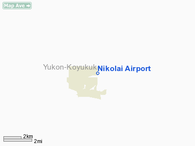
Nikolai Airport
Address:
Kuskokwim County, AK
Tel:
907-269-0782, 907-524-3241
Images
and information placed above are from
http://www.airport-data.com/airport/FSP/
We
thank them for the data!
| General
Info |
| Country |
United
States |
| State |
ALASKA
|
| FAA ID |
FSP
|
| Latitude |
63.018561
63� 01' 06.82" N |
| Longitude |
-154.358436
154� 21' 30.37" W |
| Elevation |
441 feet
134 meters |
| Magnetic
Variation |
019� E
(01/06) |
| Operating
Agency |
U.S.CIVIL
AIRPORT WHEREIN PERMIT COVERS USE BY TRANSIT MILITARY AIRCRAFT
|
We don't guarantee the information is fresh and accurate. The data may
be wrong or outdated.
For more up-to-date information please refer to other sources.
|
|


