 |
|
| Nightmute Airport |
| IATA: NME – ICAO: PAGT – FAA LID: IGT |
| Summary |
| Airport type |
Public |
| Owner |
Alaska DOT&PF - Central Region |
| Serves |
Nightmute, Alaska |
| Elevation AMSL |
4 ft / 1 m |
| Coordinates |
60°28′16″N 164°42′03″W / 60.47111°N 164.70083°W / 60.47111; -164.70083 |
| Runways |
| Direction |
Length |
Surface |
| ft |
m |
| 3/21 |
1,600 |
488 |
Gravel |
| Source: Federal Aviation Administration |
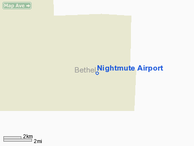
Nightmute Airport (IATA: NME, ICAO: PAGT, FAA LID: IGT) is a state-owned public-use airport located southeast of the central business district of Nightmute, a village in the Bethel Census Area of the U.S. state of Alaska.
Although most U.S. airports use the same three-letter location identifier for the FAA and IATA, this airport is assigned IGT by the FAA and NME by the IATA. Facilities
Nightmute Airport has one runway designated 3/21 with a gravel surface measuring 1,600 by 50 feet (488 x 15 m).
Airlines
- Hageland Aviation Services
The above content comes from Wikipedia and is published under free licenses – click here to read more.
Location
& QuickFacts
|
FAA
Information Effective: |
2006-02-16 |
|
Airport
Identifier: |
IGT |
|
Longitude/Latitude: |
164-42-03.0200W/60-28-15.7000N
-164.700839/60.471028 (Estimated) |
|
Elevation: |
14 ft / 4.27 m (Estimated) |
|
Land: |
0 acres |
|
From
nearest city: |
1 nautical miles N of Nightmute, AK |
|
Location: |
Bethel County, AK |
|
Magnetic Variation: |
17E (1985) |
Owner
& Manager
|
Ownership: |
Publicly
owned |
|
Owner: |
St Of Ak Dotpf/c Rgn |
|
Address: |
Po Box 196900
Anchorage, AK 99519-6900 |
|
Phone number: |
907-269-0747 |
|
Manager: |
L.j. Davis |
|
Address: |
Box 505
Bethel, AK 99559 |
|
Phone number: |
907-543-2495 |
Airport
Operations and Facilities
|
Airport
Use: |
Open
to public |
|
Wind
indicator: |
Yes
WINDSOCK MAY BE UNRELIABLE. |
|
Segmented Circle: |
Yes |
|
Control
Tower: |
No |
|
Attendance Schedule: |
UNATNDD |
|
Landing
fee charge: |
No |
|
Sectional chart: |
Bethel |
|
Region: |
AAL - Alaska |
|
Boundary
ARTCC: |
ZAN - Anchorage |
|
Tie-in
FSS: |
ENA - Kenai |
|
FSS
on Airport: |
No |
|
FSS
Phone: |
800-478-3576 |
|
FSS
Toll Free: |
1-800-WX-BRIEF |
|
NOTAMs
Facility: |
MYU (NOTAM-d service avaliable) |
|
Federal Agreements: |
NGY |
Airport
Communications
Airport
Services
|
Airframe
Repair: |
NONE |
|
Power
Plant Repair: |
NONE |
|
Bottled
Oxygen: |
NONE |
|
Bulk
Oxygen: |
NONE |
|
Runway Information
Runway 02/20
|
Dimension: |
1650 x 45 ft / 502.9 x 13.7 m
RY 02/20 SAFETY AREA 1942 FT BY 100 FT; SAFETY AREAS ROUGH. |
|
Surface: |
GRVL, Poor Condition
SEVERAL DEPRESSIONS DIPS & RUTS & LOOSE GRAVEL. THRESHOLD
BOARDS DESTROYED OR OBSCURED IN BRUSH MARKED WITH NSTD CONES. |
|
|
Runway
02 |
Runway
20 |
|
Traffic
Pattern: |
Left |
Left |
|
Radio Navigation
Aids
|
ID |
Type |
Name |
Ch |
Freq |
Var |
Dist |
|
AIX |
NDB/DME |
Nanwak |
076X |
323.00 |
16E |
45.2 nm |
|
IIK |
VOR/DME |
Kipnuk |
106X |
115.90 |
17E |
37.5 nm |
Remarks
- RY
COND NOT MONITORED; RECOMMEND VISUAL INSPECTION PRIOR TO USING.
- PILOTS
ARE REQD TO SELF-ANNOUNCE ON CTAF BEFORE TAXIING ON THE RY FOR DEP,
LEAVING THE RY AND WI 5 NM OF THE ARPT WHEN APP TO LND.
- THR
PANELS DAMAGED.
Nightmute Airport
Address:
Bethel County, AK
Tel:
907-269-0747, 907-543-2495
Images
and information placed above are from
http://www.airport-data.com/airport/IGT/
We
thank them for the data!
| General
Info |
| Country |
United
States |
| State |
ALASKA
|
| FAA ID |
IGT |
| Latitude |
60-28-13.178N
|
| Longitude |
164-41-08.309W
|
| Elevation |
14 feet
|
| Near City |
NIGHTMUTE
|
We don't guarantee the information is fresh and accurate. The data may
be wrong or outdated.
For more up-to-date information please refer to other sources.
|
|


