 |
|
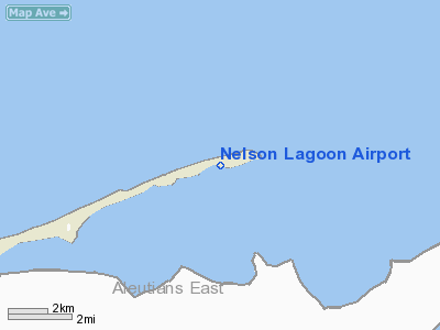
| Nelson Lagoon Airport |
| IATA: NLG – ICAO: PAOU – FAA LID: OUL |
| Summary |
| Airport type |
Public |
| Owner |
Alaska DOT&PF - Central Region |
| Serves |
Nelson Lagoon, Alaska |
| Elevation AMSL |
14 ft / 4 m |
| Coordinates |
56°00′27″N 161°09′37″W / 56.0075°N 161.16028°W / 56.0075; -161.16028 |
| Runways |
| Direction |
Length |
Surface |
| ft |
m |
| 8/26 |
4,000 |
1,219 |
Gravel |
| Statistics (2005) |
| Aircraft operations |
302 |
| Enplanements (2008) |
290 |
| Source: Federal Aviation Administration |
Nelson Lagoon Airport (IATA: NLG, ICAO: PAOU, FAA LID: OUL, formerly Z73) is a state-owned, public-use airport located one nautical mile (1.85 km) east of the central business district of Nelson Lagoon, in the Aleutians East Borough of the U.S. state of Alaska. Scheduled airline service to Cold Bay Airport is provided by Peninsula Airways (PenAir).
As per Federal Aviation Administration records, this airport had 290 commercial passenger boardings (enplanements) in calendar year 2008, a decrease of 4% from the 302 enplanements in 2007. Nelson Lagoon Airport is included in the FAA's National Plan of Integrated Airport Systems (2009-2013), which categorizes it as a general aviation facility.
Although most U.S. airports use the same three-letter location identifier for the FAA and IATA, this airport is assigned OUL by the FAA and NLG by the IATA (which assigned OUL to Oulu Airport in Oulu, Finland). Airlines and destinations
Facilities and aircraft
Nelson Lagoon Airport has one runway designated 8/26 with a gravel surface measuring 4,000 by 75 feet (1,219 x 23 m). For the 12-month period ending December 31, 2005, the airport had 302 aircraft operations, an average of 25 per month: 68% air taxi and 32% general aviation.
The above content comes from Wikipedia and is published under free licenses – click here to read more.
Location
& QuickFacts
|
FAA
Information Effective: |
2006-02-16 |
|
Airport
Identifier: |
OUL |
|
Longitude/Latitude: |
161-09-37.3220W/56-00-27.1300N
-161.160367/56.007536 (Estimated) |
|
Elevation: |
14 ft / 4.27 m (Surveyed) |
|
Land: |
0 acres |
|
From
nearest city: |
1 nautical miles E of Nelson Lagoon, AK |
|
Location: |
Aleutian Islands County, AK |
|
Magnetic Variation: |
18E (1985) |
Owner
& Manager
|
Ownership: |
Publicly owned |
|
Owner: |
State Of Ak Dotpf-central Rgn |
|
Address: |
Pouch 196900
Anchorage, AK 99519-6900 |
|
Phone number: |
907-269-0747 |
|
Manager: |
Harold Kreamer |
|
Address: |
Box 97
Cold Bay, AK 99571 |
|
Phone number: |
907-532-5000 |
Airport
Operations and Facilities
|
Airport
Use: |
Open to public |
|
Wind
indicator: |
Yes
EAST END WIND S0CK FADED. |
|
Segmented
Circle: |
Yes |
|
Control
Tower: |
No |
|
Attendance
Schedule: |
UNATNDD |
|
Lighting
Schedule: |
RDO-CTL
ACTVT ROTG BCN - CTAF. |
|
Beacon
Color: |
Clear-Green (lighted land airport) |
|
Landing
fee charge: |
No |
|
Sectional
chart: |
Anchorage |
|
Region: |
AAL - Alaska |
|
Boundary
ARTCC: |
ZAN - Anchorage |
|
Tie-in
FSS: |
CDB - Cold Bay |
|
FSS
on Airport: |
No |
|
FSS
Phone: |
907-532-2454 |
|
FSS
Toll Free: |
1-800-478-7250 |
|
Alternate
FSS: |
ENA - Kenai |
|
Alt.
FSS Toll Free: |
1-800-WX-BRIEF |
|
NOTAMs
Facility: |
CDB (NOTAM-d service avaliable) |
|
Federal Agreements: |
NGY |
Airport
Communications
Airport
Services
|
Fuel
available: |
100LL |
|
Airframe
Repair: |
NONE |
|
Power
Plant Repair: |
NONE |
|
Bottled
Oxygen: |
NONE |
|
Bulk
Oxygen: |
NONE |
|
Runway Information
Runway 08/26
|
Dimension: |
4000 x 75 ft / 1219.2 x 22.9 m |
|
Surface: |
GRVL, Good Condition
FIRST 300 FT RWY 08 SOFT IN MIDDLE.
RUTS ENTIRE LENGTH LOOSE GRVL ON SFC; TURF ENCROACHMENT BOTH SIDES. |
|
Edge
Lights: |
Medium |
|
|
Runway 08 |
Runway 26 |
|
Longitude: |
161-10-12.3310W |
161-09-02.3130W |
|
Latitude: |
56-00-29.2050N |
56-00-25.0540N |
|
Elevation: |
14.00 ft |
10.00 ft |
|
Alignment: |
96 |
127 |
|
Traffic
Pattern: |
Left |
Left |
|
Radio Navigation
Aids
|
ID |
Type |
Name |
Ch |
Freq |
Var |
Dist |
|
HBT |
NDB/DME |
Borland |
079X |
390.00 |
18E |
46.9 nm |
Remarks
- LARGE
SEA BIRDS ALONG BEACH ADJACENT TO RWY.
- CTN:
RWY CONDITION NOT MONITORED; RECOMMEND VISUAL INSPECTION PRIOR TO USING.
- 10
FT DITCHES PARALLEL RY - FULL LENGTH - BOTH SIDES.
- PILOTS
ARE REQUESTED TO SELF-ANNOUNCE ON CTAF PRIOR TO TAXIING ON RWY FOR DEPARTURE;
LEAVING THE RWY AND WITHIN 10 NM OF THE ARPT WHEN APPROACHING TO LAND.
- WX
CAMERA AVBL ON INTERNET AT HTTP://AKWEATHERCAMS.FAA.GOV
Based Aircraft
|
Aircraft
based on field: |
3 |
|
Single
Engine Airplanes: |
3 |
Operational Statistics
|
Aircraft
Operations: |
26/Month |
|
Air Taxi: |
68.2% |
|
General
Aviation Local: |
27.8% |
|
General
Aviation Itinerant: |
4.0% |
Nelson Lagoon Airport
Address:
Aleutian Islands County, AK
Tel:
907-532-5000
Images
and information placed above are from
http://www.airport-data.com/airport/OUL/
We
thank them for the data!
| General
Info |
| Country |
United
States |
| State |
ALASKA
|
| FAA ID |
OUL
|
| Latitude |
56.007536
56� 00' 27.13" N |
| Longitude |
-161.160367
161� 09' 37.32" W |
| Elevation |
14 feet
4 meters |
| Magnetic
Variation |
014� E
(01/06) |
| Operating
Agency |
U.S.CIVIL
AIRPORT WHEREIN PERMIT COVERS USE BY TRANSIT MILITARY AIRCRAFT
|
We don't guarantee the information is fresh and accurate. The data may
be wrong or outdated.
For more up-to-date information please refer to other sources.
|
|


