 |
|
|
|
|
|
Location
& QuickFacts
|
FAA
Information Effective: |
2006-02-16 |
|
Airport
Identifier: |
60Z |
|
Longitude/Latitude: |
149-58-51.7960W/67-12-58.4550N
-149.981054/67.216237 (Estimated) |
|
Elevation: |
1670 ft / 509.02 m (Estimated) |
|
Land: |
0 acres |
|
From
nearest city: |
0 nautical miles N of Myrtle Creek, AK |
|
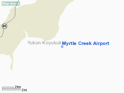
Location: |
Yukon-koyukuk County, AK |
|
Magnetic Variation: |
28E (1985) |
Owner
& Manager
|
Ownership: |
Publicly owned |
|
Owner: |
Us Gov - Blm |
|
Address: |
6881 Abbot Loop Road
Anchorage, AK 99507 |
|
Phone number: |
907-267-1213 |
|
Address: |
|
Airport
Operations and Facilities
|
Airport
Use: |
Open to public |
|
Wind
indicator: |
No |
|
Segmented
Circle: |
No |
|
Control
Tower: |
No |
|
Attendance
Schedule: |
UNATNDD |
|
Landing
fee charge: |
No |
|
Sectional
chart: |
Fairbanks |
|
Region: |
AAL - Alaska |
|
Traffic
Pattern Alt: |
1000 ft |
|
Boundary
ARTCC: |
ZAN - Anchorage |
|
Tie-in
FSS: |
FAI - Fairbanks |
|
FSS
on Airport: |
No |
|
FSS
Phone: |
907-474-0788 |
|
FSS
Toll Free: |
1-866-248-6516 |
|
NOTAMs
Facility: |
FAI (NOTAM-d service avaliable) |
Airport
Communications
Airport
Services
|
Airframe
Repair: |
NONE |
|
Power
Plant Repair: |
NONE |
|
Bottled
Oxygen: |
NONE |
|
Bulk
Oxygen: |
NONE |
|
Runway Information
Runway 08/26
|
Dimension: |
950 x 12 ft / 289.6 x 3.7 m |
|
Surface: |
GRVL-DIRT, Poor Condition
EDGES OVERGROWN; LANDING PATH CURVES BACK & FORTH. |
|
|
Runway 08 |
Runway 26 |
|
Traffic
Pattern: |
Left |
Left |
|
Obstruction: |
, 50:1 slope to clear |
19 ft tree, 190.0 ft from runway, 10:1 slope
to clear |
|
Radio Navigation
Aids
|
ID |
Type |
Name |
Ch |
Freq |
Var |
Dist |
|
PPC |
NDB |
Prospect |
|
340.00 |
27E |
28.4 nm |
|
CQR |
NDB |
Chandalar Lake |
|
263.00 |
29E |
39.0 nm |
|
EAV |
NDB |
Evansville |
|
391.00 |
27E |
41.9 nm |
|
BTT |
VOR/DME |
Bettles |
107X |
116.00 |
27E |
40.9 nm |
Remarks
- SMALL
BLDG; DRUMS ON E EDGE OF RY; 10 FT ROCKY OUTCROP ON END RY 26.
- VERY
SOFT DURG SPRING BREAKUP.
- NO
LINE OF SIGHT FROM RY 08 TO RY 26. RY HIGH IN MIDDLE; FALLS OFF FAST
TOWARD RY 08.
- RY
26 BLUFF AT END OF RY 26.
Operational Statistics
|
Aircraft
Operations: |
5/Month |
|
General
Aviation Itinerant: |
100.0% |
Myrtle Creek Airport
Address:
Yukon-koyukuk County, AK
Tel:
907-267-1213
Images
and information placed above are from
http://www.airport-data.com/airport/60Z/
We
thank them for the data!
| General
Info |
| Country |
United
States |
| State |
ALASKA
|
| FAA ID |
60Z
|
| Latitude |
67-12-58.455N
|
| Longitude |
149-58-51.796W
|
| Elevation |
1670 feet
|
| Near City |
MYRTLE
CREEK |
We don't guarantee the information is fresh and accurate. The data may
be wrong or outdated.
For more up-to-date information please refer to other sources.
|
|


