 |
|
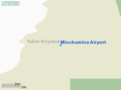
Minchumina Airport
Lake Minchumina Airport |
| IATA: MHM – ICAO: PAMH – FAA LID: MHM |
| Summary |
| Airport type |
Public |
| Owner |
Alaska DOT&PF |
| Serves |
Lake Minchumina, Alaska |
| Elevation AMSL |
678 ft / 207 m |
| Coordinates |
63°53′10″N 152°18′07″W / 63.88611°N 152.30194°W / 63.88611; -152.30194 |
| Runways |
| Direction |
Length |
Surface |
| ft |
m |
| 3/21 |
4,200 |
1,280 |
Gravel |
| Statistics (2005) |
| Aircraft operations |
1,140 |
| Source: Federal Aviation Administration |
Minchumina Airport (IATA: MHM, ICAO: PAMH, FAA LID: MHM) is a state-owned public-use airport serving Lake Minchumina, in the Yukon-Koyukuk Census Area of the U.S. state of Alaska. It is also known as Lake Minchumina Airport (IATA: LMA).
Scheduled passenger service at this airport is subsidized by the United States Department of Transportation via the Essential Air Service program. Facilities and aircraft
Minchumina Airport covers an area of 674 acres (273 ha) at an elevation of 678 feet (207 m) above mean sea level. It has one runway designated 3/21 with a gravel surface measuring 4,200 by 100 feet (1,280 x 30 m). For the 12-month period ending December 31, 2005, the airport had 1,140 aircraft operations, an average of 95 per month: 96% general aviation and 4% air taxi.
Airline and destinations
Footnotes
The above content comes from Wikipedia and is published under free licenses – click here to read more.
Location
& QuickFacts
|
FAA
Information Effective: |
2006-02-16 |
|
Airport
Identifier: |
MHM |
|
Longitude/Latitude: |
152-18-06.7450W/63-53-09.5900N
-152.301874/63.885997 (Estimated) |
|
Elevation: |
678 ft / 206.65 m (Estimated) |
|
Land: |
674 acres |
|
From
nearest city: |
0 nautical miles SE of Minchumina, AK |
|
Location: |
Yukon-koyukuk County, AK |
|
Magnetic Variation: |
21E (2005) |
Owner
& Manager
|
Ownership: |
Publicly owned |
|
Owner: |
State Of Alaska Dot |
|
Address: |
2301 Pegar Road
Fairbanks, AK 99709 |
|
Phone number: |
907-451-5217 |
|
Manager: |
Bill O'halloran |
|
Address: |
2301 Peger Rd
Fairbanks, AK 99709 |
|
Phone number: |
907-451-5250 |
Airport
Operations and Facilities
|
Airport
Use: |
Open to public |
|
Wind
indicator: |
Yes |
|
Segmented
Circle: |
Yes
SEGMENTED CIRCLE OVERGROWN. |
|
Control
Tower: |
No |
|
Attendance
Schedule: |
UNATNDD |
|
Lighting
Schedule: |
DUSK-DAWN
ACTVT MIRL RY 02/20 & PAPI RY 02 - CTAF. |
|
Beacon
Color: |
Clear-Green (lighted land airport) |
|
Landing
fee charge: |
No |
|
Sectional
chart: |
Mc Grath |
|
Region: |
AAL - Alaska |
|
Boundary
ARTCC: |
ZAN - Anchorage |
|
Tie-in
FSS: |
FAI - Fairbanks |
|
FSS
on Airport: |
No |
|
FSS
Phone: |
907-474-0788 |
|
FSS
Toll Free: |
1-866-248-6516 |
|
NOTAMs
Facility: |
MHM (NOTAM-d service avaliable) |
|
Federal Agreements: |
N |
Airport
Communications
Airport
Services
|
Airframe
Repair: |
NONE |
|
Power
Plant Repair: |
NONE |
|
Bottled
Oxygen: |
NONE |
|
Bulk
Oxygen: |
NONE |
|
Runway Information
Runway 02/20
|
Dimension: |
4200 x 100 ft / 1280.2 x 30.5 m |
|
Surface: |
GRAVEL, |
|
Edge
Lights: |
Medium |
|
|
Runway 02 |
Runway 20 |
|
Longitude: |
152-18-39.9000W |
152-17-33.5900W |
|
Latitude: |
63-52-54.9700N |
63-53-24.2100N |
|
Elevation: |
669.00 ft |
676.00 ft |
|
Alignment: |
45 |
127 |
|
Traffic
Pattern: |
Left |
Left |
|
Crossing
Height: |
35.00 ft |
0.00 ft |
|
VASI: |
4-light PAPI on left side |
|
|
Visual
Glide Angle: |
3.00� |
0.00� |
|
Runway
End Identifier: |
No |
No |
|
Centerline
Lights: |
No |
No |
|
Touchdown
Lights: |
No |
No |
|
Radio Navigation
Aids
|
ID |
Type |
Name |
Ch |
Freq |
Var |
Dist |
|
MHM |
NDB |
Minchumina |
|
227.00 |
25E |
0.4 nm |
Remarks
- BLM
FIRE FIGHTING EQUIP & ACFT OPRG DURG SUMMER MONTHS.
- WX
REPORTS HRLY ONLY.
- RY
CONDITION NOT MONITORED; RECOMMEND VISUAL INSPECTION PRIOR TO LANDING.
- SNOW
REMOVAL OPERATIONS DURING WINTER--MONITOR CTAF.
Based Aircraft
|
Aircraft
based on field: |
1 |
|
Single
Engine Airplanes: |
1 |
Operational Statistics
|
Aircraft
Operations: |
20/Week |
|
Air Taxi: |
3.8% |
|
General
Aviation Itinerant: |
96.2% |
Minchumina Airport
Address:
Yukon-koyukuk County, AK
Tel:
907-451-5217, 907-451-5250
Images
and information placed above are from
http://www.airport-data.com/airport/MHM/
We
thank them for the data!
| General
Info |
| Country |
United
States |
| State |
ALASKA
|
| FAA ID |
MHM
|
| Latitude |
63-52-50.034N
|
| Longitude |
152-18-02.432W
|
| Elevation |
684 feet
|
| Near City |
MINCHUMINA
|
We don't guarantee the information is fresh and accurate. The data may
be wrong or outdated.
For more up-to-date information please refer to other sources.
|
|


